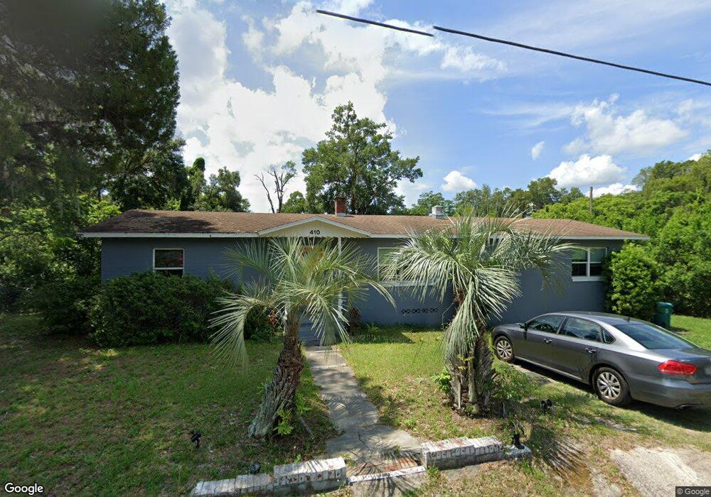
410 W Hubbard Ave Unit B Deland, FL 32720
Estimated Value: $380,774 - $449,000
2
Beds
1
Bath
700
Sq Ft
$602/Sq Ft
Est. Value
About This Home
This home is located at 410 W Hubbard Ave Unit B, Deland, FL 32720 and is currently estimated at $421,694, approximately $602 per square foot. 410 W Hubbard Ave Unit B is a home located in Volusia County with nearby schools including Edith I. Starke Elementary School, Deland High School, and Southwestern Middle School.
Ownership History
Date
Name
Owned For
Owner Type
Purchase Details
Closed on
Jul 12, 2021
Sold by
Russell Nicholas James
Bought by
Larsen Kalen
Current Estimated Value
Home Financials for this Owner
Home Financials are based on the most recent Mortgage that was taken out on this home.
Original Mortgage
$254,250
Outstanding Balance
$230,692
Interest Rate
2.9%
Mortgage Type
New Conventional
Estimated Equity
$191,002
Purchase Details
Closed on
Feb 18, 2020
Sold by
Bank Of America National Association
Bought by
Russell Nicholas James
Purchase Details
Closed on
Jun 11, 2019
Sold by
Small Beatrice
Bought by
Bank Of America National Association
Purchase Details
Closed on
Aug 17, 2006
Sold by
Small Theodore W and Small Beatrice
Bought by
Small Theodore W and Small Beatrice
Create a Home Valuation Report for This Property
The Home Valuation Report is an in-depth analysis detailing your home's value as well as a comparison with similar homes in the area
Home Values in the Area
Average Home Value in this Area
Purchase History
| Date | Buyer | Sale Price | Title Company |
|---|---|---|---|
| Larsen Kalen | $339,000 | Landtrust Ttl Of Ctrl Fl Llc | |
| Russell Nicholas James | $105,000 | Title365 | |
| Bank Of America National Association | -- | None Available | |
| Small Theodore W | -- | Volusia Title Services |
Source: Public Records
Mortgage History
| Date | Status | Borrower | Loan Amount |
|---|---|---|---|
| Open | Larsen Kalen | $254,250 |
Source: Public Records
Tax History Compared to Growth
Tax History
| Year | Tax Paid | Tax Assessment Tax Assessment Total Assessment is a certain percentage of the fair market value that is determined by local assessors to be the total taxable value of land and additions on the property. | Land | Improvement |
|---|---|---|---|---|
| 2025 | $6,887 | $397,328 | $36,358 | $360,970 |
| 2024 | $6,887 | $399,055 | $36,358 | $362,697 |
| 2023 | $6,887 | $372,493 | $20,571 | $351,922 |
| 2022 | $6,337 | $331,933 | $20,571 | $311,362 |
| 2021 | $5,404 | $263,048 | $16,266 | $246,782 |
| 2020 | $4,042 | $196,165 | $11,796 | $184,369 |
| 2019 | $3,871 | $179,289 | $9,640 | $169,649 |
| 2018 | $2,914 | $129,441 | $8,117 | $121,324 |
| 2017 | $251 | $54,037 | $0 | $0 |
| 2016 | $235 | $52,926 | $0 | $0 |
| 2015 | -- | $52,558 | $0 | $0 |
| 2014 | -- | $52,141 | $0 | $0 |
Source: Public Records
Map
Nearby Homes
- 647 S Delaware Ave
- 534 S Adelle Ave
- 526 W Hubbard Ave
- 709 S Parsons Ave
- 430 S Parsons Ave
- 406 S Delaware Ave
- 624 W Euclid Ave
- 205 W Division St
- 221 W Euclid Ave
- 632 W Hubbard Ave
- 409 W Beresford Ave
- 217 W Chelsea St
- 808 S Clara Ave
- 736 S Stone St
- 706 W Franklin Ave
- 138 W Volusia Ave
- 412 W Beresford Ave
- 540 W Mathis St
- 536 W Hubbard Ave
- 800 W Hubbard Ave
- 410 W Hubbard Ave
- 611 S Thompson Ave
- 406 W Hubbard Ave
- 615 S Thompson Ave
- 407 W Hubbard Ave
- 604 S Delaware Ave
- 421 W Hubbard Ave
- 530 S Delaware Ave
- 614 S Thompson Ave
- 612 S Delaware Ave
- 427 W Hubbard Ave
- 528 S Delaware Ave
- 628 S Delaware Ave
- 524 S Delaware Ave
- 431 W Hubbard Ave
- 528 S Thompson Ave
- 630 S Delaware Ave
- 624 S Thompson Ave
- 589 S Thompson Ave
- 645 S Thompson Ave