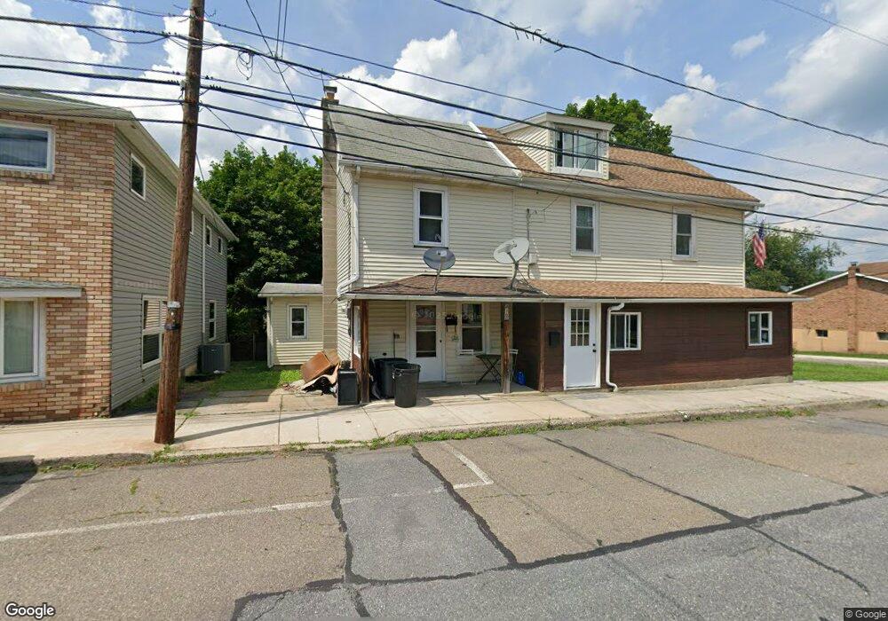
410 W Railroad St Nesquehoning, PA 18240
Estimated Value: $70,929 - $88,000
2
Beds
1
Bath
780
Sq Ft
$103/Sq Ft
Est. Value
About This Home
This home is located at 410 W Railroad St, Nesquehoning, PA 18240 and is currently estimated at $80,232, approximately $102 per square foot. 410 W Railroad St is a home located in Carbon County with nearby schools including Panther Valley Elementary School, Panther Valley Intermediate School, and Panther Valley Junior/Senior High School.
Ownership History
Date
Name
Owned For
Owner Type
Purchase Details
Closed on
Jan 7, 2016
Sold by
Griffith Cynthia G
Bought by
Hansen Nathan U and Hansen Amanda M
Current Estimated Value
Home Financials for this Owner
Home Financials are based on the most recent Mortgage that was taken out on this home.
Original Mortgage
$38,000
Outstanding Balance
$1,523
Interest Rate
3.96%
Mortgage Type
Seller Take Back
Estimated Equity
$78,709
Purchase Details
Closed on
Dec 20, 2004
Bought by
Griffith Cynthia G
Create a Home Valuation Report for This Property
The Home Valuation Report is an in-depth analysis detailing your home's value as well as a comparison with similar homes in the area
Home Values in the Area
Average Home Value in this Area
Purchase History
| Date | Buyer | Sale Price | Title Company |
|---|---|---|---|
| Hansen Nathan U | $38,000 | Attorney | |
| Griffith Cynthia G | -- | -- | |
| Griffith Cynthia G | -- | None Available |
Source: Public Records
Mortgage History
| Date | Status | Borrower | Loan Amount |
|---|---|---|---|
| Open | Hansen Nathan U | $38,000 |
Source: Public Records
Tax History Compared to Growth
Tax History
| Year | Tax Paid | Tax Assessment Tax Assessment Total Assessment is a certain percentage of the fair market value that is determined by local assessors to be the total taxable value of land and additions on the property. | Land | Improvement |
|---|---|---|---|---|
| 2025 | $1,063 | $11,250 | $4,050 | $7,200 |
| 2024 | $1,106 | $11,250 | $4,050 | $7,200 |
| 2023 | $1,084 | $11,250 | $4,050 | $7,200 |
| 2022 | $1,091 | $11,250 | $4,050 | $7,200 |
| 2021 | $1,091 | $11,250 | $4,050 | $7,200 |
| 2020 | $1,074 | $11,250 | $4,050 | $7,200 |
| 2019 | $1,012 | $11,250 | $4,050 | $7,200 |
| 2018 | $1,001 | $11,250 | $4,050 | $7,200 |
| 2017 | $1,001 | $11,250 | $4,050 | $7,200 |
| 2016 | -- | $11,250 | $4,050 | $7,200 |
| 2015 | -- | $11,250 | $4,050 | $7,200 |
| 2014 | -- | $11,250 | $4,050 | $7,200 |
Source: Public Records
Map
Nearby Homes
- 229 W High St
- 153 W High St
- 134 W Railroad St Unit 136
- 158162 Coal St
- 61 Rhume St
- 34 Coal St
- 58 W Columbus Ave
- 2 W Catawissa St
- 1 W High St
- 41 E Catawissa St
- 24 W Garibaldi Ave
- 20 W Garibaldi Ave
- 105 E Columbus Ave
- 142 E Center St
- 142 E Catawissa St
- 117 E Garibaldi Ave
- 116 Spruce St
- 129 Lentz Trail
- 0 11th Ave Unit PM-131093
- 0 Birch Dr Unit 759990
- 408 W Railroad St
- 420 W Railroad St
- 413 W Catawissa St
- 407 W Catawissa St
- 354 W Railroad St
- 405 W Catawissa St
- 415 W Catawissa St
- 403 W Catawissa St
- 417 W Catawissa St
- 419 W Catawissa St
- 359 W Catawissa St
- 421 W Catawissa St
- 355 W Catawissa St Unit 359
- 349 W Catawissa St
- 350 W Railroad St
- 347 W Catawissa St
- 341-343 W Catawissa St
- 340 W Railroad St Unit 342
- 343 W Catawissa St Unit A
- 410 W Catawissa St