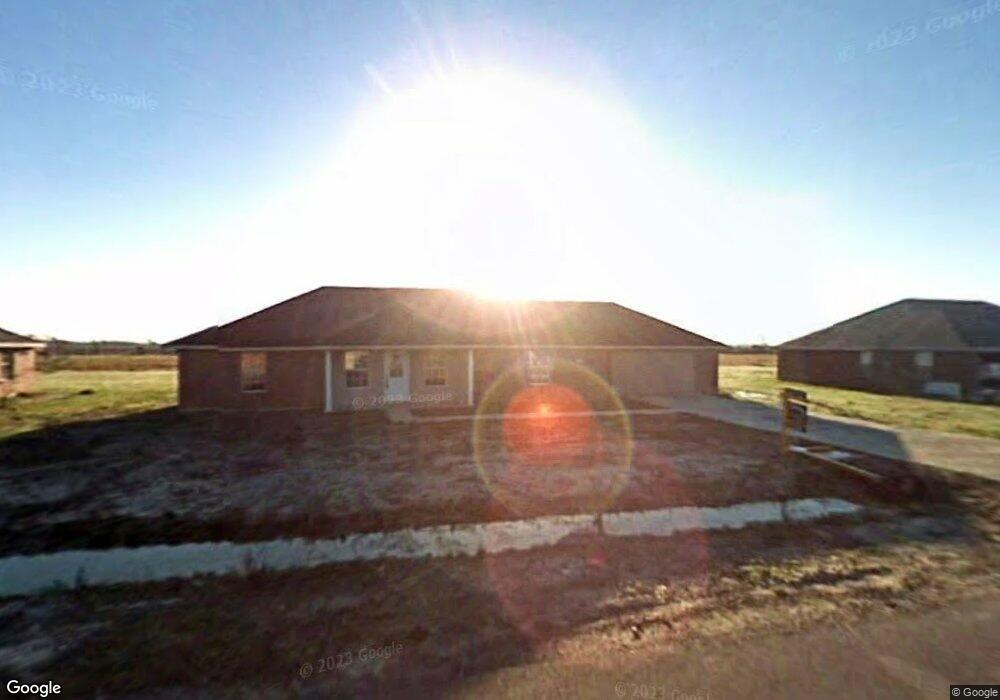
4100 Bertie Ann Rd Lake Charles, LA 70611
Gillis NeighborhoodEstimated Value: $241,432 - $305,000
3
Beds
2
Baths
1,676
Sq Ft
$161/Sq Ft
Est. Value
About This Home
This home is located at 4100 Bertie Ann Rd, Lake Charles, LA 70611 and is currently estimated at $269,858, approximately $161 per square foot. 4100 Bertie Ann Rd is a home located in Calcasieu Parish with nearby schools including Graham & Parks Alternative Public School, Gillis Elementary School, and Putnam Avenue Upper School.
Ownership History
Date
Name
Owned For
Owner Type
Purchase Details
Closed on
Oct 15, 2008
Sold by
Oak Meadows Land & Development Inc
Bought by
Housh Donald Frank and Housh Lisa Marie
Current Estimated Value
Home Financials for this Owner
Home Financials are based on the most recent Mortgage that was taken out on this home.
Original Mortgage
$161,733
Outstanding Balance
$107,135
Interest Rate
6.35%
Mortgage Type
Purchase Money Mortgage
Estimated Equity
$162,723
Create a Home Valuation Report for This Property
The Home Valuation Report is an in-depth analysis detailing your home's value as well as a comparison with similar homes in the area
Home Values in the Area
Average Home Value in this Area
Purchase History
| Date | Buyer | Sale Price | Title Company |
|---|---|---|---|
| Housh Donald Frank | $158,500 | Landmark Title Services |
Source: Public Records
Mortgage History
| Date | Status | Borrower | Loan Amount |
|---|---|---|---|
| Open | Housh Donald Frank | $161,733 |
Source: Public Records
Tax History Compared to Growth
Tax History
| Year | Tax Paid | Tax Assessment Tax Assessment Total Assessment is a certain percentage of the fair market value that is determined by local assessors to be the total taxable value of land and additions on the property. | Land | Improvement |
|---|---|---|---|---|
| 2024 | $1,080 | $17,550 | $2,850 | $14,700 |
| 2023 | $1,080 | $17,550 | $2,850 | $14,700 |
| 2022 | $1,062 | $17,550 | $2,850 | $14,700 |
| 2021 | $1,114 | $17,550 | $2,850 | $14,700 |
| 2020 | $1,739 | $15,970 | $2,740 | $13,230 |
| 2019 | $1,895 | $17,340 | $2,640 | $14,700 |
| 2018 | $1,077 | $17,340 | $2,640 | $14,700 |
| 2017 | $1,092 | $17,340 | $2,640 | $14,700 |
| 2016 | $1,936 | $17,340 | $2,640 | $14,700 |
| 2015 | $1,936 | $17,340 | $2,640 | $14,700 |
Source: Public Records
Map
Nearby Homes
- 0 Camryn Rd
- 4179 Camryn Rd
- 4194 Camryn Rd
- 657 Topsy Rd
- 1032 Birdnest Rd
- 4167 Greentree Ln
- 4259 Greentree Ln
- 0 N Hwy 171 Hwy Unit SWL23004627
- 0 Bunker Hill Rd Unit SWL25001343
- 0 Bunker Hill Rd Unit SWL25100640
- 3074 N Hwy 171
- 3076 Hwy 171 Hwy N
- 3039 N Hwy 171 Hwy
- 0 Talon Ln Unit Lot 7 SWL25100714
- 0 Talon Ln Unit Lot 6 SWL24003702
- 0 Talon Ln Unit Lot 13 SWL25100712
- 0 Talon Ln Unit Lot 1 SWL25100706
- TBD Mesa Ln
- 8 Buffalo Run Dr
- 17 Swooping Eagle Dr
- 4108 Bertie Ann Rd
- 4090 Bertie Ann Rd
- 4101 Bertie Ann Rd
- 4093 Bertie Ann Rd
- 4082 Bertie Ann Rd
- 4085 Bertie Ann Rd
- 0 Bertie Ann Rd Unit 190580
- 0 Bertie Ann Rd Unit 180319
- 0 Bertie Ann Rd
- TBD Bertie Ann Rd
- 4122 Bertie Ann Rd
- 4074 Bertie Ann Rd
- 4077 Bertie Ann Rd
- 4118 Camryn Rd
- 4123 Bertie Ann Rd
- 4123 Birdie Ann
- 4134 Camryn Rd
- 4110 Camryn Rd
- 4078 Camryn Rd
- 4062 Camryn Rd