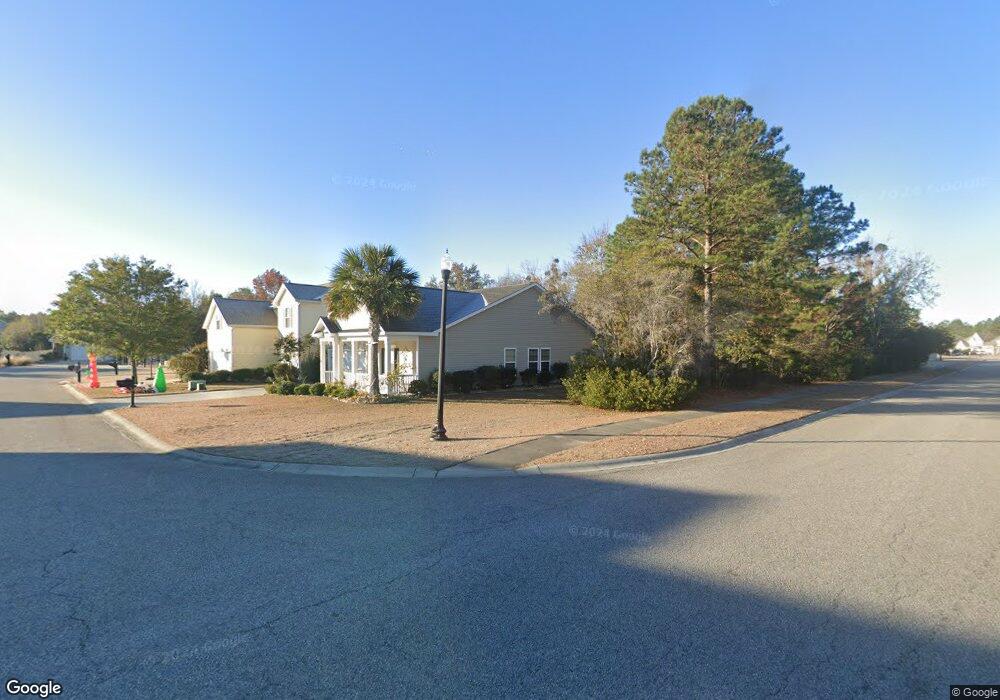
4100 Briar Patch Ct Unit Lot 372 Myrtle Beach, SC 29579
Estimated Value: $326,777 - $343,000
3
Beds
2
Baths
1,920
Sq Ft
$174/Sq Ft
Est. Value
About This Home
This home is located at 4100 Briar Patch Ct Unit Lot 372, Myrtle Beach, SC 29579 and is currently estimated at $333,694, approximately $173 per square foot. 4100 Briar Patch Ct Unit Lot 372 is a home located in Horry County with nearby schools including Carolina Forest Elementary School, Ten Oaks Middle, and Carolina Forest High School.
Ownership History
Date
Name
Owned For
Owner Type
Purchase Details
Closed on
May 26, 2022
Sold by
Monette Matthew D
Bought by
Cafaro Robert and Cafaro Iris
Current Estimated Value
Home Financials for this Owner
Home Financials are based on the most recent Mortgage that was taken out on this home.
Original Mortgage
$215,000
Outstanding Balance
$202,759
Interest Rate
5.1%
Mortgage Type
New Conventional
Estimated Equity
$130,935
Purchase Details
Closed on
Apr 4, 2016
Sold by
Morrissey Daniel J
Bought by
Monette Matthew D
Home Financials for this Owner
Home Financials are based on the most recent Mortgage that was taken out on this home.
Original Mortgage
$172,000
Interest Rate
3.64%
Purchase Details
Closed on
Nov 12, 2010
Sold by
Lennar Homes
Bought by
Morrissey Daniel J
Create a Home Valuation Report for This Property
The Home Valuation Report is an in-depth analysis detailing your home's value as well as a comparison with similar homes in the area
Home Values in the Area
Average Home Value in this Area
Purchase History
| Date | Buyer | Sale Price | Title Company |
|---|---|---|---|
| Cafaro Robert | $325,000 | -- | |
| Monette Matthew D | $184,000 | -- | |
| Morrissey Daniel J | $134,989 | -- |
Source: Public Records
Mortgage History
| Date | Status | Borrower | Loan Amount |
|---|---|---|---|
| Open | Cafaro Robert | $215,000 | |
| Previous Owner | Monette Matthew D | $172,000 |
Source: Public Records
Tax History
| Year | Tax Paid | Tax Assessment Tax Assessment Total Assessment is a certain percentage of the fair market value that is determined by local assessors to be the total taxable value of land and additions on the property. | Land | Improvement |
|---|---|---|---|---|
| 2025 | $4,005 | $0 | $0 | $0 |
| 2024 | $4,005 | $17,503 | $5,457 | $12,046 |
| 2023 | $3,607 | $8,336 | $2,126 | $6,210 |
| 2021 | $878 | $13,054 | $3,190 | $9,864 |
| 2020 | $770 | $13,054 | $3,190 | $9,864 |
| 2019 | $770 | $13,054 | $3,190 | $9,864 |
| 2018 | $0 | $10,873 | $3,169 | $7,704 |
| 2017 | $2,341 | $10,873 | $3,169 | $7,704 |
| 2016 | $0 | $9,326 | $2,756 | $6,570 |
| 2015 | -- | $6,218 | $1,838 | $4,380 |
| 2014 | $542 | $6,218 | $1,838 | $4,380 |
Source: Public Records
Map
Nearby Homes
- 4108 Briar Patch Ct
- 3616 White Wing Cir
- 5700 Redgum Dr
- 5260 Walnutwood Trail
- 4940 Sandlewood Dr
- 4613 Marshwood Dr
- 4959 Sandlewood Dr
- 5433 Merrywind Ct
- 5434 Merrywind Ct
- 4543 Marshwood Dr
- 6142 Chadderton Cir
- 4604 Day Lily Run St
- 208 Starlit Way
- 6194 Chadderton Cir
- 4752 Hopespring St
- 4473 Marshwood Dr
- 6204 Chadderton Cir
- 6415 Chadderton Cir
- 8028 Brogdon Dr
- 4570 Day Lily Run St
- 4100 Briar Patch Ct
- 4104 Briar Patch Ct
- 4935 Sandlewood Dr Unit Compton LC2A
- 4904 Sandlewood Dr Unit Rosemont LC1A
- 4931 Sandlewood Dr Unit Morgan LC2A
- 4919 Sandlewood Dr Unit Hartwell LC2G
- 4904 Sandlewood Dr Unit Hartwell LC1A
- 5004 Sandlewood Dr Unit Lot 398 - Yates A
- 5032 Sandlewood Dr Unit Lot 405 - Newbury B
- 5044 Sandlewood Dr Unit Lot 408 Chadwick B
- 4904 Sandlewood Dr
- 5032 Sandlewood Dr
- 5004 Sandlewood Dr
- 4935 Sandlewood Dr
- 4919 Sandlewood Dr
- 4911 Sandlewood Dr
- 4915 Sandlewood Dr
- 4892 Sandlewood Dr
- 4888 Sandlewood Dr
- 4884 Sandlewood Dr
Your Personal Tour Guide
Ask me questions while you tour the home.