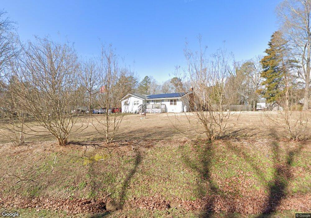
4100 Larkin Ln Midlothian, VA 23112
Estimated Value: $313,000 - $351,449
3
Beds
2
Baths
1,664
Sq Ft
$200/Sq Ft
Est. Value
About This Home
This home is located at 4100 Larkin Ln, Midlothian, VA 23112 and is currently estimated at $333,362, approximately $200 per square foot. 4100 Larkin Ln is a home located in Chesterfield County with nearby schools including Thelma Crenshaw Elementary School, Bailey Bridge Middle School, and Manchester High.
Ownership History
Date
Name
Owned For
Owner Type
Purchase Details
Closed on
Aug 1, 2022
Sold by
Western Charles A
Bought by
Western Charles A and Western Betty S
Current Estimated Value
Purchase Details
Closed on
Jun 1, 2006
Sold by
Thompson Mamie
Bought by
Lane Daniel
Home Financials for this Owner
Home Financials are based on the most recent Mortgage that was taken out on this home.
Original Mortgage
$142,452
Interest Rate
6.62%
Mortgage Type
New Conventional
Purchase Details
Closed on
Jun 22, 1998
Sold by
Sikes William D and Sikes Sikes
Bought by
Thompson Kenneth P and Thompson Mamie L
Home Financials for this Owner
Home Financials are based on the most recent Mortgage that was taken out on this home.
Original Mortgage
$79,950
Interest Rate
7.09%
Mortgage Type
New Conventional
Create a Home Valuation Report for This Property
The Home Valuation Report is an in-depth analysis detailing your home's value as well as a comparison with similar homes in the area
Home Values in the Area
Average Home Value in this Area
Purchase History
| Date | Buyer | Sale Price | Title Company |
|---|---|---|---|
| Western Charles A | -- | Lane & Hamner Pc | |
| Lane Daniel | $149,450 | -- | |
| Thompson Kenneth P | $100,000 | -- |
Source: Public Records
Mortgage History
| Date | Status | Borrower | Loan Amount |
|---|---|---|---|
| Previous Owner | Lane Daniel | $142,452 | |
| Previous Owner | Thompson Kenneth P | $79,950 |
Source: Public Records
Tax History
| Year | Tax Paid | Tax Assessment Tax Assessment Total Assessment is a certain percentage of the fair market value that is determined by local assessors to be the total taxable value of land and additions on the property. | Land | Improvement |
|---|---|---|---|---|
| 2025 | $2,801 | $311,900 | $47,400 | $264,500 |
| 2024 | $2,801 | $302,900 | $45,800 | $257,100 |
| 2023 | $2,751 | $273,600 | $44,200 | $229,400 |
| 2022 | $2,064 | $224,300 | $42,600 | $181,700 |
| 2021 | $1,915 | $198,900 | $41,000 | $157,900 |
| 2020 | $1,778 | $187,200 | $39,400 | $147,800 |
| 2019 | $1,670 | $175,800 | $37,800 | $138,000 |
| 2018 | $1,636 | $172,200 | $36,600 | $135,600 |
| 2017 | $1,510 | $157,300 | $36,600 | $120,700 |
| 2016 | $1,480 | $154,200 | $36,600 | $117,600 |
| 2015 | $1,548 | $161,200 | $36,600 | $124,600 |
| 2014 | $1,527 | $161,700 | $36,600 | $125,100 |
Source: Public Records
Map
Nearby Homes
- 12112 Merit Grove Ct
- 11632 Fort Cosby Dr
- 4114 Ebbies Crossing
- 11718 Bailey Woods Dr
- 4524 Twelveoaks Rd
- 4118 Ebbies Crossing
- 12438 Wescott Ave
- 12440 Wescott Ave
- 12442 Wescott Ave
- 4001 Next Level Trace
- 3727 Maze Runner Dr
- 12444 Wescott Ave
- 4003 Next Level Trace
- 3729 Maze Runner Dr
- 12448 Wescott Ave
- 4917 Bailey Woods Ln
- 4005 Next Level Trace
- 3731 Maze Runner Dr
- 4007 Next Level Trace
- 3733 Maze Runner Dr
- 4030 Larkin Ln
- 4110 Larkin Ln
- 12101 Merit Grove Ct
- 4104 Larkin Ln
- 4020 Larkin Ln
- 12107 Merit Grove Ct
- 4103 Larkin Ln
- 4101 Larkin Ln
- 4200 Larkin Ln
- 4107 Larkin Ln
- 4041 Larkin Ln
- 12100 Dehaviland Dr
- 4109 Larkin Ln
- 4206 Larkin Ln
- 12100 Merit Grove Ct
- 12106 Dehaviland Dr
- 4031 Larkin Ln
- 12113 Merit Grove Ct
- 12112 Dehaviland Dr
- 4010 Larkin Ln
Your Personal Tour Guide
Ask me questions while you tour the home.