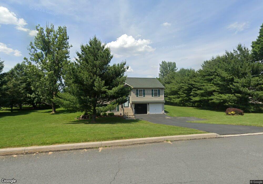
4101 Ford Dr Emmaus, PA 18049
Estimated Value: $400,860 - $481,000
3
Beds
2
Baths
1,836
Sq Ft
$245/Sq Ft
Est. Value
About This Home
This home is located at 4101 Ford Dr, Emmaus, PA 18049 and is currently estimated at $450,715, approximately $245 per square foot. 4101 Ford Dr is a home located in Lehigh County with nearby schools including Macungie Elementary School, Eyer Middle School, and Emmaus High School.
Ownership History
Date
Name
Owned For
Owner Type
Purchase Details
Closed on
Jul 17, 2000
Sold by
Gregory Thomas S and Gregory Jennifer J
Bought by
Toy William J and Toy Janet C
Current Estimated Value
Purchase Details
Closed on
May 23, 1997
Sold by
Amelio Rudolph G
Bought by
Thomas S Gregory and Thomas Jennifer J
Purchase Details
Closed on
Aug 1, 1996
Sold by
Beck Oliver and Frank Beck
Bought by
Amelio Rudolph G
Create a Home Valuation Report for This Property
The Home Valuation Report is an in-depth analysis detailing your home's value as well as a comparison with similar homes in the area
Home Values in the Area
Average Home Value in this Area
Purchase History
| Date | Buyer | Sale Price | Title Company |
|---|---|---|---|
| Toy William J | $148,350 | -- | |
| Thomas S Gregory | $138,500 | -- | |
| Amelio Rudolph G | $30,000 | -- |
Source: Public Records
Tax History
| Year | Tax Paid | Tax Assessment Tax Assessment Total Assessment is a certain percentage of the fair market value that is determined by local assessors to be the total taxable value of land and additions on the property. | Land | Improvement |
|---|---|---|---|---|
| 2026 | $5,517 | $209,200 | $71,100 | $138,100 |
| 2025 | $5,341 | $209,200 | $71,100 | $138,100 |
| 2024 | $5,104 | $209,200 | $71,100 | $138,100 |
| 2023 | $5,001 | $209,200 | $71,100 | $138,100 |
| 2022 | $4,881 | $209,200 | $138,100 | $71,100 |
| 2021 | $4,776 | $209,200 | $71,100 | $138,100 |
| 2020 | $4,730 | $209,200 | $71,100 | $138,100 |
| 2019 | $4,701 | $209,200 | $71,100 | $138,100 |
| 2018 | $4,581 | $209,200 | $71,100 | $138,100 |
| 2017 | $4,499 | $209,200 | $71,100 | $138,100 |
| 2016 | -- | $209,200 | $71,100 | $138,100 |
| 2015 | -- | $209,200 | $71,100 | $138,100 |
| 2014 | -- | $209,200 | $71,100 | $138,100 |
Source: Public Records
Map
Nearby Homes
- 3985 Mink Rd
- 4471 Stole Rd
- 3722 Samantha Ln Unit Lot 12
- 3722 Samantha Ln
- 3740 Samantha Ln
- 3710 Samantha Ln
- 3710 Samantha Ln Unit 16
- 4435 Stole Rd
- 3641 Samantha Ln Unit 49
- 3643 Samantha Ln Unit 50
- 3868 Mink Rd
- 3872 Mink Rd
- 4476 Lenni Cir
- 1717 W Minor St
- 5288 Brocton Ct
- 3540 Lenape Ln
- 3508 Lenape Ln
- 210 S 16th St
- 3513 Lenape Ln
- 830 E Main St
- 4109 Ford Dr
- 4092 Tank Farm Rd
- 4141 Ford Dr
- 4124 Tank Farm Rd
- 4140 Tank Farm Rd
- 4165 Ford Dr
- 4113 Ford Dr
- 4031 Tank Farm Rd
- 4191 Ford Dr
- 4984 Buckeye Rd
- 4183 Ford Dr
- 4114 Tank Farm Rd
- 4950 Buckeye Rd
- 4998 Buckeye Rd
- 4942 Buckeye Rd
- 4117 Ford Dr
- 4177 Ford Dr
- 4976 Buckeye Rd
- 4968 Buckeye Rd
- 4910 Buckeye Rd
Your Personal Tour Guide
Ask me questions while you tour the home.