
Seller's Agent in 2025
Kyle Westrate
United Realty Services LLC
(616) 916-0490
5 in this area
708 Total Sales
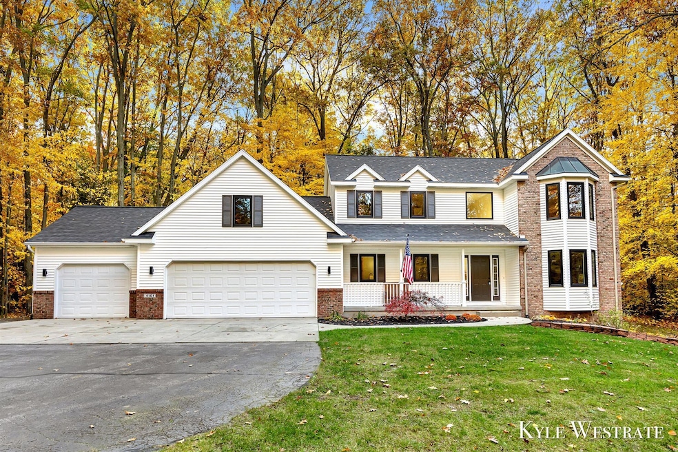
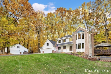

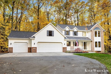
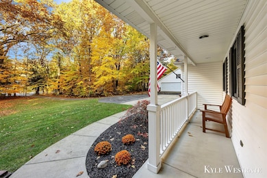
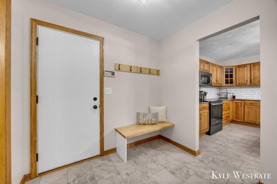
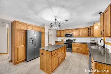
Welcome to 4101 White Pine Dr! This 3 bed 3.5 bath home is move in ready! Located at the end of a quiet cul-de-sac on a 2 acre lot this property offers total privacy! The main level features a spacious living area, dining space, kitchen with center island, sun room, full bath, laundry, and extra sitting area! The upper level features a large primary suite with a private bath, two additional bedrooms, and a full bath! Enjoy the partially finished lower level walkout with an entertainment area, non conforming 4th bedroom/office, and storage! The outdoor space features a large deck perfect for hosting and entertaining! The additional two stall garage offers extra storage and workshop! Come see everything this property has to offer! Schedule your showing today!
Last Agent to Sell the Property
United Realty Services LLC License #6501413577 Listed on: 11/07/2025
| Date | Type | Sale Price | Title Company |
|---|---|---|---|
| Warranty Deed | $595,000 | Irongate Title | |
| Warranty Deed | $411,000 | Irongate Title | |
| Warranty Deed | $411,000 | Irongate Title | |
| Warranty Deed | $300,000 | -- | |
| Deed | -- | -- | |
| Deed | $28,000 | -- |
| Date | Status | Loan Amount | Loan Type |
|---|---|---|---|
| Open | $442,500 | New Conventional | |
| Previous Owner | $260,000 | No Value Available |
| Date | Event | Price | List to Sale | Price per Sq Ft |
|---|---|---|---|---|
| 12/11/2025 12/11/25 | Sold | $595,000 | -0.8% | $211 / Sq Ft |
| 11/11/2025 11/11/25 | Pending | -- | -- | -- |
| 11/07/2025 11/07/25 | For Sale | $599,900 | -- | $212 / Sq Ft |
| Year | Tax Paid | Tax Assessment Tax Assessment Total Assessment is a certain percentage of the fair market value that is determined by local assessors to be the total taxable value of land and additions on the property. | Land | Improvement |
|---|---|---|---|---|
| 2025 | $4,492 | $265,500 | $19,100 | $246,400 |
| 2024 | $4,090 | $261,700 | $19,100 | $242,600 |
| 2023 | $4,090 | $221,700 | $19,100 | $202,600 |
| 2022 | $4,090 | $202,600 | $19,100 | $183,500 |
| 2021 | $3,834 | $177,300 | $19,100 | $158,200 |
| 2020 | $3,659 | $174,200 | $19,100 | $155,100 |
| 2019 | $3,659 | $169,900 | $19,100 | $150,800 |
| 2018 | $3,569 | $142,900 | $19,100 | $123,800 |
| 2017 | $0 | $147,900 | $19,100 | $128,800 |
| 2016 | $0 | $135,300 | $21,400 | $113,900 |
| 2015 | -- | $135,300 | $21,400 | $113,900 |
| 2014 | -- | $120,200 | $20,900 | $99,300 |
| 2013 | -- | $108,700 | $20,800 | $87,900 |
Seller's Agent in 2025
Kyle Westrate
United Realty Services LLC
(616) 916-0490
5 in this area
708 Total Sales
B
Buyer's Agent in 2025
Blake Timmer
EXP Realty (Grand Rapids)
(888) 501-7085
3 in this area
70 Total Sales
Source: MichRIC
MLS Number: 25057330
APN: 05-299-004-00
Disclaimer: Certain information contained herein is derived from information provided by parties other than Homes.com. All information provided is deemed reliable, but is not guaranteed to be accurate and should be independently verified.
![]() Information is deemed reliable but not guaranteed.
Information is deemed reliable but not guaranteed.
Copyright 2026 MichRIC, LLC. All rights reserved.
Ask me questions while you tour the home.