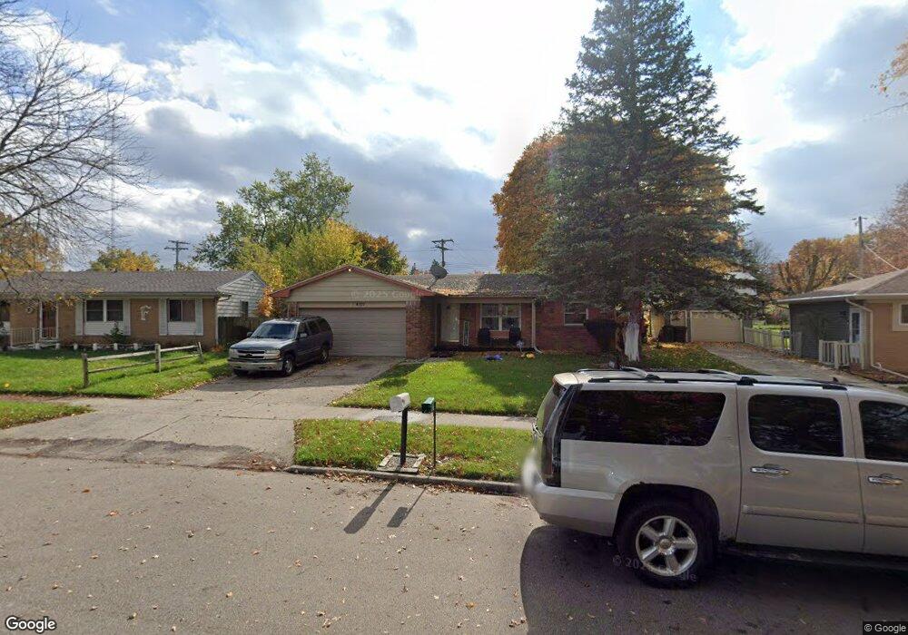
4101 Woodcreek Ln Lansing, MI 48911
Lansing-Eaton NeighborhoodEstimated Value: $171,000 - $181,000
3
Beds
2
Baths
1,307
Sq Ft
$134/Sq Ft
Est. Value
About This Home
This home is located at 4101 Woodcreek Ln, Lansing, MI 48911 and is currently estimated at $175,692, approximately $134 per square foot. 4101 Woodcreek Ln is a home located in Eaton County with nearby schools including Averill Elementary School, Attwood School, and J.W. Sexton High School.
Ownership History
Date
Name
Owned For
Owner Type
Purchase Details
Closed on
Sep 30, 2009
Sold by
Powell Roger L and Adams Powell Karen
Bought by
Thomas La Sonia
Current Estimated Value
Home Financials for this Owner
Home Financials are based on the most recent Mortgage that was taken out on this home.
Original Mortgage
$5,000
Outstanding Balance
$3,283
Interest Rate
5.19%
Mortgage Type
Unknown
Estimated Equity
$172,409
Purchase Details
Closed on
Sep 21, 2006
Sold by
New Century Mortgage Corp
Bought by
Deutsche Bank National Trust Co
Purchase Details
Closed on
Jul 6, 2006
Sold by
Blocker Terry and Blocker Antoinetta
Bought by
New Century Mortgage Corp
Create a Home Valuation Report for This Property
The Home Valuation Report is an in-depth analysis detailing your home's value as well as a comparison with similar homes in the area
Home Values in the Area
Average Home Value in this Area
Purchase History
| Date | Buyer | Sale Price | Title Company |
|---|---|---|---|
| Thomas La Sonia | $103,000 | Tri Title Agency | |
| Deutsche Bank National Trust Co | -- | None Available | |
| New Century Mortgage Corp | $122,831 | None Available |
Source: Public Records
Mortgage History
| Date | Status | Borrower | Loan Amount |
|---|---|---|---|
| Open | Thomas La Sonia | $5,000 | |
| Open | Thomas La Sonia | $99,715 |
Source: Public Records
Tax History Compared to Growth
Tax History
| Year | Tax Paid | Tax Assessment Tax Assessment Total Assessment is a certain percentage of the fair market value that is determined by local assessors to be the total taxable value of land and additions on the property. | Land | Improvement |
|---|---|---|---|---|
| 2025 | $2,703 | $73,400 | $0 | $0 |
| 2024 | $4,796 | $69,100 | $0 | $0 |
| 2023 | $4,796 | $62,600 | $0 | $0 |
| 2022 | $2,320 | $56,300 | $0 | $0 |
| 2021 | $2,229 | $50,900 | $0 | $0 |
| 2020 | $2,218 | $47,800 | $0 | $0 |
| 2019 | $2,160 | $43,200 | $0 | $0 |
| 2018 | $2,007 | $36,200 | $0 | $0 |
| 2017 | $1,964 | $34,700 | $0 | $0 |
| 2016 | $1,540 | $34,600 | $0 | $0 |
| 2015 | -- | $34,800 | $0 | $0 |
| 2014 | -- | $36,200 | $0 | $0 |
| 2013 | -- | $37,600 | $0 | $0 |
Source: Public Records
Map
Nearby Homes
- 4130 Windward Dr
- 4107 Windward Dr
- 4009 Heathgate Dr
- 4018 Clayborn Rd
- 4317 Seaway Dr
- 4328 Chadburne Dr
- 4123 Balmoral Dr
- 4400 Chadburne Dr
- 3700 W Holmes Rd
- 3941 Glenburne Blvd
- 3526 Berwick Dr
- 2800 S Waverly Hwy
- 4024 Stillwell Ave
- 4000 Churchill Ave
- 3600 Ronald St
- 3600 Sandhurst Dr
- 3200 Lawdor Rd
- 4.5 Locust Ln
- 2 Locust Ln
- 2838 Sunderland Rd
- 4033 Woodcreek Ln
- 4109 Woodcreek Ln
- 4100 Rivershell Ln
- 4027 Woodcreek Ln
- 4038 Rivershell Ln
- 4117 Woodcreek Ln
- 4110 Rivershell Ln
- 4030 Rivershell Ln
- 4116 Rivershell Ln
- 4026 Rivershell Ln
- 4125 Woodcreek Ln
- 4023 Woodcreek Ln
- 4020 Rivershell Ln
- 4122 Rivershell Ln
- 4107 Rivershell Ln
- 4017 Woodcreek Ln
- 4131 Woodcreek Ln
- 4016 Rivershell Ln
- 2912 Dwood
- 2906 Dwood