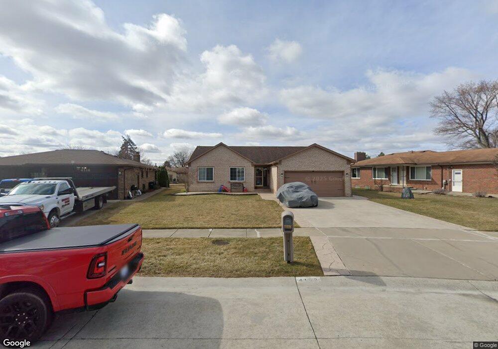
4102 Bloomfield Dr Sterling Heights, MI 48310
Estimated Value: $328,000 - $375,000
3
Beds
2
Baths
1,448
Sq Ft
$242/Sq Ft
Est. Value
About This Home
This home is located at 4102 Bloomfield Dr, Sterling Heights, MI 48310 and is currently estimated at $350,543, approximately $242 per square foot. 4102 Bloomfield Dr is a home located in Macomb County with nearby schools including Jefferson Elementary School, Grissom Middle School, and Sterling Heights Senior H.S..
Ownership History
Date
Name
Owned For
Owner Type
Purchase Details
Closed on
Jul 23, 2004
Sold by
Kejbou Issam J and Kejbou Dikra
Bought by
Abro Talal and Abro Mayada
Current Estimated Value
Home Financials for this Owner
Home Financials are based on the most recent Mortgage that was taken out on this home.
Original Mortgage
$188,790
Outstanding Balance
$92,906
Interest Rate
6.1%
Mortgage Type
FHA
Estimated Equity
$257,637
Purchase Details
Closed on
Dec 19, 1995
Sold by
Hugelier D and Hugelier P
Bought by
Kejbou I and Kejbou D
Create a Home Valuation Report for This Property
The Home Valuation Report is an in-depth analysis detailing your home's value as well as a comparison with similar homes in the area
Home Values in the Area
Average Home Value in this Area
Purchase History
| Date | Buyer | Sale Price | Title Company |
|---|---|---|---|
| Abro Talal | $195,000 | Title One Inc | |
| Kejbou I | $129,000 | -- |
Source: Public Records
Mortgage History
| Date | Status | Borrower | Loan Amount |
|---|---|---|---|
| Open | Abro Talal | $188,790 |
Source: Public Records
Tax History Compared to Growth
Tax History
| Year | Tax Paid | Tax Assessment Tax Assessment Total Assessment is a certain percentage of the fair market value that is determined by local assessors to be the total taxable value of land and additions on the property. | Land | Improvement |
|---|---|---|---|---|
| 2025 | $5,487 | $185,100 | $0 | $0 |
| 2024 | $5,293 | $173,900 | $0 | $0 |
| 2023 | $4,906 | $152,400 | $0 | $0 |
| 2022 | $4,758 | $135,900 | $0 | $0 |
| 2021 | $4,917 | $128,200 | $0 | $0 |
| 2020 | $4,675 | $120,900 | $0 | $0 |
| 2019 | $4,609 | $114,000 | $0 | $0 |
| 2018 | $4,646 | $107,900 | $0 | $0 |
| 2017 | $4,483 | $100,300 | $15,200 | $85,100 |
| 2016 | $4,388 | $100,300 | $0 | $0 |
| 2015 | -- | $91,300 | $0 | $0 |
| 2014 | -- | $74,800 | $0 | $0 |
Source: Public Records
Map
Nearby Homes
- 38338 Coronation Dr
- 4325 Fox Hill Dr
- 38576 Cottonwood Dr
- 4622 Ardmore Dr
- 4653 Lucerne Dr
- 3349 Dobbin Dr
- 38915 Claremont Ct
- 3816 Pokley Ct
- 3601 Denson Dr
- 3217 Barton Dr
- 4761 Fox Hill Dr
- 3038 Donna Dr
- 3600 Brandi Dr
- 37258 Carpathia Blvd
- 38172 Yonkers Dr
- 39198 Faith Dr
- 4768 Dreon Ct
- 38638 Harrison Dr
- 38968 Harrison Dr
- 37288 Vernon Dr
- 4116 Bloomfield Dr Unit Bldg-Unit
- 4116 Bloomfield Dr
- 4117 Lin Dr Unit Bldg-Unit
- 4117 Lin Dr
- 4128 Bloomfield Dr
- 4105 Lin Dr
- 4129 Lin Dr
- 4027 Lin Dr
- 4141 Lin Dr
- 4140 Bloomfield Dr
- 38307 Coronation Dr
- 38301 Coronation Dr
- 38306 Coronation Dr
- 4129 Bloomfield Dr
- 4013 Lin Dr
- 4153 Lin Dr
- 38315 Coronation Dr
- 4141 Bloomfield Dr
- 38324 Coronation Dr
- 4205 Lin Dr