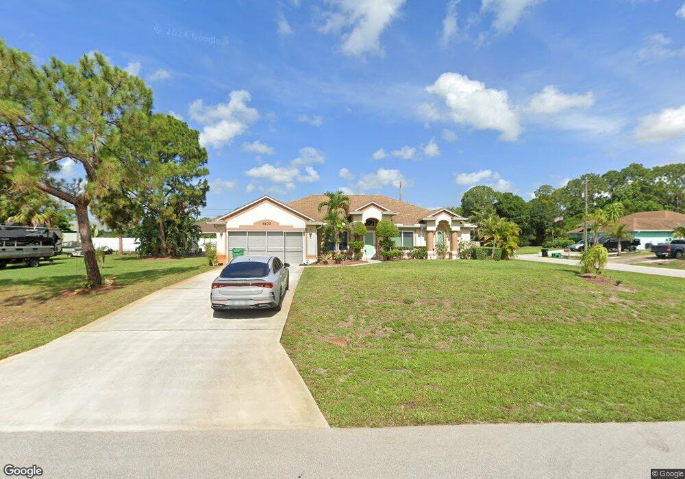
4102 SW Rardin St Port Saint Lucie, FL 34953
Rosser Reserve NeighborhoodEstimated Value: $452,000 - $500,000
4
Beds
2
Baths
2,261
Sq Ft
$212/Sq Ft
Est. Value
About This Home
This home is located at 4102 SW Rardin St, Port Saint Lucie, FL 34953 and is currently estimated at $480,038, approximately $212 per square foot. 4102 SW Rardin St is a home located in St. Lucie County with nearby schools including Windmill Point Elementary School, Oak Hammock K-8 School, and Bayshore Elementary School.
Ownership History
Date
Name
Owned For
Owner Type
Purchase Details
Closed on
Oct 13, 2025
Sold by
Skinner David R and Skinner Teresa L
Bought by
Skinner David R and Skinner Teresa L
Current Estimated Value
Purchase Details
Closed on
Aug 1, 2002
Sold by
Maddox Roberto D
Bought by
Skinner David
Purchase Details
Closed on
Jan 17, 2001
Sold by
Mercedes Homes Inc
Bought by
Skinner David R
Home Financials for this Owner
Home Financials are based on the most recent Mortgage that was taken out on this home.
Original Mortgage
$120,500
Interest Rate
7.53%
Mortgage Type
VA
Purchase Details
Closed on
Aug 9, 2000
Sold by
Skinner David Roger
Bought by
Mercedes Homes Inc
Purchase Details
Closed on
Apr 10, 2000
Sold by
Mamone Scott A and Mamone Jennifer L
Bought by
Skinner David Roger
Purchase Details
Closed on
Dec 22, 1999
Sold by
Trimble Michael F and Trimble Lori
Bought by
Mamone Scott A and Mamone Jennifer L
Create a Home Valuation Report for This Property
The Home Valuation Report is an in-depth analysis detailing your home's value as well as a comparison with similar homes in the area
Home Values in the Area
Average Home Value in this Area
Purchase History
| Date | Buyer | Sale Price | Title Company |
|---|---|---|---|
| Skinner David R | $100 | None Listed On Document | |
| Skinner David | -- | -- | |
| Skinner David R | $126,000 | -- | |
| Mercedes Homes Inc | -- | -- | |
| Skinner David Roger | $5,500 | -- | |
| Mamone Scott A | $2,000 | -- |
Source: Public Records
Mortgage History
| Date | Status | Borrower | Loan Amount |
|---|---|---|---|
| Previous Owner | Skinner David R | $120,500 |
Source: Public Records
Tax History Compared to Growth
Tax History
| Year | Tax Paid | Tax Assessment Tax Assessment Total Assessment is a certain percentage of the fair market value that is determined by local assessors to be the total taxable value of land and additions on the property. | Land | Improvement |
|---|---|---|---|---|
| 2024 | $3,355 | $167,652 | -- | -- |
| 2023 | $3,355 | $162,769 | $0 | $0 |
| 2022 | $3,205 | $158,029 | $0 | $0 |
| 2021 | $3,115 | $153,427 | $0 | $0 |
| 2020 | $2,931 | $143,528 | $0 | $0 |
| 2019 | $2,896 | $140,302 | $0 | $0 |
| 2018 | $2,752 | $137,686 | $0 | $0 |
| 2017 | $3,163 | $209,900 | $59,100 | $150,800 |
| 2016 | $3,117 | $215,000 | $50,700 | $164,300 |
| 2015 | $3,136 | $167,900 | $30,400 | $137,500 |
| 2014 | $3,007 | $130,123 | $0 | $0 |
Source: Public Records
Map
Nearby Homes
- 1581 SW Crater Ave
- 1371 SW Halford Ave
- 4149 SW Bamberg St
- 1357 SW Hebner Ave
- 1434 SW Jacksonville Ave
- 1517 SW KaMcHatka Ave
- 4100 SW Jive St
- 1442 SW Jacksonville Ave
- 1331 SW Ingrassina Ave
- 1281 SW Kapok Ave
- 1589 SW Iffla Ave
- 1319 SW Hunnicut Ave
- 1374 SW Wampler Ave
- 1411 SW Hackensack Ave
- 1450 SW Hackensack Ave
- 3966 SW Brunswick St
- 4133 SW Tuscol St
- 1574 SW Hackensack Ave
- 1250 SW Paar Dr
- 1261 SW Kapok Ave
- 4101 SW Daniff St
- 4118 SW Rardin St
- 4119 SW Daniff St
- 4109 SW Rardin St
- 4101 SW Rardin St
- 4126 SW Rardin St
- 1491 SW Delos Ave
- 4117 SW Rardin St
- 1481 SW Delos Ave
- 1501 SW Delos Ave
- 4155 SW Daniff St
- 1521 SW Delos Ave
- 1471 SW Delos Ave
- 4125 SW Rardin St
- 4134 SW Rardin St
- 4102 SW Daniff St
- 4110 SW Darien St
- 1450 SW Delos Ave
- 1461 SW Delos Ave
- 4118 SW Darien St