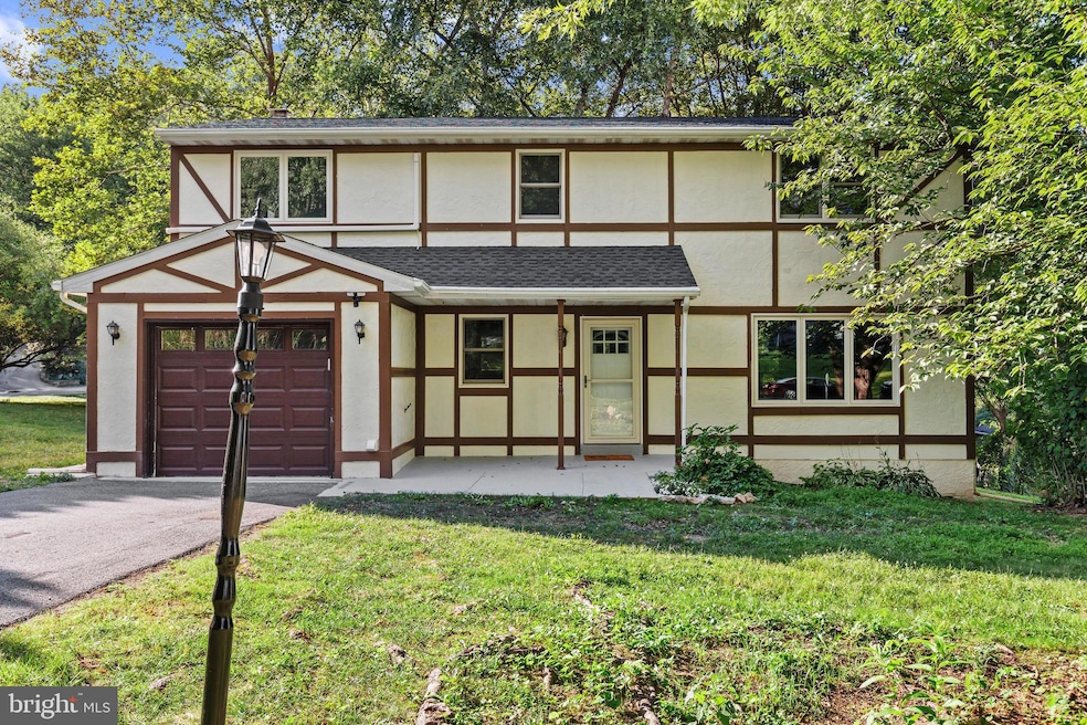
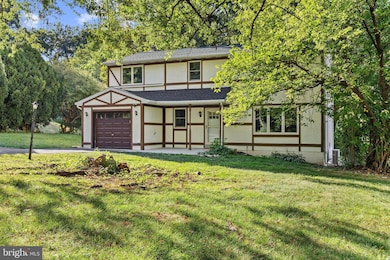
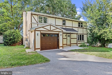
4103 Forrest Rd Mount Joy, PA 17552
Farmdale NeighborhoodEstimated payment $2,671/month
Highlights
- 0.49 Acre Lot
- Recreation Room
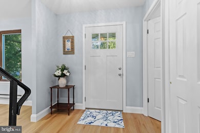
- Wood Flooring
- Farmdale Elementary School Rated A-
- Traditional Architecture
- No HOA
About This Home
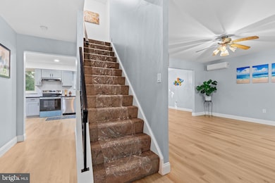
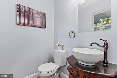
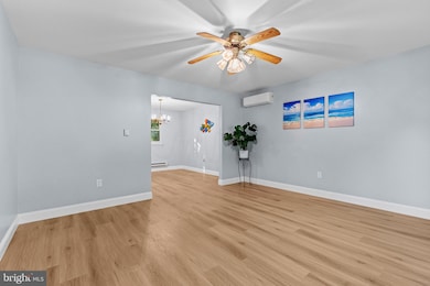
Welcome to this completely remodeled 4 bed, 3 bath home nestled in the Farmdale neighborhood in Hempfield school district. Tucked away in a serene wooded cul-de-sac setting, this home offers a functional floor plan with generous living space, featuring four bedrooms and three full bathrooms, offering comfort and convenience for households of all sizes. First floor laundry room. Brand new floors and paint, new plumbing and electric throughout. New AC, New roof. Finished basement has transformed into a spacious room that provides additional versatility for recreation, office, or guest accommodations. Large yard with a shed. Situated in this desirable location close to schools, shopping, dining, and major commuter routes, this property combines convenience with exceptional living space. This home is move-in ready and available for its next owner. Schedule your private showing today.
Listing Agent
(717) 309-4133 michaelchanrealtor@gmail.com Iron Valley Real Estate of Central PA License #5000977 Listed on: 09/03/2025

Home Details
Home Type
- Single Family
Est. Annual Taxes
- $4,985
Year Built
- Built in 1979 | Remodeled in 2025
Parking
- 1 Car Direct Access Garage
- 4 Driveway Spaces
- Front Facing Garage
Home Design
- Traditional Architecture
- Brick Foundation
- Frame Construction
Interior Spaces
- Property has 2 Levels
- Ceiling Fan
- Recessed Lighting
- Wood Burning Fireplace
- Brick Fireplace
- Family Room
- Living Room
- Formal Dining Room
- Recreation Room
- Finished Basement
- Interior Basement Entry
Kitchen
- Electric Oven or Range
- Built-In Microwave
- Dishwasher
Flooring
- Wood
- Carpet
Bedrooms and Bathrooms
- 4 Bedrooms
- Walk-In Closet
- Walk-in Shower
Laundry
- Laundry Room
- Laundry on main level
- Washer and Dryer Hookup
Schools
- Hempfield Senior High School
Utilities
- Central Air
- Ductless Heating Or Cooling System
- Electric Baseboard Heater
- 200+ Amp Service
- Electric Water Heater
Additional Features
- Shed
- 0.49 Acre Lot
Community Details
- No Home Owners Association
- Farmdale Subdivision
Listing and Financial Details
- Assessor Parcel Number 300-14053-0-0000
Map
Home Values in the Area
Average Home Value in this Area
Tax History
| Year | Tax Paid | Tax Assessment Tax Assessment Total Assessment is a certain percentage of the fair market value that is determined by local assessors to be the total taxable value of land and additions on the property. | Land | Improvement |
|---|---|---|---|---|
| 2025 | $4,693 | $208,100 | $53,100 | $155,000 |
| 2024 | $4,693 | $208,100 | $53,100 | $155,000 |
| 2023 | $4,603 | $208,100 | $53,100 | $155,000 |
| 2022 | $4,482 | $208,100 | $53,100 | $155,000 |
| 2021 | $4,393 | $208,100 | $53,100 | $155,000 |
| 2020 | $4,393 | $208,100 | $53,100 | $155,000 |
| 2019 | $4,321 | $208,100 | $53,100 | $155,000 |
| 2018 | $908 | $208,100 | $53,100 | $155,000 |
| 2017 | $4,175 | $162,400 | $47,600 | $114,800 |
| 2016 | $4,092 | $162,400 | $47,600 | $114,800 |
| 2015 | $824 | $162,400 | $47,600 | $114,800 |
| 2014 | $3,036 | $162,400 | $47,600 | $114,800 |
Property History
| Date | Event | Price | List to Sale | Price per Sq Ft |
|---|---|---|---|---|
| 10/12/2025 10/12/25 | Pending | -- | -- | -- |
| 10/01/2025 10/01/25 | Price Changed | $428,500 | -1.2% | $158 / Sq Ft |
| 09/11/2025 09/11/25 | Price Changed | $433,500 | -1.4% | $160 / Sq Ft |
| 09/03/2025 09/03/25 | For Sale | $439,500 | -- | $162 / Sq Ft |
Purchase History
| Date | Type | Sale Price | Title Company |
|---|---|---|---|
| Sheriffs Deed | $281,000 | None Listed On Document | |
| Deed | $260,000 | Realty Settlement Svc Inc |
Mortgage History
| Date | Status | Loan Amount | Loan Type |
|---|---|---|---|
| Previous Owner | $262,626 | USDA |
Source: Bright MLS
MLS Number: PALA2075388
APN: 300-14053-0-0000
Disclaimer: Certain information contained herein is derived from information provided by parties other than Homes.com. All information provided is deemed reliable, but is not guaranteed to be accurate and should be independently verified.
![]() The data relating to real estate for sale on this website appears in part through the BRIGHT Internet Data Exchange program, a voluntary cooperative exchange of property listing data between licensed real estate brokerage firms, and is provided by BRIGHT through a licensing agreement.
The data relating to real estate for sale on this website appears in part through the BRIGHT Internet Data Exchange program, a voluntary cooperative exchange of property listing data between licensed real estate brokerage firms, and is provided by BRIGHT through a licensing agreement.
Listing information is from various brokers who participate in the Bright MLS IDX program and not all listings may be visible on the site.
The property information being provided on or through the website is for the personal, non-commercial use of consumers and such information may not be used for any purpose other than to identify prospective properties consumers may be interested in purchasing.
Some properties which appear for sale on the website may no longer be available because they are for instance, under contract, sold or are no longer being offered for sale.
Property information displayed is deemed reliable but is not guaranteed.
Copyright 2025 Bright MLS, Inc.
- 2640 Hemlock Dr
- 520 Pitney Rd
- 2636A Ironville Pike
- 4493 LOT #1 Chinchilla Ave
- 4493 LOT #2 Chinchilla Ave
- 121 Erica Ln
- 122 Erica Ln
- 124 Erica Ln
- 120 Erica Ln
- 126 Erica Ln
- 4032 Bradford Cir
- 4003 Parkside Ct
- Falcon Plan at Peregrine
- Kendal Plan at Peregrine
- Chickadee Plan at Peregrine
- Dawn Plan at Peregrine
- Hutton Plan at Peregrine
- Cardinal Plan at Peregrine
- 4318 Heather Ln Unit 2
- HENLEY Plan at Reserve at Lakeside