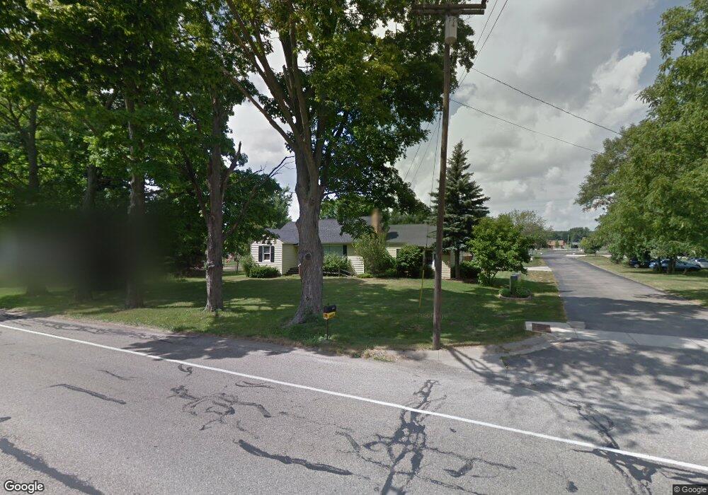
4103 Port Sheldon St Hudsonville, MI 49426
Estimated Value: $319,000 - $379,000
4
Beds
2
Baths
1,973
Sq Ft
$172/Sq Ft
Est. Value
About This Home
This home is located at 4103 Port Sheldon St, Hudsonville, MI 49426 and is currently estimated at $339,231, approximately $171 per square foot. 4103 Port Sheldon St is a home located in Ottawa County with nearby schools including Baldwin Street Middle School, Hudsonville Freshman Campus, and Hudsonville High School.
Ownership History
Date
Name
Owned For
Owner Type
Purchase Details
Closed on
May 27, 2021
Sold by
Lirio Ruel R
Bought by
Lirio Ruel R and Lirio Nicole L
Current Estimated Value
Purchase Details
Closed on
Apr 16, 2004
Sold by
Levandoski Steven and Levandoski Kelly
Bought by
Lirio Ruel R
Home Financials for this Owner
Home Financials are based on the most recent Mortgage that was taken out on this home.
Original Mortgage
$97,200
Interest Rate
5.66%
Mortgage Type
Purchase Money Mortgage
Create a Home Valuation Report for This Property
The Home Valuation Report is an in-depth analysis detailing your home's value as well as a comparison with similar homes in the area
Home Values in the Area
Average Home Value in this Area
Purchase History
| Date | Buyer | Sale Price | Title Company |
|---|---|---|---|
| Lirio Ruel R | -- | None Available | |
| Lirio Ruel R | $121,500 | -- |
Source: Public Records
Mortgage History
| Date | Status | Borrower | Loan Amount |
|---|---|---|---|
| Closed | Lirio Ruel R | $97,200 |
Source: Public Records
Tax History Compared to Growth
Tax History
| Year | Tax Paid | Tax Assessment Tax Assessment Total Assessment is a certain percentage of the fair market value that is determined by local assessors to be the total taxable value of land and additions on the property. | Land | Improvement |
|---|---|---|---|---|
| 2025 | $3,351 | $142,400 | $0 | $0 |
| 2024 | $3,077 | $139,600 | $0 | $0 |
| 2023 | $2,935 | $124,100 | $0 | $0 |
| 2022 | $3,041 | $109,200 | $0 | $0 |
| 2021 | $2,951 | $102,100 | $0 | $0 |
| 2020 | $2,916 | $95,500 | $0 | $0 |
| 2019 | $2,897 | $88,300 | $0 | $0 |
| 2018 | $2,743 | $84,300 | $0 | $0 |
| 2017 | $2,690 | $81,700 | $0 | $0 |
| 2016 | $2,598 | $58,100 | $0 | $0 |
| 2015 | $2,507 | $58,100 | $0 | $0 |
| 2014 | $2,507 | $58,100 | $0 | $0 |
Source: Public Records
Map
Nearby Homes
- 3808 Port Sheldon St
- 4106 Blair St
- 4372 Shady Oak Ct
- 3755 Black Creek Dr
- 6950 Meadowcreek Dr
- 6863 Bridgeport Dr
- 6207 Gemini Ct
- 7114 Tory Dr
- 7068 Jasper Dr
- 5744 36th Ave
- V/L Port Sheldon St
- 6500 Van Dam Ave Unit 1
- 6530 Van Dam Ave Unit 3
- 3204 Port Sheldon St
- 5640 Lawndale Ave
- 6561 Van Dam Ave
- 5570 Marlin Ave
- 3550 Oak St
- 6324 Blendon Woods Dr Unit 21
- 6308 Blendon Woods Dr Unit 19
- 4141 Port Sheldon St
- 4151 Port Sheldon St
- 4091 Port Sheldon St
- 4163 Port Sheldon St
- 4120 Port Sheldon St
- 4100 Port Sheldon St
- 4077 Port Sheldon St
- 4164 Port Sheldon St
- 4134 Dale Ct
- 4065 Port Sheldon St
- 4090 Port Sheldon St
- 4187 Port Sheldon St
- 4148 Dale Ct
- 4068 Port Sheldon St
- 4128 Dale Ct
- 4172 Port Sheldon St
- 4051 Port Sheldon St
- 4160 Dale Ct
- 4191 Port Sheldon St
- 4133 Dale Ct