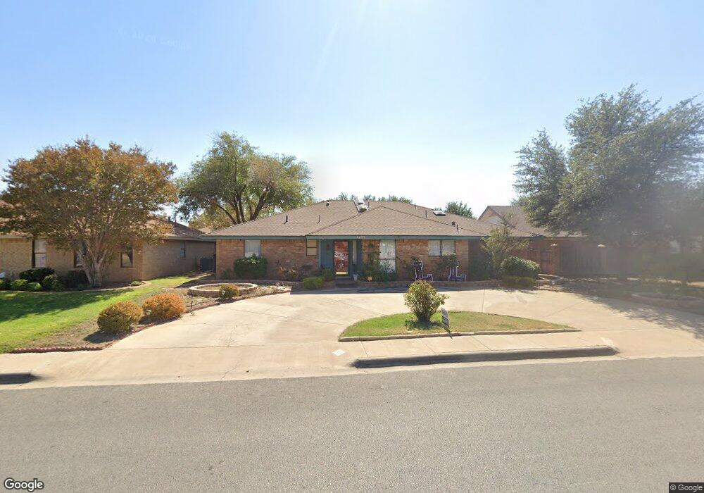
4105 Saint Andrews Dr Midland, TX 79707
Trinity NeighborhoodEstimated Value: $390,000 - $438,000
--
Bed
2
Baths
2,565
Sq Ft
$161/Sq Ft
Est. Value
About This Home
This home is located at 4105 Saint Andrews Dr, Midland, TX 79707 and is currently estimated at $412,600, approximately $160 per square foot. 4105 Saint Andrews Dr is a home located in Midland County with nearby schools including Parker Elementary School, Alamo Junior High School, and Trinity School of Midland.
Ownership History
Date
Name
Owned For
Owner Type
Purchase Details
Closed on
Apr 17, 2019
Sold by
Pate Melvin J and Pate Ellen M
Bought by
Perusse Dennis E and Perusse Maria L
Current Estimated Value
Home Financials for this Owner
Home Financials are based on the most recent Mortgage that was taken out on this home.
Original Mortgage
$294,464
Outstanding Balance
$258,884
Interest Rate
4.4%
Mortgage Type
FHA
Estimated Equity
$153,716
Purchase Details
Closed on
May 25, 2006
Sold by
Agrawal Bhupendra K and Agrawal Sudhi
Bought by
Pate Melvin J and Ellen Pate M
Home Financials for this Owner
Home Financials are based on the most recent Mortgage that was taken out on this home.
Original Mortgage
$179,638
Interest Rate
6.5%
Mortgage Type
VA
Purchase Details
Closed on
Oct 1, 1981
Bought by
Pate Melvin J
Create a Home Valuation Report for This Property
The Home Valuation Report is an in-depth analysis detailing your home's value as well as a comparison with similar homes in the area
Home Values in the Area
Average Home Value in this Area
Purchase History
| Date | Buyer | Sale Price | Title Company |
|---|---|---|---|
| Perusse Dennis E | -- | Lone Star Abstract & Ttl Co | |
| Pate Melvin J | -- | Lone Star Abstract & Title C | |
| Pate Melvin J | -- | -- |
Source: Public Records
Mortgage History
| Date | Status | Borrower | Loan Amount |
|---|---|---|---|
| Open | Perusse Dennis E | $294,464 | |
| Previous Owner | Pate Melvin J | $179,638 |
Source: Public Records
Tax History Compared to Growth
Tax History
| Year | Tax Paid | Tax Assessment Tax Assessment Total Assessment is a certain percentage of the fair market value that is determined by local assessors to be the total taxable value of land and additions on the property. | Land | Improvement |
|---|---|---|---|---|
| 2025 | $5,849 | $379,560 | $18,110 | $361,450 |
| 2024 | $5,857 | $385,690 | $18,110 | $367,580 |
| 2023 | $5,415 | $361,340 | $18,110 | $343,230 |
| 2022 | $5,002 | $320,170 | $18,110 | $302,060 |
| 2021 | $5,329 | $305,880 | $18,110 | $287,770 |
| 2020 | $5,154 | $297,420 | $18,110 | $279,310 |
| 2019 | $5,631 | $297,420 | $18,110 | $279,310 |
| 2018 | $5,509 | $283,310 | $18,110 | $265,200 |
| 2017 | $5,352 | $275,240 | $18,110 | $257,130 |
| 2016 | $4,927 | $252,960 | $18,110 | $234,850 |
| 2015 | -- | $251,030 | $18,110 | $232,920 |
| 2014 | -- | $244,590 | $0 | $0 |
Source: Public Records
Map
Nearby Homes
- 4207 Merrill Dr
- 4101 Gleneagles Dr
- 4209 Merrill Dr
- 4304 Downing Ave
- 4003 Compton Dr
- 3400 Wedgwood St
- 4315 Lehigh Dr
- 4521 Gleneagles Dr
- 4529 Gleneagles Dr
- 3901 Arroyo Dr
- 4200 Boulder Dr
- 3804 Faircircle
- 4206 Nelson Rd
- 3619 W Wadley Ave
- 3502 Canemont Dr
- 4310 Nelson Rd
- 4303 Arroyo Dr
- 3907 Westminister Dr
- 3400 Salisbury Place
- 3200 Highsky Dr
- 4107 Saint Andrews Dr
- 4103 Saint Andrews Dr
- 4201 Saint Andrews Ct
- 4104 Gleneagles Dr
- 4201 Saint Andrews Dr
- 4101 Saint Andrews Dr
- 4102 Gleneagles Dr
- 4106 Gleneagles Dr
- 4100 Gleneagles Dr
- 4200 Gleneagles Dr
- 4203 Saint Andrews Dr
- 4203 Saint Andrews Dr
- 4200 St Andrews Dr
- 4200 Saint Andrews Dr
- 4202 Gleneagles Dr
- 4205 Saint Andrews Dr
- 4007 Saint Andrews Dr
- 4007 Saint Andrews Dr
- 4202 Saint Andrews Dr
- 4105 Gleneagles Dr