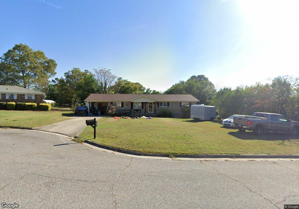
4106 Michael Place Hephzibah, GA 30815
Jamestown NeighborhoodEstimated Value: $131,000 - $182,000
4
Beds
2
Baths
1,436
Sq Ft
$113/Sq Ft
Est. Value
About This Home
This home is located at 4106 Michael Place, Hephzibah, GA 30815 and is currently estimated at $162,505, approximately $113 per square foot. 4106 Michael Place is a home located in Richmond County with nearby schools including Diamond Lakes Elementary School, Pine Hill Middle School, and Johnson Magnet.
Ownership History
Date
Name
Owned For
Owner Type
Purchase Details
Closed on
Sep 15, 2017
Sold by
Reid Bobby
Bought by
Page Reid Bobby and Page Reid Bryan
Current Estimated Value
Purchase Details
Closed on
Apr 8, 2016
Sold by
Deutsche Bank National Trust Co Trustee
Bought by
Reid Bobby
Purchase Details
Closed on
Dec 3, 2001
Sold by
Garland George L
Bought by
Garland George L and Garland Marilyn
Home Financials for this Owner
Home Financials are based on the most recent Mortgage that was taken out on this home.
Original Mortgage
$48,500
Interest Rate
6.49%
Mortgage Type
Credit Line Revolving
Purchase Details
Closed on
Oct 27, 1969
Sold by
Strickland A K
Bought by
Garland George L
Create a Home Valuation Report for This Property
The Home Valuation Report is an in-depth analysis detailing your home's value as well as a comparison with similar homes in the area
Home Values in the Area
Average Home Value in this Area
Purchase History
| Date | Buyer | Sale Price | Title Company |
|---|---|---|---|
| Page Reid Bobby | -- | -- | |
| Reid Bobby | $65,089 | -- | |
| Garland George L | -- | -- | |
| Garland George L | -- | -- |
Source: Public Records
Mortgage History
| Date | Status | Borrower | Loan Amount |
|---|---|---|---|
| Previous Owner | Garland George L | $48,500 |
Source: Public Records
Tax History Compared to Growth
Tax History
| Year | Tax Paid | Tax Assessment Tax Assessment Total Assessment is a certain percentage of the fair market value that is determined by local assessors to be the total taxable value of land and additions on the property. | Land | Improvement |
|---|---|---|---|---|
| 2025 | $2,259 | $71,572 | $4,360 | $67,212 |
| 2024 | $2,259 | $56,864 | $4,360 | $52,504 |
| 2023 | $1,228 | $55,736 | $4,360 | $51,376 |
| 2022 | $1,674 | $50,636 | $4,360 | $46,276 |
| 2021 | $1,308 | $34,693 | $4,355 | $30,338 |
| 2020 | $1,291 | $34,693 | $4,355 | $30,338 |
| 2019 | $1,356 | $34,693 | $4,355 | $30,338 |
| 2018 | $1,364 | $34,693 | $4,355 | $30,338 |
| 2017 | $1,219 | $34,693 | $4,355 | $30,338 |
| 2016 | $1,501 | $34,693 | $4,355 | $30,338 |
| 2015 | $375 | $34,693 | $4,355 | $30,338 |
| 2014 | $375 | $34,693 | $4,355 | $30,338 |
Source: Public Records
Map
Nearby Homes
- 4124 Country Ln
- 3422 Firestone Dr
- 3434 Firestone Dr Unit 151
- 3424 Firestone Dr
- 3424 Firestone Dr Unit 155
- 3434 Firestone Dr
- 3422 Firestone Dr Unit 156
- Maywood 3 Plan at Laurel Park Townhomes
- 3440 Firestone Dr
- 3440 Firestone Dr Unit 148
- Stratford Plan at Laurel Park Townhomes
- 3428 Firestone Dr Unit 153
- Sudbury Plan at Laurel Park Townhomes
- 3432 Firestone Dr Unit 152
- 3420 Firestone Dr Unit 157
- 3418 Firestone Dr Unit 158
- 5446 Thrasher Ln
- 0 Talbot Dr
- 1054 Mizuno Dr
- 1058 Mizuno Dr
- 4104 Michael Place
- 4115 N Allendale Ct
- 4110 Michael Place
- 4117 N Allendale Ct
- 4113 N Allendale Ct
- 4102 Michael Place
- 4103 Michael Place
- 4105 Michael Place
- 2513 Anthony Dejuan Pkwy
- 4112 Michael Place
- 4101 Michael Place
- 4107 Michael Place
- 2511 Anthony Dejuan Pkwy
- 4110 N Allendale Ct
- 4109 Michael Place
- 4172 Kevin Rd
- 4170 Kevin Rd
- 4174 Kevin Rd
- 4114 N Allendale Ct