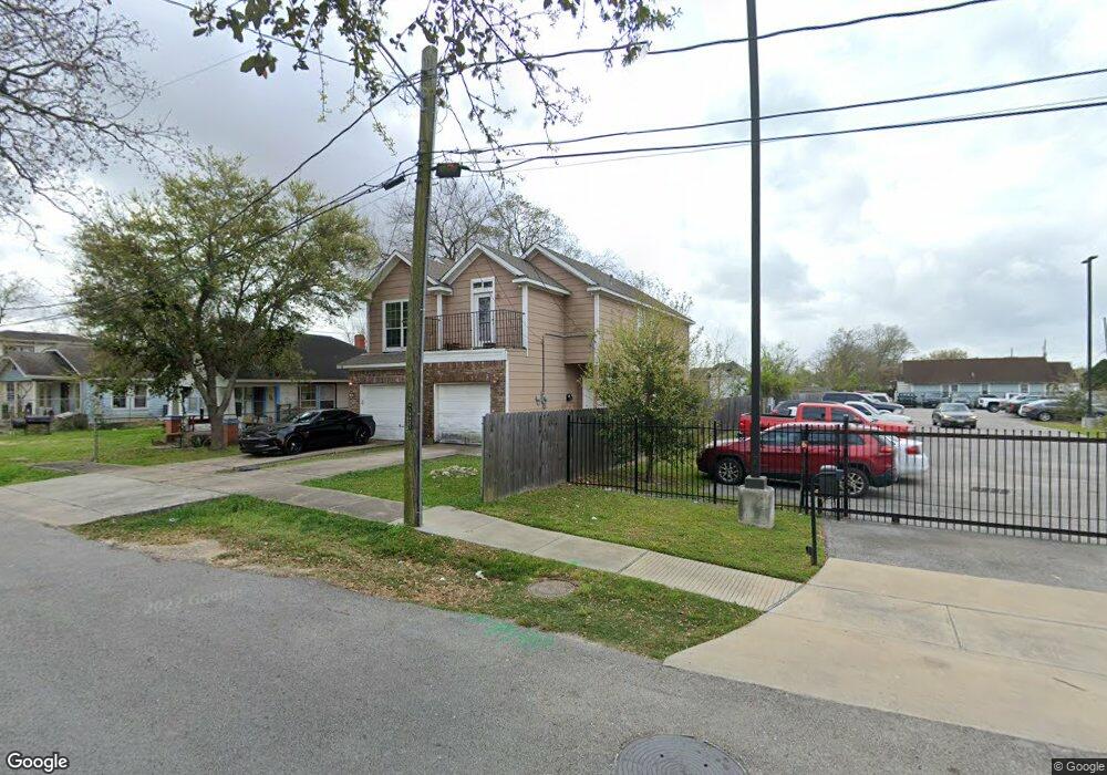
4108 Curtis St Unit A Houston, TX 77020
Estimated Value: $229,000 - $585,000
3
Beds
3
Baths
1,696
Sq Ft
$227/Sq Ft
Est. Value
About This Home
This home is located at 4108 Curtis St Unit A, Houston, TX 77020 and is currently estimated at $385,512, approximately $227 per square foot. 4108 Curtis St Unit A is a home located in Harris County with nearby schools including Atherton Elementary School, Fleming Middle School, and Wheatley High School.
Ownership History
Date
Name
Owned For
Owner Type
Purchase Details
Closed on
Dec 16, 2009
Sold by
Stock Loan Services Llc
Bought by
Jaw Unlimited Llc
Current Estimated Value
Purchase Details
Closed on
Jun 2, 2009
Sold by
Ross Nancy
Bought by
Stock Loan Services Llc
Purchase Details
Closed on
Jul 5, 2007
Sold by
Ross Theodore
Bought by
Ross Nancy
Purchase Details
Closed on
Feb 28, 2007
Sold by
Sm Apartments Lp
Bought by
Ross Theodore W
Home Financials for this Owner
Home Financials are based on the most recent Mortgage that was taken out on this home.
Original Mortgage
$16,299
Interest Rate
5.88%
Mortgage Type
Seller Take Back
Purchase Details
Closed on
Mar 7, 2006
Sold by
Lewis Romie and Lewis Ethel
Bought by
Sm Apartments Lp
Create a Home Valuation Report for This Property
The Home Valuation Report is an in-depth analysis detailing your home's value as well as a comparison with similar homes in the area
Home Values in the Area
Average Home Value in this Area
Purchase History
| Date | Buyer | Sale Price | Title Company |
|---|---|---|---|
| Jaw Unlimited Llc | -- | Stewart Title Of Montgomery | |
| Stock Loan Services Llc | $185,000 | None Available | |
| Ross Nancy | -- | None Available | |
| Ross Theodore W | -- | None Available | |
| Sm Apartments Lp | $2,128 | None Available |
Source: Public Records
Mortgage History
| Date | Status | Borrower | Loan Amount |
|---|---|---|---|
| Previous Owner | Ross Theodore W | $16,299 |
Source: Public Records
Tax History Compared to Growth
Tax History
| Year | Tax Paid | Tax Assessment Tax Assessment Total Assessment is a certain percentage of the fair market value that is determined by local assessors to be the total taxable value of land and additions on the property. | Land | Improvement |
|---|---|---|---|---|
| 2025 | $6,235 | $167,000 | $70,400 | $96,600 |
| 2024 | $6,235 | $167,000 | $70,400 | $96,600 |
| 2023 | $6,235 | $271,020 | $82,175 | $188,845 |
| 2022 | $6,379 | $289,700 | $71,363 | $218,337 |
| 2021 | $5,827 | $250,000 | $48,657 | $201,343 |
| 2020 | $4,359 | $180,000 | $36,763 | $143,237 |
| 2019 | $4,029 | $159,209 | $36,763 | $122,446 |
| 2018 | $3,484 | $137,664 | $27,032 | $110,632 |
| 2017 | $3,430 | $135,663 | $23,788 | $111,875 |
| 2016 | $3,352 | $132,581 | $19,463 | $113,118 |
| 2015 | $3,466 | $134,839 | $13,624 | $121,215 |
| 2014 | $3,466 | $134,839 | $13,624 | $121,215 |
Source: Public Records
Map
Nearby Homes
- 4108 Farmer St
- 4110 Farmer St
- 3922 Farmer St
- 1501 Featherstone St
- 1711 Benson St
- 1416 Copeland St
- 4417 New Orleans St
- 3716 Farmer St
- 4009 New Orleans St Unit A
- 4009 New Orleans St Unit A/B
- 4414 Orange St
- 1512 Tralle St
- 3407 Stonewall St
- 3408 Stonewall St
- 1018 Press St
- 4201 Hershe St
- 3617 Farmer St
- 4403 New Orleans St
- 3605 Farmer St
- 4604 & 4608 Market St
- 4112 Curtis St
- 4114 Curtis St
- 1415 Press St
- 1420 Benson St
- 4120 Curtis St
- 4113 Curtis St
- 4119 Curtis St
- 1403 Press St
- 4102 Farmer St
- 1414 Benson St
- 4011 Curtis St
- 4201 Orange St
- 1410 Benson St
- 1410 Benson St
- 1403 Featherstone St
- 1405 Featherstone St
- 4007 Curtis St
- 1407 Featherstone St
- 4016 Farmer St
- 1401 Featherstone St