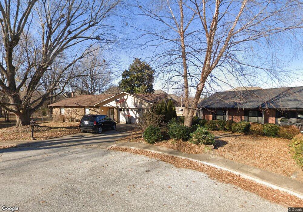
4108 Mohawk Cir Springdale, AR 72764
Shady Grove NeighborhoodEstimated Value: $274,229 - $324,000
3
Beds
2
Baths
1,700
Sq Ft
$176/Sq Ft
Est. Value
About This Home
This home is located at 4108 Mohawk Cir, Springdale, AR 72764 and is currently estimated at $298,807, approximately $175 per square foot. 4108 Mohawk Cir is a home located in Washington County with nearby schools including J. O. Kelly Middle School, Harp Elementary School, and George Junior High School.
Ownership History
Date
Name
Owned For
Owner Type
Purchase Details
Closed on
Oct 7, 2005
Sold by
Jordan Della and Hess Terry
Bought by
Barr Alford D
Current Estimated Value
Home Financials for this Owner
Home Financials are based on the most recent Mortgage that was taken out on this home.
Original Mortgage
$128,000
Outstanding Balance
$67,617
Interest Rate
5.65%
Mortgage Type
Fannie Mae Freddie Mac
Estimated Equity
$231,190
Purchase Details
Closed on
Jan 1, 1985
Bought by
Hess Ted E
Create a Home Valuation Report for This Property
The Home Valuation Report is an in-depth analysis detailing your home's value as well as a comparison with similar homes in the area
Home Values in the Area
Average Home Value in this Area
Purchase History
| Date | Buyer | Sale Price | Title Company |
|---|---|---|---|
| Barr Alford D | $128,000 | Lenders Title Co | |
| Hess Ted E | -- | -- |
Source: Public Records
Mortgage History
| Date | Status | Borrower | Loan Amount |
|---|---|---|---|
| Open | Barr Alford D | $128,000 |
Source: Public Records
Tax History
| Year | Tax Paid | Tax Assessment Tax Assessment Total Assessment is a certain percentage of the fair market value that is determined by local assessors to be the total taxable value of land and additions on the property. | Land | Improvement |
|---|---|---|---|---|
| 2025 | $841 | $44,150 | $14,000 | $30,150 |
| 2024 | $879 | $44,150 | $14,000 | $30,150 |
| 2023 | $916 | $44,150 | $14,000 | $30,150 |
| 2022 | $903 | $26,400 | $9,500 | $16,900 |
| 2021 | $847 | $26,400 | $9,500 | $16,900 |
| 2020 | $791 | $26,400 | $9,500 | $16,900 |
| 2019 | $736 | $21,080 | $6,000 | $15,080 |
| 2018 | $761 | $21,080 | $6,000 | $15,080 |
| 2017 | $750 | $21,080 | $6,000 | $15,080 |
| 2016 | $750 | $21,080 | $6,000 | $15,080 |
| 2015 | $750 | $21,080 | $6,000 | $15,080 |
| 2014 | $786 | $21,760 | $7,000 | $14,760 |
Source: Public Records
Map
Nearby Homes
- 303 Indian Trail
- 405 Indian Trail
- 3801 Southland Dr
- 587 Bordeaux Ave
- 500 Lake Rd
- 883 E Don Tyson Pkwy
- 102 Franjo Ln
- 405 Lake Rd
- 4079 Jessica Ln
- 301 W Edmondson Ave
- 3200 Kennesaw St
- 7 Acres Don Tyson Pkwy
- 2973 Pagosa St
- 307 Terry Ave
- 3476 Ryan St
- 3359 Ryan St
- 310 Emerald Point Dr
- 261 Carrington Ave
- 123 E Colorado Ave
- 1415 Clear Creek Dr
- 4106 Mohawk Cir
- 397 Saint James Ave
- 4109 Mohawk Cir
- 375 Saint James Ave
- Lot 15 Prince Philipe St
- 415 Saint James Ave
- 4107 Seminole Cir
- 4107 Seminole Valley Cir
- 4107 Mohawk Cir
- 361 Saint James Ave
- 4109 Seminole Valley Cir
- 4104 Mohawk Cir
- 0 St James Ave Unit 585127
- 0 St James Ave Unit 585128
- 0 St James Lot 71 Ave Unit 587497
- 0 St James Lot 72 Ave Unit 587500
- 0 St James Lot 73 Ave Unit 587502
- 0 St James Lot 67 Ave Unit 587493
- 0 St James Lot 1 Ave Unit 586677
- 0 St James Lot 18 Ave Unit 586684
Your Personal Tour Guide
Ask me questions while you tour the home.