Estimated Value: $139,808 - $173,000
Studio
--
Bath
1,128
Sq Ft
$137/Sq Ft
Est. Value
About This Home
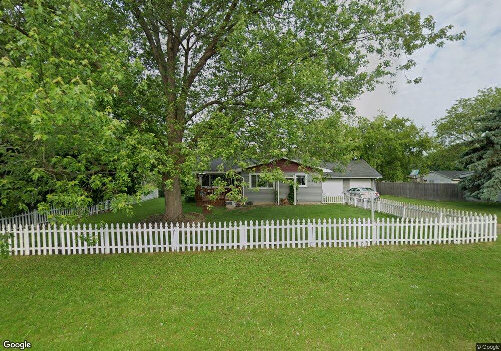
This home is located at 4109 Independence Dr, Flint, MI 48506 and is currently estimated at $154,952, approximately $137 per square foot. 4109 Independence Dr is a home located in Genesee County with nearby schools including Weston Elementary School, Leota Fiedler Elementary School, and Kate Dowdall Elementary School.
Ownership History
Date
Name
Owned For
Owner Type
Purchase Details
Closed on
Jul 17, 2017
Sold by
Summers Gloria G
Bought by
Summers Gloria G and Summers Brandy Michelle
Current Estimated Value
Home Financials for this Owner
Home Financials are based on the most recent Mortgage that was taken out on this home.
Original Mortgage
$71,100
Interest Rate
3.89%
Mortgage Type
New Conventional
Create a Home Valuation Report for This Property
The Home Valuation Report is an in-depth analysis detailing your home's value as well as a comparison with similar homes in the area
Home Values in the Area
Average Home Value in this Area
Purchase History
| Date | Buyer | Sale Price | Title Company |
|---|---|---|---|
| Summers Gloria G | -- | Cislo Title Co |
Source: Public Records
Mortgage History
| Date | Status | Borrower | Loan Amount |
|---|---|---|---|
| Closed | Summers Gloria G | $71,100 |
Source: Public Records
Tax History
| Year | Tax Paid | Tax Assessment Tax Assessment Total Assessment is a certain percentage of the fair market value that is determined by local assessors to be the total taxable value of land and additions on the property. | Land | Improvement |
|---|---|---|---|---|
| 2025 | $1,473 | $73,600 | $0 | $0 |
| 2024 | $1,410 | $67,700 | $0 | $0 |
| 2023 | $359 | $60,300 | $0 | $0 |
| 2022 | $1,173 | $49,500 | $0 | $0 |
| 2021 | $1,164 | $44,800 | $0 | $0 |
| 2020 | $317 | $41,100 | $0 | $0 |
| 2019 | $312 | $36,900 | $0 | $0 |
| 2018 | $1,104 | $32,800 | $0 | $0 |
| 2017 | $1,070 | $31,600 | $0 | $0 |
| 2016 | $1,065 | $30,500 | $0 | $0 |
| 2015 | $862 | $28,800 | $0 | $0 |
| 2014 | $288 | $26,000 | $0 | $0 |
| 2012 | -- | $24,800 | $24,800 | $0 |
Source: Public Records
Map
Nearby Homes
- 6054 E Pierson Rd
- 6367 E Pierson Rd
- 6312 Tamara Dr
- 6443 Richfield Rd
- 3179 Gehring Dr
- 3267 Mills Acres St
- 7045 Normandy Ct
- 4044 N Genesee Rd
- 6076 E Carpenter Rd
- 4455 N Genesee Rd
- 4413 Esta Dr
- 4452 Muriel Dr
- 4444 Meadowbrook Dr
- 0 Whisper Ridge Ct
- 0 Sugar Maple Farms Unit 50195365
- 4489 Home Town Dr Unit 32
- 2411 Briar Creek Ln
- 4465 Market Place
- 3246 Comer Dr
- 4459 Market Place
- 4099 Independence Dr
- 4123 Independence Dr
- 6088 Stoney Point St
- 4091 Independence Dr
- 6082 Stoney Point St
- 6087 Crown Point
- 6087 Crown Point St
- 4122 Independence Dr
- 4108 Independence Dr
- 4114 Independence Dr
- 4100 Independence Dr
- 4135 Independence Dr
- 6076 Stoney Point St
- 6069 Crown Point
- 4130 Independence Dr
- 4092 Independence Dr
- 6061 Crown Point
- 6081 Stoney Point St
- 6068 Stoney Point St
- 4147 Independence Dr
Your Personal Tour Guide
Ask me questions while you tour the home.