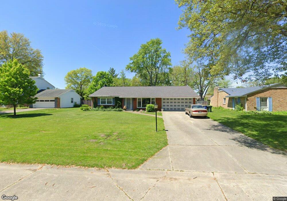
4109 N Redding Rd Muncie, IN 47304
Halteman NeighborhoodEstimated Value: $213,000 - $242,325
3
Beds
2
Baths
2,151
Sq Ft
$105/Sq Ft
Est. Value
About This Home
This home is located at 4109 N Redding Rd, Muncie, IN 47304 and is currently estimated at $226,581, approximately $105 per square foot. 4109 N Redding Rd is a home located in Delaware County with nearby schools including North View Elementary School, Muncie Central High School, and Northside Middle School.
Ownership History
Date
Name
Owned For
Owner Type
Purchase Details
Closed on
Jun 30, 2011
Sold by
Kane Gertrude M and Courtney Karen Kane
Bought by
Wood William L and Wood Diann
Current Estimated Value
Home Financials for this Owner
Home Financials are based on the most recent Mortgage that was taken out on this home.
Original Mortgage
$103,312
Interest Rate
4.75%
Mortgage Type
FHA
Purchase Details
Closed on
Mar 15, 2004
Sold by
Kane Gertrude M
Bought by
Kane Gertrude M and Kane Denarie A
Create a Home Valuation Report for This Property
The Home Valuation Report is an in-depth analysis detailing your home's value as well as a comparison with similar homes in the area
Home Values in the Area
Average Home Value in this Area
Purchase History
| Date | Buyer | Sale Price | Title Company |
|---|---|---|---|
| Wood William L | -- | Itic | |
| Kane Gertrude M | -- | None Available |
Source: Public Records
Mortgage History
| Date | Status | Borrower | Loan Amount |
|---|---|---|---|
| Open | Wood William L | $93,814 | |
| Closed | Wood William L | $101,734 | |
| Closed | Wood William L | $103,312 |
Source: Public Records
Tax History Compared to Growth
Tax History
| Year | Tax Paid | Tax Assessment Tax Assessment Total Assessment is a certain percentage of the fair market value that is determined by local assessors to be the total taxable value of land and additions on the property. | Land | Improvement |
|---|---|---|---|---|
| 2024 | $1,780 | $166,200 | $21,100 | $145,100 |
| 2023 | $1,848 | $171,200 | $21,100 | $150,100 |
| 2022 | $1,728 | $159,200 | $21,100 | $138,100 |
| 2021 | $1,493 | $135,700 | $19,400 | $116,300 |
| 2020 | $1,343 | $120,700 | $16,800 | $103,900 |
| 2019 | $1,276 | $114,000 | $16,800 | $97,200 |
| 2018 | $1,285 | $114,900 | $16,800 | $98,100 |
| 2017 | $1,174 | $103,800 | $15,300 | $88,500 |
| 2016 | $1,132 | $99,600 | $15,300 | $84,300 |
| 2014 | $1,032 | $96,100 | $14,600 | $81,500 |
| 2013 | -- | $99,400 | $14,600 | $84,800 |
Source: Public Records
Map
Nearby Homes
- 2609 W Lincolnshire Dr
- 4401 N Redding Rd
- 4501 N Wheeling Ave Unit 6B-102
- 4501 N Wheeling Ave Unit 7A-306
- 4501 N Wheeling Ave Unit 2-104
- 4501 N Wheeling Ave Unit 5E4
- 4501 N Wheeling Ave
- 4501 N Wheeling Ave Unit 3-106
- 2500 W Norwood Dr
- 2210 W Christy Ln
- 4501 N Wheeling Ave Unit 3-106
- 2508 W Twickingham Dr
- 2011 W Sheffield Dr
- 2905 W Woodbridge Dr
- 4501 N Wheeling 2-306 Ave Unit 2-306
- 3313 N Vienna Woods Dr
- 3209 W Twickingham Dr
- 4210 N Oakwood Ave
- 4304 N Oakwood Ave
- 2213 W Audubon Dr
- 4201 N Redding Rd
- 4103 N Redding Rd
- 4108 N Manchester Rd
- 4104 N Manchester Rd
- 4205 N Redding Rd
- 4104 N Redding Rd
- 2700 W Purdue Ave
- 4206 N Manchester Rd
- 4208 N Redding Rd
- 2704 W Purdue Ave
- 2612 W Purdue Ave
- 4233 N Lancaster Dr
- 2608 W Lincolnshire Dr
- 4212 N Manchester Rd
- 4109 N Manchester Rd
- 4201 N Manchester Rd
- 4105 N Manchester Rd
- 4212 N Redding Rd
- 2608 W Purdue Ave