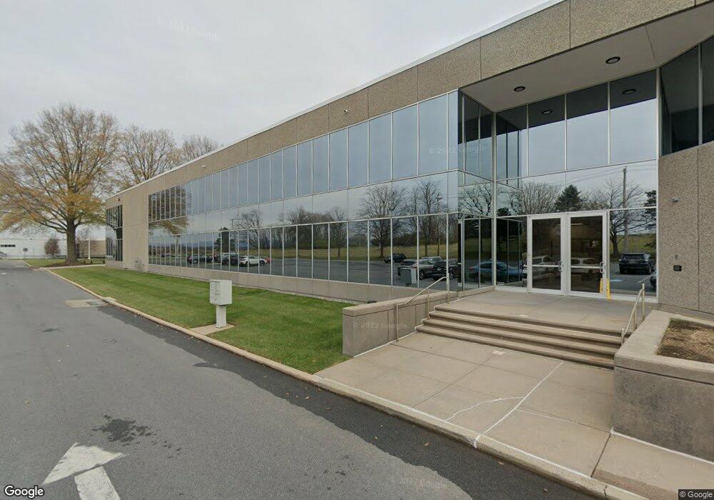
411 Aviation Way Frederick, MD 21701
East Frederick NeighborhoodEstimated Value: $8,121,483
--
Bed
--
Bath
41,972
Sq Ft
$193/Sq Ft
Est. Value
About This Home
This home is located at 411 Aviation Way, Frederick, MD 21701 and is currently estimated at $8,121,483, approximately $193 per square foot. 411 Aviation Way is a home located in Frederick County with nearby schools including Spring Ridge Elementary School, Gov. Thomas Johnson Middle School, and Gov. Thomas Johnson High School.
Ownership History
Date
Name
Owned For
Owner Type
Purchase Details
Closed on
Sep 15, 2025
Sold by
Aircraft Owners And Pilots Association
Bought by
Keller 411 Llc
Current Estimated Value
Home Financials for this Owner
Home Financials are based on the most recent Mortgage that was taken out on this home.
Original Mortgage
$4,547,935
Outstanding Balance
$4,547,935
Interest Rate
6.63%
Mortgage Type
New Conventional
Estimated Equity
$3,573,548
Purchase Details
Closed on
Jul 15, 2004
Sold by
Avemco Insurance Company
Bought by
Aircraft Owners And Pilots Assoc
Purchase Details
Closed on
Feb 15, 2000
Sold by
Avemco Corp
Bought by
Avemco Insurance Company
Create a Home Valuation Report for This Property
The Home Valuation Report is an in-depth analysis detailing your home's value as well as a comparison with similar homes in the area
Home Values in the Area
Average Home Value in this Area
Purchase History
| Date | Buyer | Sale Price | Title Company |
|---|---|---|---|
| Keller 411 Llc | $5,250,000 | None Listed On Document | |
| Aircraft Owners And Pilots Assoc | $4,500,000 | -- | |
| Avemco Insurance Company | -- | -- |
Source: Public Records
Mortgage History
| Date | Status | Borrower | Loan Amount |
|---|---|---|---|
| Open | Keller 411 Llc | $4,547,935 |
Source: Public Records
Tax History Compared to Growth
Tax History
| Year | Tax Paid | Tax Assessment Tax Assessment Total Assessment is a certain percentage of the fair market value that is determined by local assessors to be the total taxable value of land and additions on the property. | Land | Improvement |
|---|---|---|---|---|
| 2025 | $68,865 | $3,749,300 | $1,111,600 | $2,637,700 |
| 2024 | $68,865 | $3,709,200 | $0 | $0 |
| 2023 | $66,223 | $3,669,100 | $0 | $0 |
| 2022 | $65,275 | $3,629,000 | $1,111,600 | $2,517,400 |
| 2021 | $65,078 | $3,629,000 | $1,111,600 | $2,517,400 |
| 2020 | $65,078 | $3,629,000 | $1,111,600 | $2,517,400 |
| 2019 | $70,790 | $3,953,900 | $1,111,600 | $2,842,300 |
| 2018 | $71,412 | $3,953,900 | $1,111,600 | $2,842,300 |
| 2017 | $70,696 | $3,953,900 | $0 | $0 |
| 2016 | $86,629 | $5,038,300 | $0 | $0 |
| 2015 | $86,629 | $4,939,000 | $0 | $0 |
| 2014 | $86,629 | $4,839,700 | $0 | $0 |
Source: Public Records
Map
Nearby Homes
- 340 Ensemble Way
- 326 Ensemble Way
- 562 Union St
- 324 Ensemble Way
- 329 Ensemble Way
- 321 Ensemble Way
- 826 Creekway Dr
- 760 Union St
- 738 Compass Way
- 423 Ensemble Way
- 425 Ensemble Way
- 813 Bond St
- 518 Carroll Walk Ave
- 462 Herringbone Way
- 459 Hanson St
- 449 Ensemble Way
- 461 Hanson St
- 465 Hanson St
- 467 Hanson St
- 723 Courier Ln
- 411 Aviation Way Unit 220
- 411 Aviation Way Unit 240
- 411 Aviation Way Unit 204
- 411 Aviation Way Unit 100
- 411 Aviation Way Unit 230
- 411 Aviation Way Unit 200
- 411 Aviation Way Unit 210
- 411 Aviation Way Unit 245
- 421 Aviation Way
- 0 Aviation Way Unit 5,000 SF MDFR2038510
- 0 Aviation Way Unit 5,000 SF MDFR2030062
- 0 Aviation Way Unit 15,000 SF
- 0 Aviation Way Unit 3,000 SF MDFR2030058
- 0 Aviation Way Unit 55,002 SF
- 0 Aviation Way Unit 5,000 SF MDFR2030056
- 0 Aviation Way Unit 15000 SF MDFR2030054
- 310 Aviation Way
- 431 Aviation Way
- 1341 Hughes Ford Rd Unit 114/115/116
- 1341 Hughes Ford Rd Unit 115/116