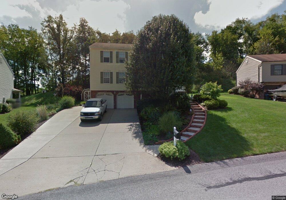
411 Battery Dr S Mc Donald, PA 15057
Estimated Value: $402,000 - $466,569
4
Beds
3
Baths
2,474
Sq Ft
$177/Sq Ft
Est. Value
About This Home
This home is located at 411 Battery Dr S, Mc Donald, PA 15057 and is currently estimated at $438,142, approximately $177 per square foot. 411 Battery Dr S is a home located in Allegheny County with nearby schools including South Fayette Elementary School, South Fayette Intermediate School, and South Fayette Middle School.
Ownership History
Date
Name
Owned For
Owner Type
Purchase Details
Closed on
Jan 4, 2022
Sold by
Kalp David S and Kalp Jessica M
Bought by
Citizens Bank N A and Kalp
Current Estimated Value
Purchase Details
Closed on
Aug 28, 2008
Sold by
Lambert Thomas M
Bought by
Kichta Shawn P and Mckeever,Tammy L
Home Financials for this Owner
Home Financials are based on the most recent Mortgage that was taken out on this home.
Original Mortgage
$218,275
Interest Rate
6.69%
Mortgage Type
FHA
Create a Home Valuation Report for This Property
The Home Valuation Report is an in-depth analysis detailing your home's value as well as a comparison with similar homes in the area
Home Values in the Area
Average Home Value in this Area
Purchase History
| Date | Buyer | Sale Price | Title Company |
|---|---|---|---|
| Kichta Shawn P | $220,000 | -- | |
| Citizens Bank N A | -- | -- |
Source: Public Records
Mortgage History
| Date | Status | Borrower | Loan Amount |
|---|---|---|---|
| Previous Owner | Kichta Shawn P | $218,275 |
Source: Public Records
Tax History Compared to Growth
Tax History
| Year | Tax Paid | Tax Assessment Tax Assessment Total Assessment is a certain percentage of the fair market value that is determined by local assessors to be the total taxable value of land and additions on the property. | Land | Improvement |
|---|---|---|---|---|
| 2025 | $7,774 | $215,000 | $40,200 | $174,800 |
| 2024 | $7,774 | $215,000 | $40,200 | $174,800 |
| 2023 | $7,774 | $215,000 | $40,200 | $174,800 |
| 2022 | $7,774 | $215,000 | $40,200 | $174,800 |
| 2021 | $1,017 | $215,000 | $40,200 | $174,800 |
| 2020 | $7,774 | $215,000 | $40,200 | $174,800 |
| 2019 | $7,774 | $215,000 | $40,200 | $174,800 |
| 2018 | $1,017 | $215,000 | $40,200 | $174,800 |
| 2017 | $7,721 | $215,000 | $40,200 | $174,800 |
| 2016 | $1,017 | $215,000 | $40,200 | $174,800 |
| 2015 | $1,017 | $215,000 | $40,200 | $174,800 |
| 2014 | $7,185 | $215,000 | $40,200 | $174,800 |
Source: Public Records
Map
Nearby Homes
- 1201 Oakridge Rd
- 4552 Battle Ridge Rd
- 520 Old Fayette Trail
- 215 Creekside Dr
- Boston Plan at Creekside Meadows
- Somerset Plan at Creekside Meadows
- Waterloo Plan at Creekside Meadows
- Tucson Plan at Creekside Meadows
- Rockford Plan at Creekside Meadows
- 5812 Windsor Dr
- 8059 Hinsdale Ln
- 232 Creekside Dr
- 307 Champions Way
- 246 Creekside Dr
- 1015 Livorno Dr
- 1021 Stonegate Dr
- 2006 Field Stone Dr
- 0 Thoms Run Rd
- 193 Firenze Dr
- 5418 Forest Edge Dr
- 409 Battery Dr S
- 413 Battery Dr S
- 407 Battery Dr S
- 412 Battery Dr S
- 415 Battery Dr S
- 414 Battery Dr S
- 410 Battery Dr S
- 405 Battery Dr S
- 417 Battery Dr S
- 416 Battery Dr S
- 408 Battery Dr S
- 419 Battery Dr S
- 403 Battery Dr S
- 406 Battery Dr S
- 317 Battery Dr N
- 318 Battery Dr N
- 209 Stuart Cir
- 326 Battery Dr S
- 316 Battery Dr N
- 404 Battery Dr S