Estimated Value: $288,795 - $357,000
Studio
2
Baths
1,586
Sq Ft
$205/Sq Ft
Est. Value
About This Home
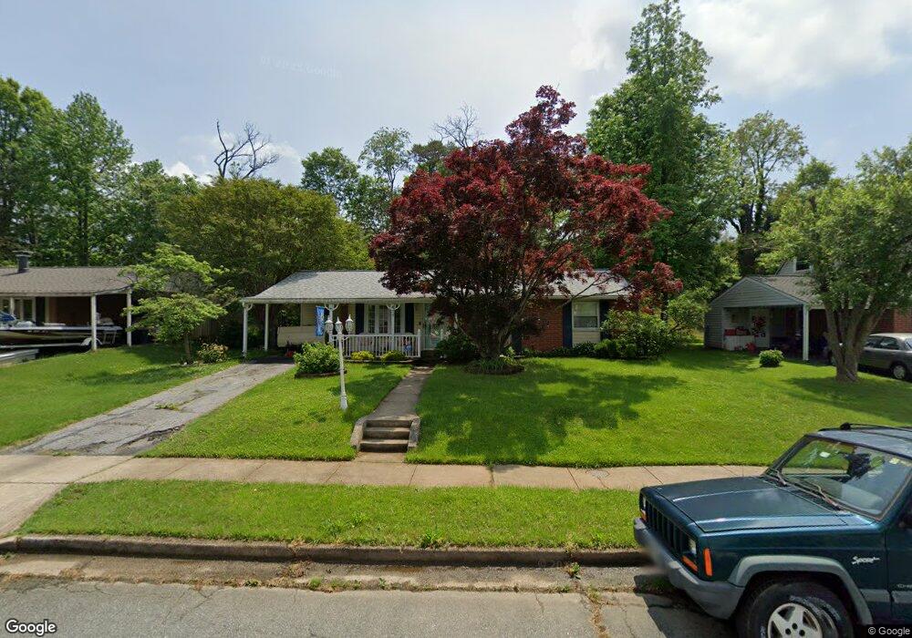
This home is located at 411 Breslin Rd, Joppa, MD 21085 and is currently estimated at $325,199, approximately $205 per square foot. 411 Breslin Rd is a home located in Harford County with nearby schools including Joppatowne Elementary School, Magnolia Middle School, and Joppatowne High School.
Ownership History
Date
Name
Owned For
Owner Type
Purchase Details
Closed on
Feb 8, 2005
Sold by
Proser Ronald L
Bought by
Proser Whitney B
Current Estimated Value
Purchase Details
Closed on
Sep 21, 1987
Sold by
Proser Ronald L and Proser Wf
Bought by
Proser Ronald L
Create a Home Valuation Report for This Property
The Home Valuation Report is an in-depth analysis detailing your home's value as well as a comparison with similar homes in the area
Home Values in the Area
Average Home Value in this Area
Purchase History
| Date | Buyer | Sale Price | Title Company |
|---|---|---|---|
| Proser Whitney B | -- | -- | |
| Proser Ronald L | $1,500 | -- |
Source: Public Records
Tax History
| Year | Tax Paid | Tax Assessment Tax Assessment Total Assessment is a certain percentage of the fair market value that is determined by local assessors to be the total taxable value of land and additions on the property. | Land | Improvement |
|---|---|---|---|---|
| 2025 | $2,338 | $225,800 | $0 | $0 |
| 2024 | $2,338 | $214,500 | $69,300 | $145,200 |
| 2023 | $2,249 | $206,333 | $0 | $0 |
| 2022 | $2,160 | $198,167 | $0 | $0 |
| 2021 | $644 | $190,000 | $69,300 | $120,700 |
| 2020 | $1,070 | $185,467 | $0 | $0 |
| 2019 | $2,088 | $180,933 | $0 | $0 |
| 2018 | $2,017 | $176,400 | $69,300 | $107,100 |
| 2017 | $1,932 | $176,400 | $0 | $0 |
| 2016 | -- | $161,467 | $0 | $0 |
| 2015 | $2,243 | $154,000 | $0 | $0 |
| 2014 | $2,243 | $154,000 | $0 | $0 |
Source: Public Records
Map
Nearby Homes
- 819 Chatfield Rd
- 714 Joppa Farm Rd
- 800 Ferguson Rd
- 415 Trimble Rd
- 304 Barksdale Rd
- 527A Trimble Rd
- 424 Trimble Rd
- 503 Eckhart Dr
- 737 Shore Dr
- 395 Enfield Rd
- 722 Shore Dr
- 413 Trimble Rd
- TBD Trimble Rd
- LOTS 2-6 Trimble Rd
- 688 Shore Dr
- 546 Riviera Dr Unit B
- HOMESITE #18 341 Tumblers Way
- 349 Tumblers Way Unit 22
- 345 Tumblers Way Unit 20
- 355 Tumblers Way Unit 25
- 409 Breslin Rd
- 413 Breslin Rd
- 528 Macintosh Cir
- 407 Breslin Rd
- 415 Breslin Rd
- 530 Macintosh Cir
- 526 Macintosh Cir
- 532 Macintosh Cir
- 524 Macintosh Cir
- 534 Macintosh Cir
- 522 Macintosh Cir
- 520 Macintosh Cir
- 410 Breslin Rd
- 408 Breslin Rd
- 538 Macintosh Cir
- 540 Macintosh Cir
- 406 Breslin Rd
- 516 Macintosh Cir
- 412 Breslin Rd
- 542 Macintosh Cir
Your Personal Tour Guide
Ask me questions while you tour the home.