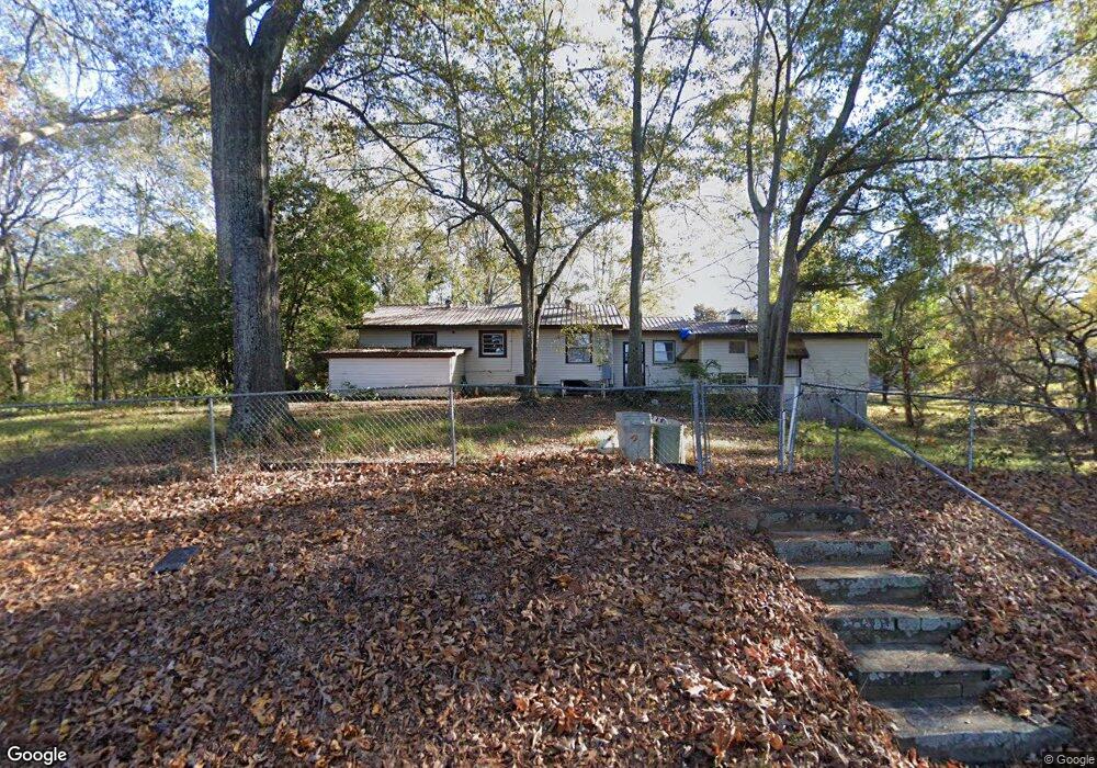
411 Burnt Log Dr Fortson, GA 31808
Estimated Value: $356,000 - $384,000
3
Beds
2
Baths
2,106
Sq Ft
$176/Sq Ft
Est. Value
About This Home
This home is located at 411 Burnt Log Dr, Fortson, GA 31808 and is currently estimated at $370,000, approximately $175 per square foot. 411 Burnt Log Dr is a home located in Harris County with nearby schools including New Mountain Hill Elementary School, Harris County Carver Middle School, and Harris County High School.
Ownership History
Date
Name
Owned For
Owner Type
Purchase Details
Closed on
Oct 14, 2014
Sold by
Elliott Brenda B
Bought by
Tharp Susan B and King Patricia B
Current Estimated Value
Purchase Details
Closed on
Aug 26, 2011
Sold by
Elliott Brenda B
Bought by
Elliott Brenda B and Adams Margaret B
Purchase Details
Closed on
May 1, 2007
Sold by
Brooks Clifford H
Bought by
Brooks Clifford H and Adell Brooks L
Purchase Details
Closed on
Mar 27, 2006
Sold by
Urquhart David M
Bought by
Brooks Clifford H and Adell Brooks L
Purchase Details
Closed on
Aug 8, 2002
Sold by
Brooks Clifford H & L Adell Life Estate
Bought by
Urquhart David M
Purchase Details
Closed on
Jun 1, 1973
Sold by
Reese John B
Bought by
Brooks Clifford H and Brooks Adell L
Create a Home Valuation Report for This Property
The Home Valuation Report is an in-depth analysis detailing your home's value as well as a comparison with similar homes in the area
Home Values in the Area
Average Home Value in this Area
Purchase History
| Date | Buyer | Sale Price | Title Company |
|---|---|---|---|
| Tharp Susan B | -- | -- | |
| Elliott Brenda B | -- | -- | |
| Brooks L Adell | -- | -- | |
| Brooks Clifford H | -- | -- | |
| Brooks Clifford H | -- | -- | |
| Urquhart David M | -- | -- | |
| Brooks Clifford H | $37,500 | -- |
Source: Public Records
Tax History Compared to Growth
Tax History
| Year | Tax Paid | Tax Assessment Tax Assessment Total Assessment is a certain percentage of the fair market value that is determined by local assessors to be the total taxable value of land and additions on the property. | Land | Improvement |
|---|---|---|---|---|
| 2024 | $1,837 | $63,377 | $30,589 | $32,788 |
| 2023 | $1,837 | $63,377 | $30,589 | $32,788 |
| 2022 | $1,837 | $63,377 | $30,589 | $32,788 |
| 2021 | $1,826 | $60,665 | $30,589 | $30,076 |
| 2020 | $1,826 | $60,665 | $30,589 | $30,076 |
| 2019 | $1,765 | $60,665 | $30,589 | $30,076 |
| 2018 | $1,798 | $60,665 | $30,589 | $30,076 |
| 2017 | $1,799 | $60,665 | $30,589 | $30,076 |
| 2016 | $1,631 | $60,019 | $30,589 | $29,430 |
| 2015 | $1,634 | $60,019 | $30,589 | $29,430 |
| 2014 | $1,637 | $60,019 | $30,589 | $29,430 |
| 2013 | -- | $60,019 | $30,589 | $29,430 |
Source: Public Records
Map
Nearby Homes
- 333 Eastside Dr Unit 23
- 333 Eastside Dr Unit 25
- 333 Eastside Dr Unit 60
- 333 Eastside Dr Unit 24
- 333 Eastside Dr Unit 4
- 161 Layfield Branch Rd
- 0 Davis Rd Unit 23501828
- 0 Davis Rd Unit 10515754
- 0 Davis Rd
- 0 Davis Rd
- 302 Odom Dr
- 39 Cove Hollow Rd
- 1236 Martin Rd
- 21 Lookout Dr
- 230 Kelly Dr
- 0 Lick Skillet Rd Unit 219228
- 340 Commodore Dr
- 94 Hidden Trail
- 695 Boat Club Rd
- 625 Boat Club Rd
- 449 Burnt Log Dr
- 477 Burnt Log Dr
- 444 Burnt Log Dr
- 514 Burnt Log Dr
- 400 Burnt Log Dr
- 986 Bartletts Ferry Rd
- 980 Bartletts Ferry Rd
- 380 Burnt Log Dr
- 540 Burnt Log Dr
- 544 Burnt Log Dr
- 570 Burnt Log Dr
- 360 Burnt Log Dr
- 600 Burnt Log Dr
- 878 Bartletts Ferry Rd
- 610 Burnt Log Dr
- 280 Burnt Log Dr
- 1051 Bartletts Ferry Rd
- 937 Bartletts Ferry Rd
- 895 Bartletts Ferry Rd
- 250 Burnt Log Dr