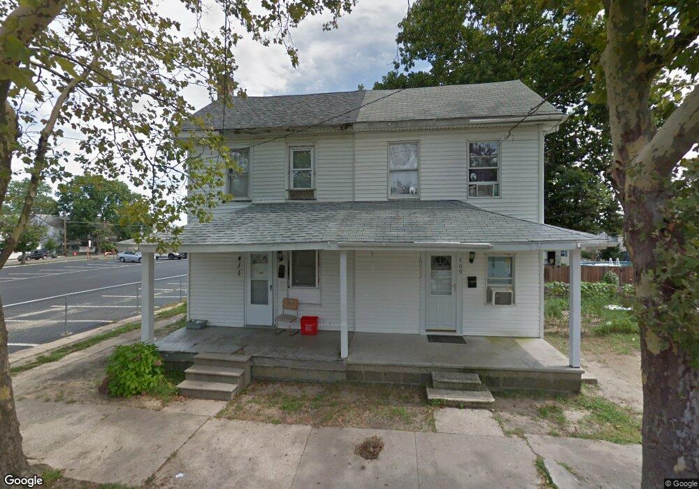
411 Dock St Millville, NJ 08332
Estimated Value: $107,838 - $160,000
--
Bed
--
Bath
1,152
Sq Ft
$122/Sq Ft
Est. Value
About This Home
This home is located at 411 Dock St, Millville, NJ 08332 and is currently estimated at $140,960, approximately $122 per square foot. 411 Dock St is a home located in Cumberland County with nearby schools including R.D. Wood Elementary School, Lakeside Middle School, and Memorial High School.
Ownership History
Date
Name
Owned For
Owner Type
Purchase Details
Closed on
Aug 14, 2009
Sold by
Pagano Nicholas
Bought by
Larry And Carrie Llc
Current Estimated Value
Home Financials for this Owner
Home Financials are based on the most recent Mortgage that was taken out on this home.
Original Mortgage
$11,299
Outstanding Balance
$7,359
Interest Rate
5.19%
Mortgage Type
Purchase Money Mortgage
Estimated Equity
$133,601
Purchase Details
Closed on
Feb 17, 2004
Sold by
Pagano Philomena
Bought by
Pagano Nicholas
Create a Home Valuation Report for This Property
The Home Valuation Report is an in-depth analysis detailing your home's value as well as a comparison with similar homes in the area
Home Values in the Area
Average Home Value in this Area
Purchase History
| Date | Buyer | Sale Price | Title Company |
|---|---|---|---|
| Larry And Carrie Llc | $20,000 | -- | |
| Pagano Nicholas | -- | -- |
Source: Public Records
Mortgage History
| Date | Status | Borrower | Loan Amount |
|---|---|---|---|
| Open | Larry And Carrie Llc | $11,299 |
Source: Public Records
Tax History Compared to Growth
Tax History
| Year | Tax Paid | Tax Assessment Tax Assessment Total Assessment is a certain percentage of the fair market value that is determined by local assessors to be the total taxable value of land and additions on the property. | Land | Improvement |
|---|---|---|---|---|
| 2025 | $2,485 | $63,300 | $14,700 | $48,600 |
| 2024 | $2,485 | $63,300 | $14,700 | $48,600 |
| 2023 | $2,464 | $63,300 | $14,700 | $48,600 |
| 2022 | $2,400 | $63,300 | $14,700 | $48,600 |
| 2021 | $2,322 | $63,300 | $14,700 | $48,600 |
| 2020 | $2,283 | $63,300 | $14,700 | $48,600 |
| 2019 | $2,178 | $63,300 | $14,700 | $48,600 |
| 2018 | $2,133 | $63,300 | $14,700 | $48,600 |
| 2017 | $2,113 | $63,300 | $14,700 | $48,600 |
| 2016 | $2,086 | $63,300 | $14,700 | $48,600 |
| 2015 | $2,040 | $63,300 | $14,700 | $48,600 |
| 2014 | $2,043 | $63,300 | $14,700 | $48,600 |
Source: Public Records
Map
Nearby Homes
- 504 Columbia Ave
- 500 Columbia Ave
- 525 Dock St Unit B
- 525 Dock St
- 525 Dock St Unit A
- 502 N High St
- 550 Columbia Ave
- 552 Columbia Ave
- 228 High St N
- 108 110 E Oak St
- 10 E Broad St
- 503 N 2nd St
- 507 N 2nd St
- 414 W Powell St
- 0 W Main St
- 709 & 707 Buck St
- 320 E Oak St
- 705 N 2nd St
- 320 E Mulberry St
- 2300 S 2nd # 81 St
- 409 Dock St
- 505 Columbia Ave
- 403 Columbia Ave Unit 405
- 509 Columbia Ave
- 22 W Vine St
- 18 W Vine St Unit 20
- 515 Columbia Ave
- 510 Columbia Ave
- 498 Dock St
- 517 Columbia Ave Unit 519
- 517 Columbia Ave # 519 Ave
- 22 W Oak St
- 503 Dock St Unit 505
- 20 W Oak St
- 18 W Oak St
- 2 W Vine St
- 517-519 Columbia Ave
- 14 W Oak St
- 16 W Oak St
- 511 Columbia Ave