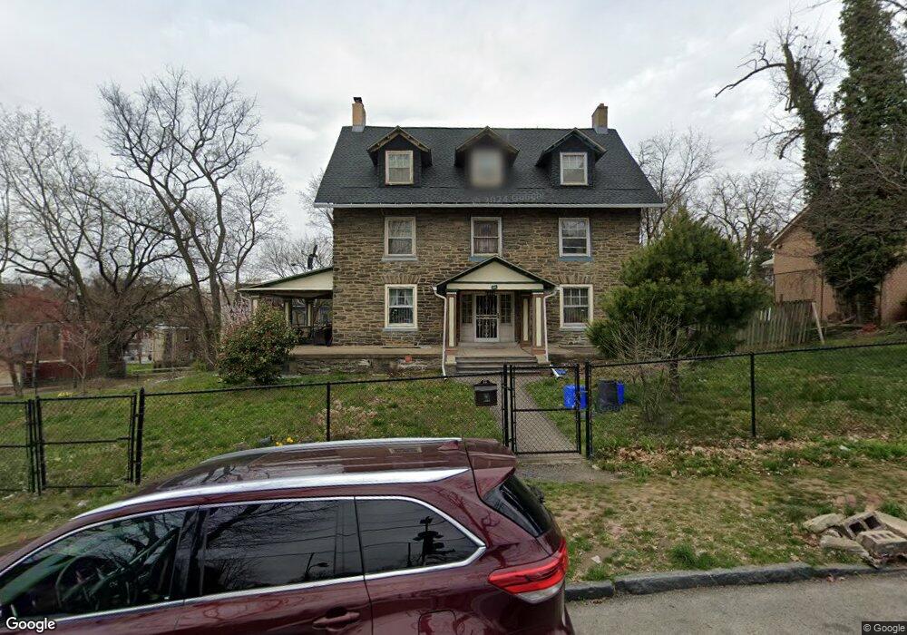
411 E Locust Ave Philadelphia, PA 19144
East Germantown NeighborhoodEstimated Value: $369,000 - $486,000
--
Bed
--
Bath
3,225
Sq Ft
$133/Sq Ft
Est. Value
About This Home
This home is located at 411 E Locust Ave, Philadelphia, PA 19144 and is currently estimated at $429,176, approximately $133 per square foot. 411 E Locust Ave is a home located in Philadelphia County with nearby schools including Roosevelt Theodore Middle School, Oak Street Elementary School, and Martin Luther King High School.
Ownership History
Date
Name
Owned For
Owner Type
Purchase Details
Closed on
Jul 19, 2001
Sold by
Baldus Merrie
Bought by
Coelho Eusebio
Current Estimated Value
Home Financials for this Owner
Home Financials are based on the most recent Mortgage that was taken out on this home.
Original Mortgage
$118,750
Outstanding Balance
$45,102
Interest Rate
7.1%
Estimated Equity
$384,074
Create a Home Valuation Report for This Property
The Home Valuation Report is an in-depth analysis detailing your home's value as well as a comparison with similar homes in the area
Home Values in the Area
Average Home Value in this Area
Purchase History
| Date | Buyer | Sale Price | Title Company |
|---|---|---|---|
| Coelho Eusebio | $125,000 | -- |
Source: Public Records
Mortgage History
| Date | Status | Borrower | Loan Amount |
|---|---|---|---|
| Open | Coelho Eusebio | $118,750 |
Source: Public Records
Tax History Compared to Growth
Tax History
| Year | Tax Paid | Tax Assessment Tax Assessment Total Assessment is a certain percentage of the fair market value that is determined by local assessors to be the total taxable value of land and additions on the property. | Land | Improvement |
|---|---|---|---|---|
| 2026 | $3,812 | $387,200 | $77,440 | $309,760 |
| 2025 | $3,812 | $387,200 | $77,440 | $309,760 |
| 2024 | $3,812 | $387,200 | $77,440 | $309,760 |
| 2023 | $3,812 | $272,300 | $54,460 | $217,840 |
| 2022 | $1,670 | $227,300 | $54,460 | $172,840 |
| 2021 | $2,300 | $0 | $0 | $0 |
| 2020 | $2,300 | $0 | $0 | $0 |
| 2019 | $2,401 | $0 | $0 | $0 |
| 2018 | $2,955 | $0 | $0 | $0 |
| 2017 | $2,955 | $0 | $0 | $0 |
| 2016 | $2,535 | $0 | $0 | $0 |
| 2015 | $2,463 | $0 | $0 | $0 |
| 2014 | -- | $213,800 | $41,195 | $172,605 |
| 2012 | -- | $24,640 | $17,151 | $7,489 |
Source: Public Records
Map
Nearby Homes
- 345 E Armat St
- 5634 Morton St
- 5638 Morton St
- 335 E Armat St
- 5630 Heiskell St
- 5634 Heiskell St
- 328 E Armat St
- 5612 Utah St
- 5604 6 Utah St
- 5357 Belfield Ave
- 436 E Chelten Ave
- 5688 90 Magnolia St
- 5433 Wakefield St
- 543 E Locust Ave
- 222 E Price St
- 527 E Chelten Ave
- 5301 Belfield Ave
- 5335 Wakefield St
- 459 E Price St
- 604 E Locust Ave
- 422 E Locust Ave
- 420 E Locust Ave
- 418 E Locust Ave
- 416 E Locust Ave
- 414 E Locust Ave
- 5618 Morton St
- 5531 Osceola St
- 5628 Morton St
- 5616 Morton St
- 412 E Locust Ave
- 349 E Armat St
- 5620 Morton St
- 5622 Morton St
- 410 E Locust Ave
- 5624 Morton St
- 5630 Morton St
- 5632 Morton St
- 5626 Morton St
- 347 E Armat St
- 5529 Osceola St