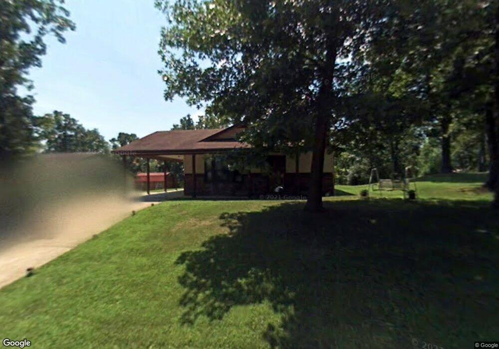
411 Fleetwood Dr Waynesville, MO 65583
Estimated Value: $171,975 - $191,000
--
Bed
1
Bath
1,200
Sq Ft
$150/Sq Ft
Est. Value
About This Home
This home is located at 411 Fleetwood Dr, Waynesville, MO 65583 and is currently estimated at $180,494, approximately $150 per square foot. 411 Fleetwood Dr is a home located in Pulaski County with nearby schools including Waynesville East Elementary School, Freedom Elementary School, and Waynesville Middle School.
Ownership History
Date
Name
Owned For
Owner Type
Purchase Details
Closed on
Sep 15, 2005
Sold by
Denison Lillian F
Bought by
Melton Barbara
Current Estimated Value
Home Financials for this Owner
Home Financials are based on the most recent Mortgage that was taken out on this home.
Original Mortgage
$91,290
Outstanding Balance
$48,564
Interest Rate
5.76%
Mortgage Type
New Conventional
Estimated Equity
$131,930
Purchase Details
Closed on
Sep 13, 2005
Sold by
Denison Lillian F
Bought by
Melton Barbara
Home Financials for this Owner
Home Financials are based on the most recent Mortgage that was taken out on this home.
Original Mortgage
$91,290
Outstanding Balance
$48,564
Interest Rate
5.76%
Mortgage Type
New Conventional
Estimated Equity
$131,930
Create a Home Valuation Report for This Property
The Home Valuation Report is an in-depth analysis detailing your home's value as well as a comparison with similar homes in the area
Home Values in the Area
Average Home Value in this Area
Purchase History
| Date | Buyer | Sale Price | Title Company |
|---|---|---|---|
| Melton Barbara | -- | -- | |
| Melton Barbara | -- | None Available |
Source: Public Records
Mortgage History
| Date | Status | Borrower | Loan Amount |
|---|---|---|---|
| Open | Melton Barbara | $91,290 |
Source: Public Records
Tax History Compared to Growth
Tax History
| Year | Tax Paid | Tax Assessment Tax Assessment Total Assessment is a certain percentage of the fair market value that is determined by local assessors to be the total taxable value of land and additions on the property. | Land | Improvement |
|---|---|---|---|---|
| 2024 | $696 | $16,463 | $3,116 | $13,347 |
| 2023 | $679 | $16,463 | $3,116 | $13,347 |
| 2022 | $675 | $16,463 | $3,116 | $13,347 |
| 2021 | $667 | $16,463 | $3,116 | $13,347 |
| 2020 | $655 | $15,614 | $0 | $0 |
| 2019 | $655 | $15,827 | $0 | $0 |
| 2018 | $655 | $15,827 | $0 | $0 |
| 2017 | $647 | $15,614 | $0 | $0 |
| 2016 | $615 | $15,830 | $0 | $0 |
| 2015 | $610 | $15,830 | $0 | $0 |
| 2014 | $610 | $15,830 | $0 | $0 |
Source: Public Records
Map
Nearby Homes
- 312 Summit Ave
- 0 Lot 1 Westwinds S D
- 307 Ellis Ave
- 412 Fleetwood Dr
- 100 S Newport Ln
- 103 S Newport Ln
- 212 Tremont Dr
- 0 El Loma St
- 107 Hull Dr
- 8 Nathan St
- 1201 Hull Valley Dr
- 123 Hull Dr
- 101 Ridge Ct
- 107 Tiger St
- 1802 Pearson St
- 508 Main St
- 20775 Reporter Rd
- 602 Sunset Dr
- 600 Sunset Dr
- 114 Pioneer Ct
- 409 Fleetwood Dr
- 413 Fleetwood Dr
- 407 Fleetwood Dr
- 311 Summit Ave
- 310 Summit Ave
- 405 Fleetwood Dr
- 309 Summit Ave
- 111 Ballew Ln
- 415 Fleetwood Dr
- 403 Fleetwood Dr
- 307 Summit Ave
- 109 Ballew Ln
- 316 Ellis Ave
- 408 Fleetwood Dr
- 101 Renee Ln
- 105 Ballew Ln
- 312 Ellis Ave
- 304 Ellis Ave
- 410 Fleetwood Dr
- 112 Ballew Ln