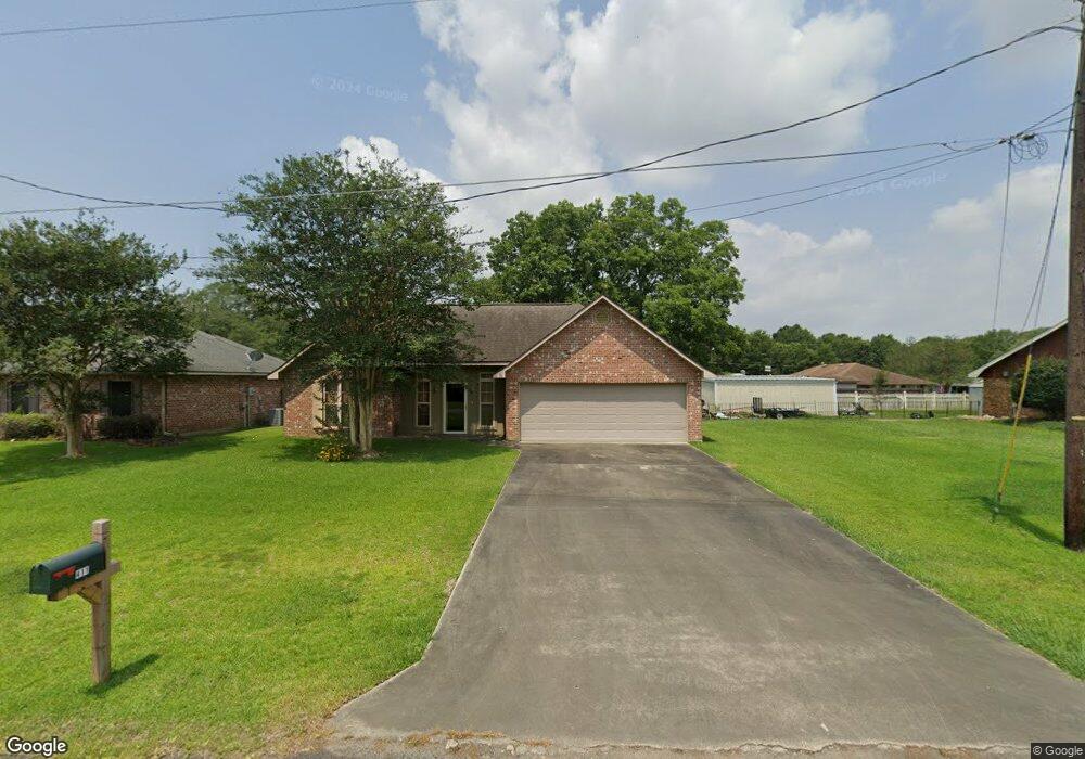
411 Harold St Eunice, LA 70535
Estimated Value: $120,734 - $236,000
Studio
--
Bath
--
Sq Ft
7,797
Sq Ft Lot
About This Home
This home is located at 411 Harold St, Eunice, LA 70535 and is currently estimated at $166,434. 411 Harold St is a home located in St. Landry Parish with nearby schools including Eunice Elementary School, Eunice Junior High School, and Central Middle School.
Ownership History
Date
Name
Owned For
Owner Type
Purchase Details
Closed on
Jun 6, 2024
Sold by
Parish Of St Landry
Bought by
Adair Asset Management Llc With Union Bank
Current Estimated Value
Purchase Details
Closed on
May 5, 2006
Sold by
S & M Builders Llc
Bought by
Thompson William Allen and Thompson Velva Jane Matt
Home Financials for this Owner
Home Financials are based on the most recent Mortgage that was taken out on this home.
Original Mortgage
$122,550
Interest Rate
5.87%
Mortgage Type
Adjustable Rate Mortgage/ARM
Create a Home Valuation Report for This Property
The Home Valuation Report is an in-depth analysis detailing your home's value as well as a comparison with similar homes in the area
Purchase History
| Date | Buyer | Sale Price | Title Company |
|---|---|---|---|
| Adair Asset Management Llc With Union Bank | $280 | None Listed On Document | |
| Thompson William Allen | $153,200 | -- |
Source: Public Records
Mortgage History
| Date | Status | Borrower | Loan Amount |
|---|---|---|---|
| Previous Owner | Thompson William Allen | $122,550 |
Source: Public Records
Tax History
| Year | Tax Paid | Tax Assessment Tax Assessment Total Assessment is a certain percentage of the fair market value that is determined by local assessors to be the total taxable value of land and additions on the property. | Land | Improvement |
|---|---|---|---|---|
| 2024 | $5 | $11,080 | $980 | $10,100 |
| 2023 | $244 | $11,080 | $980 | $10,100 |
| 2022 | $482 | $11,080 | $980 | $10,100 |
| 2021 | $482 | $11,080 | $980 | $10,100 |
| 2020 | $476 | $11,080 | $980 | $10,100 |
| 2019 | $483 | $11,080 | $980 | $10,100 |
| 2018 | $483 | $11,080 | $980 | $10,100 |
| 2017 | $483 | $11,080 | $980 | $10,100 |
| 2015 | $479 | $11,080 | $980 | $10,100 |
| 2013 | $479 | $11,080 | $980 | $10,100 |
Source: Public Records
Map
Nearby Homes
- 701 Lsu- East Dr
- 200 Thayer Ave
- 1311 Bruce Ave
- 1350 College Rd
- 1240 B and B Ave
- 1230 Phillip Ave
- 1410 W Elm St
- 1480 W Oak Ave
- 221 College Rd
- 104 Hunter St
- 0 W Maple Ave
- 99 University Place
- 0 Savannah Unit SWL25001182
- 1820 Betty St
- Tbd Savannah St
- 151 Dulles St
- 201 S 9th St
- 231 Eula St
- 1701 W Peach Ave
- 1750 W Peach Ave
Your Personal Tour Guide
Ask me questions while you tour the home.