Estimated Value: $215,000 - $232,237
3
Beds
2
Baths
1,514
Sq Ft
$148/Sq Ft
Est. Value
About This Home
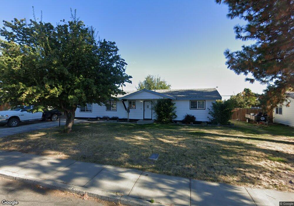
This home is located at 411 King Ave, Hines, OR 97738 and is currently estimated at $223,619, approximately $147 per square foot. 411 King Ave is a home located in Harney County with nearby schools including Henry L. Slater Elementary School, Hines Middle School, and Burns High School.
Ownership History
Date
Name
Owned For
Owner Type
Purchase Details
Closed on
Sep 22, 2020
Sold by
Doverspike Donald and Doverspike Katherine
Bought by
Lovelady Robert S
Current Estimated Value
Home Financials for this Owner
Home Financials are based on the most recent Mortgage that was taken out on this home.
Original Mortgage
$141,414
Outstanding Balance
$125,496
Interest Rate
2.9%
Mortgage Type
New Conventional
Estimated Equity
$98,123
Purchase Details
Closed on
Jun 3, 2015
Sold by
Smith Charles B and Smith Janice A
Bought by
Doverspike Donald and Doverspike Katherine
Create a Home Valuation Report for This Property
The Home Valuation Report is an in-depth analysis detailing your home's value as well as a comparison with similar homes in the area
Home Values in the Area
Average Home Value in this Area
Purchase History
| Date | Buyer | Sale Price | Title Company |
|---|---|---|---|
| Lovelady Robert S | $140,000 | Amerititle | |
| Doverspike Donald | $100,000 | Ameri Title |
Source: Public Records
Mortgage History
| Date | Status | Borrower | Loan Amount |
|---|---|---|---|
| Open | Lovelady Robert S | $141,414 |
Source: Public Records
Tax History Compared to Growth
Tax History
| Year | Tax Paid | Tax Assessment Tax Assessment Total Assessment is a certain percentage of the fair market value that is determined by local assessors to be the total taxable value of land and additions on the property. | Land | Improvement |
|---|---|---|---|---|
| 2024 | $2,226 | $127,950 | -- | -- |
| 2023 | $2,226 | $124,230 | $0 | $0 |
| 2022 | $2,092 | $120,620 | $0 | $0 |
| 2021 | $2,035 | $117,110 | $0 | $0 |
| 2020 | $1,818 | $117,110 | $0 | $0 |
| 2019 | $1,832 | $110,390 | $0 | $0 |
| 2018 | $1,705 | $107,180 | $0 | $0 |
| 2017 | $1,639 | $104,060 | $0 | $0 |
| 2016 | $1,601 | $101,030 | $0 | $0 |
| 2015 | $1,534 | $98,090 | $0 | $0 |
| 2014 | $1,530 | $97,910 | $0 | $0 |
Source: Public Records
Map
Nearby Homes
- 507 N Roanoke Ave
- 501 Westridge Ave
- 220 N Saginaw Ave
- 706 Knight Dr
- TL 200 Knight Dr
- TL 300 Pierce St
- 400 S Shasta Place
- 128 N Milwaukie Ave
- 104 N Newport Ave
- 140 S Ogden Ave
- 668 S Liberty Ave
- 781 S Kearney Ave
- 150 S Ogden Ave
- Tl 700 S Quincy Ave
- 420 S Juntura Ave
- 137 S Saginaw Ave
- 421 W Grant St
- 240 S Saginaw Ave
- TL800 Lottery Ln
- 0 Lottery Ln
- 405 King Ave
- 417 King Ave
- 410 King Ave
- 423 King Ave
- 404 King Ave
- 416 King Ave
- 422 King Ave
- 549 N Saginaw Ave
- 543 N Saginaw Ave
- 429 King Ave
- 555 N Saginaw Ave
- 537 N Saginaw Ave
- 428 King Ave
- 435 King Ave
- 525 N Saginaw Ave
- 536 N Roanoke Ave
- 530 N Roanoke Ave
- 434 King Ave
- 542 N Roanoke Ave
- 524 N Roanoke Ave