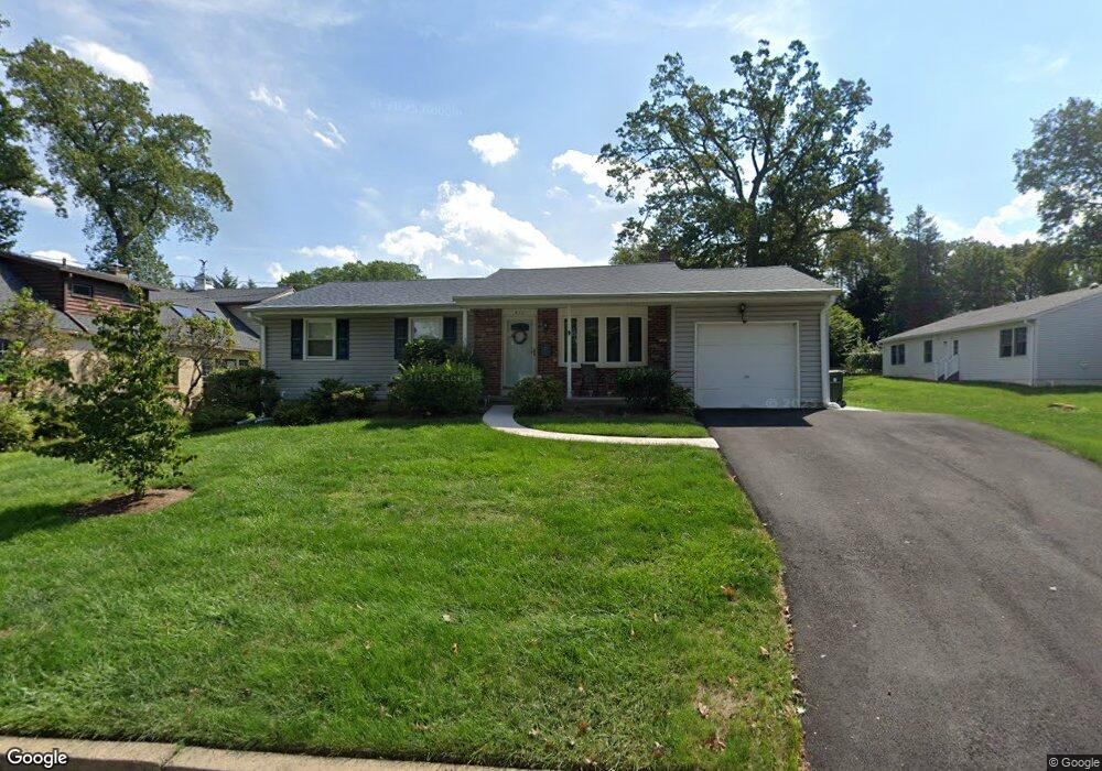
411 Locust Rd Glenside, PA 19038
Estimated Value: $410,000 - $437,000
3
Beds
1
Bath
1,240
Sq Ft
$342/Sq Ft
Est. Value
About This Home
This home is located at 411 Locust Rd, Glenside, PA 19038 and is currently estimated at $423,772, approximately $341 per square foot. 411 Locust Rd is a home located in Montgomery County with nearby schools including Copper Beech Elementary School, Abington Middle School, and Abington Senior High School.
Ownership History
Date
Name
Owned For
Owner Type
Purchase Details
Closed on
Apr 28, 2025
Sold by
Yates Joseph
Bought by
Artillio Gina and Blohm Theodore
Current Estimated Value
Home Financials for this Owner
Home Financials are based on the most recent Mortgage that was taken out on this home.
Original Mortgage
$417,302
Outstanding Balance
$415,821
Interest Rate
6.64%
Mortgage Type
FHA
Estimated Equity
$7,951
Purchase Details
Closed on
Oct 4, 1991
Bought by
Yates Joseph and Yates Victoria
Create a Home Valuation Report for This Property
The Home Valuation Report is an in-depth analysis detailing your home's value as well as a comparison with similar homes in the area
Home Values in the Area
Average Home Value in this Area
Purchase History
| Date | Buyer | Sale Price | Title Company |
|---|---|---|---|
| Artillio Gina | $425,000 | None Listed On Document | |
| Yates Joseph | $126,000 | -- |
Source: Public Records
Mortgage History
| Date | Status | Borrower | Loan Amount |
|---|---|---|---|
| Open | Artillio Gina | $417,302 |
Source: Public Records
Tax History Compared to Growth
Tax History
| Year | Tax Paid | Tax Assessment Tax Assessment Total Assessment is a certain percentage of the fair market value that is determined by local assessors to be the total taxable value of land and additions on the property. | Land | Improvement |
|---|---|---|---|---|
| 2025 | $5,796 | $125,160 | $55,870 | $69,290 |
| 2024 | $5,796 | $125,160 | $55,870 | $69,290 |
| 2023 | $5,554 | $125,160 | $55,870 | $69,290 |
| 2022 | $5,376 | $125,160 | $55,870 | $69,290 |
| 2021 | $5,087 | $125,160 | $55,870 | $69,290 |
| 2020 | $5,014 | $125,160 | $55,870 | $69,290 |
| 2019 | $5,014 | $125,160 | $55,870 | $69,290 |
| 2018 | $5,014 | $125,160 | $55,870 | $69,290 |
| 2017 | $4,866 | $125,160 | $55,870 | $69,290 |
| 2016 | $4,818 | $125,160 | $55,870 | $69,290 |
| 2015 | $4,529 | $125,160 | $55,870 | $69,290 |
| 2014 | $4,529 | $125,160 | $55,870 | $69,290 |
Source: Public Records
Map
Nearby Homes
- 2711 Taft Ave
- 229 Edge Hill Rd
- 441 Cricket Ave
- 342 Cricket Ave
- 624 Hamel Ave
- 221 Central Ave
- 502 Central Ave
- 629 Roberts Ave
- 2444 Fairhill Ave
- 648 N Tyson Ave
- 616 Tennis Ave
- 722 Maple Ave
- 550 Penn Ave
- 623 Penn Ave
- 65 Limekiln Pike
- 222 Ruscombe Ave
- 743 Penn Ave
- 332 Logan Ave
- 140 Linden Ave
- 120 Linden Ave
- 417 Locust Rd
- 2637 Hawthorne Rd
- 410 Edge Hill Rd
- 414 Edge Hill Rd
- 427 Locust Rd
- 404 Edge Hill Rd
- 410 Locust Rd
- 404 Locust Rd
- 414 Locust Rd
- 2621 Hawthorne Rd
- 422 Edge Hill Rd
- 400 Locust Rd
- 418 Locust Rd
- 424 Locust Rd
- 379 Locust Rd
- 342 Edge Hill Rd
- 428 Locust Rd
- 380 Locust Rd
- 426 Edge Hill Rd
- 411 Elm Ave