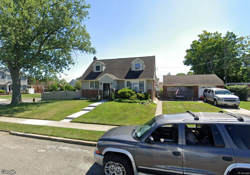
411 Mansfield Ave Levittown, NY 11756
Estimated Value: $641,832 - $754,000
--
Bed
2
Baths
1,299
Sq Ft
$537/Sq Ft
Est. Value
About This Home
This home is located at 411 Mansfield Ave, Levittown, NY 11756 and is currently estimated at $697,916, approximately $537 per square foot. 411 Mansfield Ave is a home located in Nassau County with nearby schools including Michael F. Stokes Elementary School, J Fred Sparke Elementary School, and Island Trees Middle School.
Ownership History
Date
Name
Owned For
Owner Type
Purchase Details
Closed on
Oct 7, 2002
Sold by
Eletti Brian
Current Estimated Value
Purchase Details
Closed on
Nov 28, 1995
Sold by
Fusco Charles Est
Bought by
Eletti Brian
Home Financials for this Owner
Home Financials are based on the most recent Mortgage that was taken out on this home.
Original Mortgage
$138,500
Outstanding Balance
$2,853
Interest Rate
7.44%
Estimated Equity
$695,063
Create a Home Valuation Report for This Property
The Home Valuation Report is an in-depth analysis detailing your home's value as well as a comparison with similar homes in the area
Home Values in the Area
Average Home Value in this Area
Purchase History
| Date | Buyer | Sale Price | Title Company |
|---|---|---|---|
| -- | -- | -- | |
| Eletti Brian | $165,000 | -- |
Source: Public Records
Mortgage History
| Date | Status | Borrower | Loan Amount |
|---|---|---|---|
| Open | Eletti Brian | $138,500 |
Source: Public Records
Tax History Compared to Growth
Tax History
| Year | Tax Paid | Tax Assessment Tax Assessment Total Assessment is a certain percentage of the fair market value that is determined by local assessors to be the total taxable value of land and additions on the property. | Land | Improvement |
|---|---|---|---|---|
| 2025 | $8,282 | $416 | $222 | $194 |
| 2024 | $2,753 | $424 | $226 | $198 |
| 2023 | $7,159 | $437 | $233 | $204 |
| 2022 | $7,159 | $437 | $233 | $204 |
| 2021 | $8,603 | $460 | $246 | $214 |
| 2020 | $6,822 | $498 | $475 | $23 |
| 2019 | $6,311 | $534 | $478 | $56 |
| 2018 | $6,418 | $569 | $0 | $0 |
| 2017 | $4,136 | $605 | $480 | $125 |
| 2016 | $6,622 | $641 | $458 | $183 |
| 2015 | $2,585 | $676 | $483 | $193 |
| 2014 | $2,585 | $676 | $483 | $193 |
| 2013 | $2,556 | $713 | $509 | $204 |
Source: Public Records
Map
Nearby Homes
- 458 Whittier Ave
- 421 Mansfield Ave
- 410 Mansfield Ave
- 464 Whittier Ave
- 427 Mansfield Ave
- 420 Mansfield Ave
- 453 Whittier Ave
- 447 Whittier Ave
- 459 Whittier Ave
- 470 Whittier Ave
- 430 Whittier Ave
- 441 Whittier Ave
- 426 Mansfield Ave
- 465 Whittier Ave
- 433 Mansfield Ave
- 435 Whittier Ave
- 459 Mansfield Ave
- 432 Mansfield Ave
- 444 Coleridge St
- 471 Whittier Ave