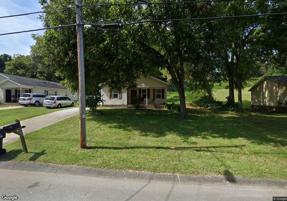
411 Pryor St Gastonia, NC 28052
Estimated Value: $209,000 - $219,452
3
Beds
2
Baths
1,043
Sq Ft
$205/Sq Ft
Est. Value
About This Home
This home is located at 411 Pryor St, Gastonia, NC 28052 and is currently estimated at $213,863, approximately $205 per square foot. 411 Pryor St is a home with nearby schools including Bessemer City Primary School, W P Grier Middle School, and Ashbrook High School.
Ownership History
Date
Name
Owned For
Owner Type
Purchase Details
Closed on
Jun 13, 2025
Sold by
Moore Landis D
Bought by
Moore Chrystal D
Current Estimated Value
Purchase Details
Closed on
Dec 13, 2012
Sold by
Habitat For Humanity Of Gaston County In
Bought by
Moore Landis D and Moore Chrystal D
Home Financials for this Owner
Home Financials are based on the most recent Mortgage that was taken out on this home.
Original Mortgage
$75,000
Interest Rate
3.44%
Mortgage Type
Purchase Money Mortgage
Create a Home Valuation Report for This Property
The Home Valuation Report is an in-depth analysis detailing your home's value as well as a comparison with similar homes in the area
Home Values in the Area
Average Home Value in this Area
Purchase History
| Date | Buyer | Sale Price | Title Company |
|---|---|---|---|
| Moore Chrystal D | -- | None Listed On Document | |
| Moore Chrystal D | -- | None Listed On Document | |
| Moore Landis D | $75,000 | None Available |
Source: Public Records
Mortgage History
| Date | Status | Borrower | Loan Amount |
|---|---|---|---|
| Previous Owner | Moore Landis D | $75,000 | |
| Previous Owner | Moore Landis D | $6,000 |
Source: Public Records
Tax History Compared to Growth
Tax History
| Year | Tax Paid | Tax Assessment Tax Assessment Total Assessment is a certain percentage of the fair market value that is determined by local assessors to be the total taxable value of land and additions on the property. | Land | Improvement |
|---|---|---|---|---|
| 2025 | $1,792 | $167,660 | $10,000 | $157,660 |
| 2024 | $1,792 | $167,660 | $10,000 | $157,660 |
| 2023 | $1,811 | $167,660 | $10,000 | $157,660 |
| 2022 | $1,277 | $96,020 | $6,000 | $90,020 |
| 2021 | $1,296 | $96,020 | $6,000 | $90,020 |
| 2019 | $1,306 | $96,020 | $6,000 | $90,020 |
| 2018 | $911 | $65,083 | $6,000 | $59,083 |
| 2017 | $911 | $65,083 | $6,000 | $59,083 |
| 2016 | $911 | $65,083 | $0 | $0 |
| 2014 | $1,162 | $82,981 | $7,500 | $75,481 |
Source: Public Records
Map
Nearby Homes
- 809 W Mauney Ave
- 00 W Davidson Ave
- 810 N Weldon St
- 907 W Mauney Ave
- 308 N Boyce St
- 903 W Davidson Ave
- 928 N Highland St
- 439 W Norment Ave
- 431 W Norment Ave
- 630 N Moran St
- 116 W Bradley Ave
- 717 W Jefferson Ave
- 119 Nat Barber Ave
- 1216 N Ransom St
- 110 Mauney Cir
- 606 N Logan St
- 714 Apple Blossom Cir
- Verona Plan at The Courtyards on New Hope
- Portico Plan at The Courtyards on New Hope
- Piazza Plan at The Courtyards on New Hope