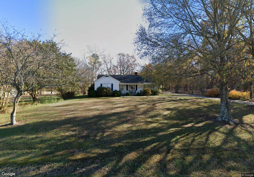
411 Randall Rd Wadesboro, NC 28170
Estimated Value: $144,000 - $183,000
3
Beds
1
Bath
1,310
Sq Ft
$127/Sq Ft
Est. Value
About This Home
This home is located at 411 Randall Rd, Wadesboro, NC 28170 and is currently estimated at $165,726, approximately $126 per square foot. 411 Randall Rd is a home located in Anson County with nearby schools including Ansonville Elementary School, Anson Middle School, and Anson High School.
Ownership History
Date
Name
Owned For
Owner Type
Purchase Details
Closed on
Oct 8, 2014
Sold by
Wilson Theresa L and Wilson Dexter
Bought by
Lee Dennis and Lee Janice
Current Estimated Value
Home Financials for this Owner
Home Financials are based on the most recent Mortgage that was taken out on this home.
Original Mortgage
$30,000
Outstanding Balance
$10,093
Interest Rate
4.16%
Mortgage Type
New Conventional
Estimated Equity
$155,633
Purchase Details
Closed on
May 13, 2010
Sold by
Wilson Theresa L and Wilson Dexter
Bought by
Lee Darrell Bower and Lee Jennifer Mcgrady
Create a Home Valuation Report for This Property
The Home Valuation Report is an in-depth analysis detailing your home's value as well as a comparison with similar homes in the area
Home Values in the Area
Average Home Value in this Area
Purchase History
| Date | Buyer | Sale Price | Title Company |
|---|---|---|---|
| Lee Dennis | $60,000 | None Available | |
| Lee Darrell Bower | -- | None Available |
Source: Public Records
Mortgage History
| Date | Status | Borrower | Loan Amount |
|---|---|---|---|
| Open | Lee Dennis | $30,000 |
Source: Public Records
Tax History Compared to Growth
Tax History
| Year | Tax Paid | Tax Assessment Tax Assessment Total Assessment is a certain percentage of the fair market value that is determined by local assessors to be the total taxable value of land and additions on the property. | Land | Improvement |
|---|---|---|---|---|
| 2024 | $8 | $91,700 | $0 | $0 |
| 2023 | $801 | $91,700 | $15,000 | $76,700 |
| 2022 | $801 | $91,700 | $15,000 | $76,700 |
| 2021 | $801 | $91,700 | $0 | $0 |
| 2020 | $801 | $91,700 | $0 | $0 |
| 2018 | $801 | $91,700 | $0 | $0 |
| 2017 | $785 | $88,800 | $0 | $0 |
| 2016 | $779 | $88,800 | $0 | $0 |
| 2015 | $779 | $88,800 | $0 | $0 |
| 2011 | -- | $64,600 | $15,000 | $49,600 |
Source: Public Records
Map
Nearby Homes
- 615 Randall Rd
- 690 Hill Rd
- 359 Martin St
- TBD S Park Dr
- 120 Maynard Ave
- 109 Maynard Ave
- 65 Maynard Ave
- 335 Plank Rd
- 330 Plank Rd
- 9605 Hwy 52 None N Unit 4
- 9697 U S 52
- 109 Nc Highway 109 Hwy N
- 358 Thomasville Rd
- 4228 Red Hill Mount Vernon Rd
- 11056 Us Highway 52 N
- 11550 U S 52
- 1637 Jack's Branch Rd
- 1434 Cedar Grove Church Rd
- 8612 N Carolina 742
- 245 Ivy Rd
- 555 Randall Rd
- 824 Hill Rd
- 215 Randall Rd
- 740 Hill Rd
- 706 Hill Rd
- 120 Randall Rd
- 558 Hill Rd Unit 556
- 577 Hill Rd
- 547 Hill Rd
- 755 Hill Rd
- 493 Hill Rd
- 880 Randall Rd
- 348 E Martin St
- 216 Hill Rd
- 00 Plank Rd
- 1058 Randall Rd
- 1392 Ansonville Polkton Rd Unit 1418
- 308 E Martin St
- 346 E Martin St
- 1482 Plank Rd