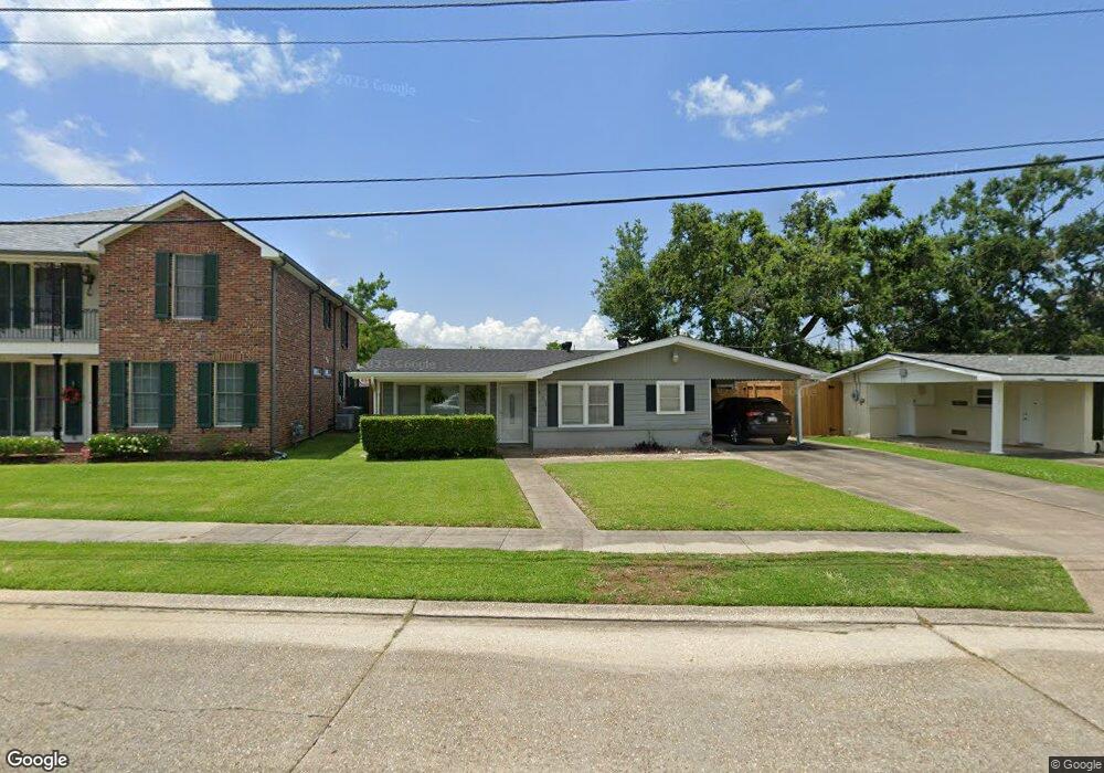
411 Rightor St Houma, LA 70364
North Houma NeighborhoodEstimated Value: $170,000 - $195,000
4
Beds
2
Baths
1,810
Sq Ft
$98/Sq Ft
Est. Value
About This Home
This home is located at 411 Rightor St, Houma, LA 70364 and is currently estimated at $178,007, approximately $98 per square foot. 411 Rightor St is a home located in Terrebonne Parish with nearby schools including Legion Park Elementary, Houma Junior High School, and Terrebonne High School.
Ownership History
Date
Name
Owned For
Owner Type
Purchase Details
Closed on
Mar 5, 2024
Sold by
Thibodaux Boudreaux Karen
Bought by
Anderson Richard Dale and Anderson Heather S
Current Estimated Value
Home Financials for this Owner
Home Financials are based on the most recent Mortgage that was taken out on this home.
Original Mortgage
$207,070
Outstanding Balance
$203,664
Interest Rate
6.69%
Mortgage Type
New Conventional
Estimated Equity
-$25,657
Purchase Details
Closed on
Aug 22, 2008
Sold by
Leblanc Brian P and Leblanc Lisa
Bought by
Mcnabb Michael and Mcnabb Staphanie
Create a Home Valuation Report for This Property
The Home Valuation Report is an in-depth analysis detailing your home's value as well as a comparison with similar homes in the area
Home Values in the Area
Average Home Value in this Area
Purchase History
| Date | Buyer | Sale Price | Title Company |
|---|---|---|---|
| Anderson Richard Dale | $193,000 | Turn Key Title Of Louisiana | |
| Mcnabb Michael | $132,500 | -- |
Source: Public Records
Mortgage History
| Date | Status | Borrower | Loan Amount |
|---|---|---|---|
| Open | Anderson Richard Dale | $207,070 | |
| Closed | Mcnabb Michael | $0 |
Source: Public Records
Tax History
| Year | Tax Paid | Tax Assessment Tax Assessment Total Assessment is a certain percentage of the fair market value that is determined by local assessors to be the total taxable value of land and additions on the property. | Land | Improvement |
|---|---|---|---|---|
| 2024 | $715 | $13,980 | $3,210 | $10,770 |
| 2023 | $728 | $13,320 | $3,060 | $10,260 |
| 2022 | $1,224 | $13,320 | $3,060 | $10,260 |
| 2021 | $546 | $12,290 | $3,060 | $9,230 |
| 2020 | $1,132 | $13,320 | $3,060 | $10,260 |
| 2019 | $1,168 | $12,680 | $2,910 | $9,770 |
| 2018 | $553 | $12,070 | $2,770 | $9,300 |
| 2017 | $1,129 | $12,070 | $2,770 | $9,300 |
| 2015 | $301 | $11,495 | $2,635 | $8,860 |
| 2014 | $288 | $9,250 | $0 | $0 |
| 2013 | $289 | $9,250 | $0 | $0 |
Source: Public Records
Map
Nearby Homes
- 1005 Morrison Ave
- 509 Central Ave
- 1103 Morrison Ave
- 613 Duval Ave
- 273 Brooklyn Ave
- 401 Maple Ave
- 306 Jefferson Davis St
- 280 Mckinley St
- 510 Eighth St
- 261 Mckinley St
- 513 Wilson Ave
- 479 Gouaux Ave
- 217 Birch Ave
- 445 T Leigh Dr
- 284 Carlos St
- 477 Gouaux Ave
- 254 Carlos St
- 902 Suthon Ave Unit 3
- 250 Carlos St
- 117 Saxony Dr
- 409 Rightor St
- 415 Rightor St
- 400 Rightor St
- 434 Prince Collins St
- 429 Prince Collins St
- 405 Rightor St
- 800 Franklin Ave
- 901 Franklin Ave
- 314 Stovall St
- 427 Prince Collins St
- 432 Prince Collins St
- 303 Nicholls St
- 903 Franklin Ave
- 402 Rightor St
- 312 Stovall St
- 302 Rightor St
- 403 Rightor St
- 430 Prince Collins St
- 302 Nicholls St
- 375 Stovall St
Your Personal Tour Guide
Ask me questions while you tour the home.