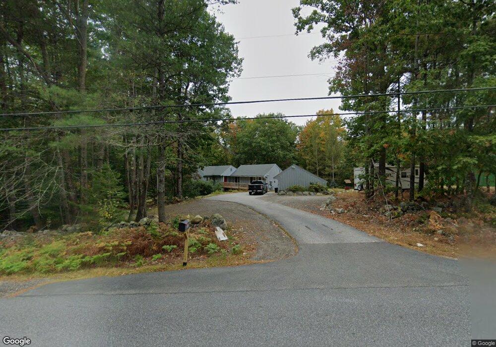
411 Runaround Pond Rd Durham, ME 04222
Estimated Value: $294,052 - $520,000
1
Bed
1
Bath
1,056
Sq Ft
$348/Sq Ft
Est. Value
About This Home
This home is located at 411 Runaround Pond Rd, Durham, ME 04222 and is currently estimated at $368,013, approximately $348 per square foot. 411 Runaround Pond Rd is a home located in Androscoggin County with nearby schools including Durham Community School and Freeport High School.
Ownership History
Date
Name
Owned For
Owner Type
Purchase Details
Closed on
Nov 9, 2018
Sold by
Bookataub George
Bought by
Finch Charles
Current Estimated Value
Purchase Details
Closed on
Oct 7, 2013
Sold by
Bookataub George F
Bought by
Rouleau Brian and Rouleau Michelle
Purchase Details
Closed on
Jan 4, 2012
Sold by
Filgate George E D Jr Est
Bought by
Bookataub George F
Home Financials for this Owner
Home Financials are based on the most recent Mortgage that was taken out on this home.
Original Mortgage
$144,896
Interest Rate
3.98%
Mortgage Type
New Conventional
Create a Home Valuation Report for This Property
The Home Valuation Report is an in-depth analysis detailing your home's value as well as a comparison with similar homes in the area
Home Values in the Area
Average Home Value in this Area
Purchase History
We collect this data history from publicly available records. To have your information removed, we recommend requesting removal directly through your county’s website.
| Date | Buyer | Sale Price | Title Company |
|---|---|---|---|
| Finch Charles | -- | -- | |
| Rouleau Brian | -- | -- | |
| Bookataub George F | -- | -- |
Source: Public Records
Mortgage History
We collect this data history from publicly available records. To have your information removed, we recommend requesting removal directly through your county’s website.
| Date | Status | Borrower | Loan Amount |
|---|---|---|---|
| Previous Owner | Bookataub George F | $144,896 |
Source: Public Records
Tax History
| Year | Tax Paid | Tax Assessment Tax Assessment Total Assessment is a certain percentage of the fair market value that is determined by local assessors to be the total taxable value of land and additions on the property. | Land | Improvement |
|---|---|---|---|---|
| 2025 | $4,490 | $133,700 | $72,000 | $61,700 |
| 2024 | $2,908 | $133,700 | $72,000 | $61,700 |
| 2023 | $2,854 | $133,700 | $72,000 | $61,700 |
| 2022 | $2,768 | $133,700 | $72,000 | $61,700 |
| 2021 | $2,768 | $133,700 | $72,000 | $61,700 |
| 2020 | $2,707 | $133,700 | $72,000 | $61,700 |
| 2019 | $2,707 | $133,700 | $72,000 | $61,700 |
| 2018 | $2,660 | $135,000 | $75,100 | $59,900 |
| 2016 | $2,538 | $135,000 | $75,100 | $59,900 |
| 2015 | $2,349 | $135,000 | $75,100 | $59,900 |
| 2014 | $2,248 | $135,000 | $75,100 | $59,900 |
| 2013 | $2,139 | $143,100 | $83,200 | $59,900 |
Source: Public Records
Map
Nearby Homes
- 850 Lawrence Rd
- Map8Lot15E Alder Way
- 72 Deer Creek Crossing
- 265 Lawrence Rd
- 133 Libby Rd
- Lot 114 Old Brunswick Rd
- 68 Adams Way
- 624 Hodsdon Rd
- 18 Glenview Rd
- 238 Hallowell Rd
- Lot # 1-A Poland Rd
- 162 Durham Rd
- 4 Harper's Trail
- 21 Curtis Rd
- 162 Merrill Rd
- 9 Picnic Hill Rd
- 42A Wardtown Rd
- 130 Bragdon Rd
- 64 Wardtown Rd
- 155 & 151 Gloucester Hill Rd
- 422 Runaround Pond Rd
- 427 Runaround Pond Rd
- 393 Runaround Pond Rd
- 436 Runaround Pond Rd
- 429 Runaround Pond Rd
- 382 Runaround Pond Rd
- 439 Runaround Pond Rd
- Lot 2 Rangdale Rd
- Lot 2 Oak Ridge Subdivision
- 1 Rangdale Rd
- 2 Rangdale Rd
- Lot 4 Rangdale
- 4 Rangdale Rd
- lot 3 Rangdale Rd
- lot #3 Rangdale Rd
- 3 Rangdale Rd
- Lot 6 Rangdale
- 6 Rangdale Rd
- 373 Runaround Pond Rd
- 12 Winifred Ln
Your Personal Tour Guide
Ask me questions while you tour the home.