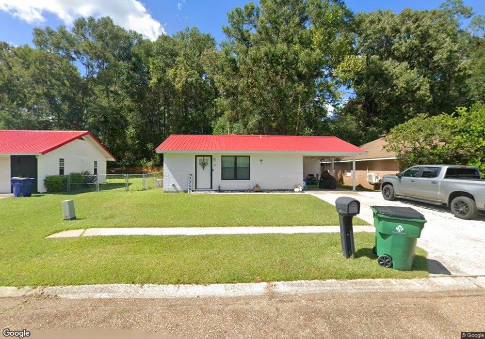
411 Shady Ln Deridder, LA 70634
Estimated Value: $108,000 - $136,375
3
Beds
1
Bath
1,305
Sq Ft
$97/Sq Ft
Est. Value
About This Home
This home is located at 411 Shady Ln, Deridder, LA 70634 and is currently estimated at $126,844, approximately $97 per square foot. 411 Shady Ln is a home located in Beauregard Parish with nearby schools including K.R. Hanchey Elementary School, Carver Elementary School, and Pine Wood Elementary School.
Ownership History
Date
Name
Owned For
Owner Type
Purchase Details
Closed on
May 30, 2024
Sold by
Reynolds Tracy Monique
Bought by
Nguyen Alvin Quoc Thai and Nguyen Gabrielle Michelle
Current Estimated Value
Home Financials for this Owner
Home Financials are based on the most recent Mortgage that was taken out on this home.
Original Mortgage
$141,988
Outstanding Balance
$140,204
Interest Rate
7.1%
Mortgage Type
VA
Estimated Equity
-$13,360
Purchase Details
Closed on
Mar 6, 2023
Sold by
Harris John L and Harris Bertha
Bought by
Reynolds Tracy M
Purchase Details
Closed on
Jan 31, 2008
Sold by
Ybarra Manuel and Ybarra Marie L
Bought by
Harris John L and Harris Bertha
Create a Home Valuation Report for This Property
The Home Valuation Report is an in-depth analysis detailing your home's value as well as a comparison with similar homes in the area
Home Values in the Area
Average Home Value in this Area
Purchase History
| Date | Buyer | Sale Price | Title Company |
|---|---|---|---|
| Nguyen Alvin Quoc Thai | $139,000 | None Listed On Document | |
| Reynolds Tracy M | $32,000 | -- | |
| Harris John L | $31,000 | -- |
Source: Public Records
Mortgage History
| Date | Status | Borrower | Loan Amount |
|---|---|---|---|
| Open | Nguyen Alvin Quoc Thai | $141,988 |
Source: Public Records
Tax History Compared to Growth
Tax History
| Year | Tax Paid | Tax Assessment Tax Assessment Total Assessment is a certain percentage of the fair market value that is determined by local assessors to be the total taxable value of land and additions on the property. | Land | Improvement |
|---|---|---|---|---|
| 2024 | $315 | $3,073 | $300 | $2,773 |
| 2023 | $326 | $3,100 | $200 | $2,900 |
| 2022 | $326 | $3,100 | $200 | $2,900 |
| 2021 | $326 | $3,100 | $200 | $2,900 |
| 2020 | $325 | $3,100 | $200 | $2,900 |
| 2019 | $326 | $3,100 | $200 | $2,900 |
| 2018 | $326 | $3,100 | $200 | $2,900 |
| 2017 | $326 | $3,100 | $200 | $2,900 |
| 2016 | $326 | $3,100 | $200 | $2,900 |
| 2015 | $32 | $3,100 | $200 | $2,900 |
| 2014 | $32 | $3,100 | $200 | $2,900 |
Source: Public Records
Map
Nearby Homes
- 0
- 507 E North St
- 129 Country Club Cir
- 0 E 1st St
- 0 E 1st St Unit Street
- 0 E 1st St Unit 61-227
- 904 Cook Dr
- 810 Wisteria Dr
- 907 Cook Dr
- 506 Hillcrest Rd
- 921 Lake Court Dr
- 132 Pine Tree Ln
- 406 Cain Ave
- 601 S Helen St
- 116 W Port St
- 0 E First St Hwy 171s 1108 Unit 15-4992
- 0 U S Highway 190 Unit WEST 02-5707
- 304 Broad St Unit Street
- 501 Magnolia St
- 0 Tbd Shirley St