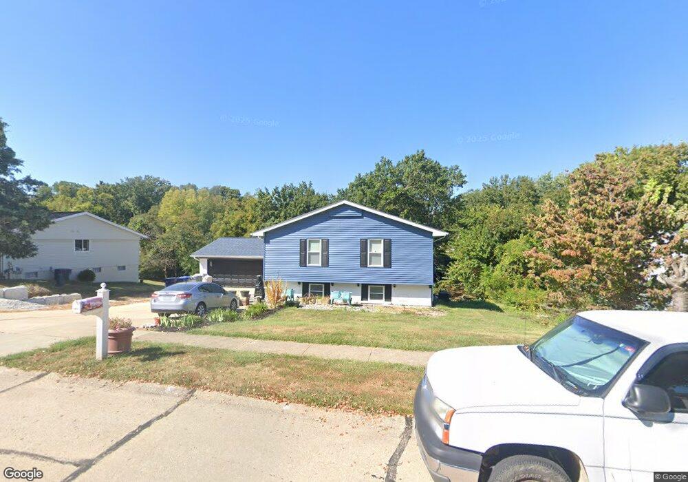
411 Westbrook Dr O Fallon, MO 63366
Estimated Value: $311,837 - $351,000
4
Beds
3
Baths
1,440
Sq Ft
$228/Sq Ft
Est. Value
About This Home
This home is located at 411 Westbrook Dr, O Fallon, MO 63366 and is currently estimated at $327,709, approximately $227 per square foot. 411 Westbrook Dr is a home located in St. Charles County with nearby schools including Joseph L. Mudd Elementary School, Forest Park Elementary School, and Fort Zumwalt North Middle School.
Ownership History
Date
Name
Owned For
Owner Type
Purchase Details
Closed on
Oct 21, 1997
Sold by
The Norman Family Living Trust
Bought by
Dotson Richard J and Dotson Ruth A
Current Estimated Value
Home Financials for this Owner
Home Financials are based on the most recent Mortgage that was taken out on this home.
Original Mortgage
$101,650
Outstanding Balance
$16,159
Interest Rate
7.33%
Estimated Equity
$311,550
Create a Home Valuation Report for This Property
The Home Valuation Report is an in-depth analysis detailing your home's value as well as a comparison with similar homes in the area
Home Values in the Area
Average Home Value in this Area
Purchase History
| Date | Buyer | Sale Price | Title Company |
|---|---|---|---|
| Dotson Richard J | $107,000 | -- |
Source: Public Records
Mortgage History
| Date | Status | Borrower | Loan Amount |
|---|---|---|---|
| Open | Dotson Richard J | $101,650 |
Source: Public Records
Tax History
| Year | Tax Paid | Tax Assessment Tax Assessment Total Assessment is a certain percentage of the fair market value that is determined by local assessors to be the total taxable value of land and additions on the property. | Land | Improvement |
|---|---|---|---|---|
| 2025 | $3,244 | $53,333 | -- | -- |
| 2023 | $3,245 | $48,923 | $0 | $0 |
| 2022 | $2,739 | $38,348 | $0 | $0 |
| 2021 | $2,741 | $38,348 | $0 | $0 |
| 2020 | $2,539 | $34,433 | $0 | $0 |
| 2019 | $2,545 | $34,433 | $0 | $0 |
| 2018 | $2,453 | $31,680 | $0 | $0 |
| 2017 | $2,417 | $31,680 | $0 | $0 |
| 2016 | $2,180 | $28,462 | $0 | $0 |
| 2015 | $2,027 | $28,462 | $0 | $0 |
| 2014 | $1,894 | $26,152 | $0 | $0 |
Source: Public Records
Map
Nearby Homes
- 0 Montbrook Dr
- 7 Autumn Valley Ct
- 302 Birmingham Dr
- 151 N Wellington St
- 24 Hawthorne Ct
- 849 Elaine Dr
- 11 Southern Hills Ct
- 10 Southern Hills Ct
- 6 Emerson Ct
- 319 Magnolia Valley Dr
- 710 Longfellow Cir
- 1117 Turtle Creek Dr
- 127 Columbia Meadows Ln
- 136 Columbia Meadows Ln
- 5 Challenger Ct
- 4 Challenger Ct
- 205 E Elm St
- 1 Grand Columbia @ Columbia Meadows
- 1 Columbia @ Columbia Meadows
- 1 Grand Columbia II @ Columbia Meadows
- 413 Westbrook Dr
- 397 Westbrook Dr
- 69 Dellbrook Ct
- 67 Dellbrook Ct
- 415 Westbrook Dr
- 393 Westbrook Dr
- 410 Westbrook Dr
- 396 Westbrook Dr
- 412 Westbrook Dr
- 71 Dellbrook Ct
- 392 Westbrook Dr
- 414 Westbrook Dr
- 389 Westbrook Dr
- 417 Westbrook Dr
- 65 Dellbrook Ct
- 63 Westbrook Dr
- 357 Westridge Dr
- 416 Westbrook Dr
- 353 Westridge Dr
- 73 Dellbrook Ct
Your Personal Tour Guide
Ask me questions while you tour the home.