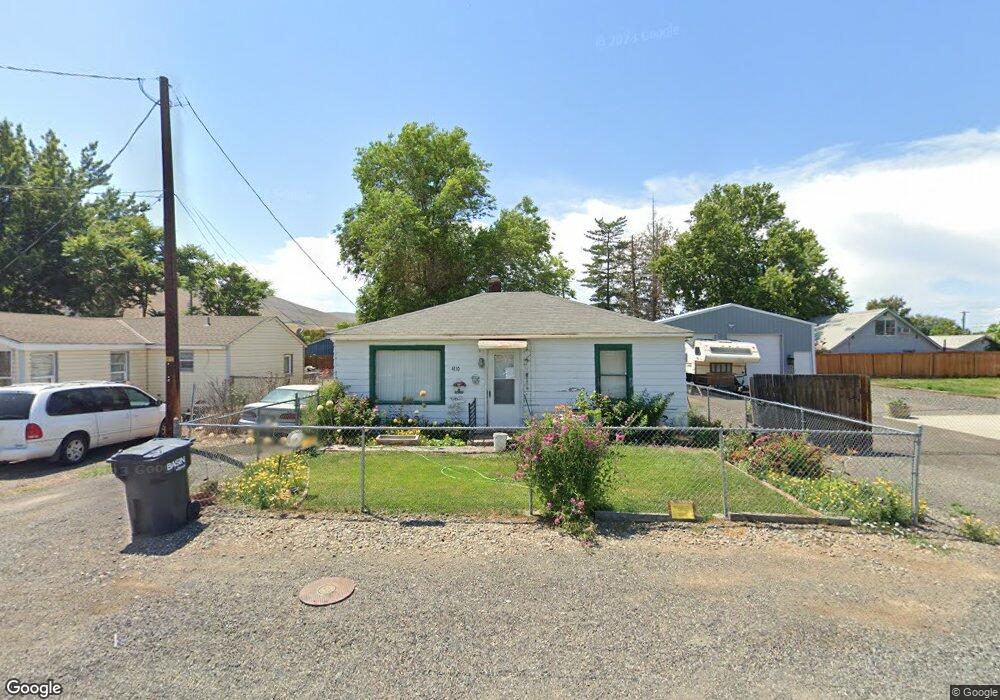
4110 2nd St Union Gap, WA 98903
Estimated Value: $173,000 - $250,000
2
Beds
1
Bath
880
Sq Ft
$233/Sq Ft
Est. Value
About This Home
This home is located at 4110 2nd St, Union Gap, WA 98903 and is currently estimated at $205,051, approximately $233 per square foot. 4110 2nd St is a home located in Yakima County with nearby schools including Union Gap School and La Salle High School.
Ownership History
Date
Name
Owned For
Owner Type
Purchase Details
Closed on
Nov 8, 2024
Sold by
Rogers Alice E
Bought by
Stewart Mikaela
Current Estimated Value
Home Financials for this Owner
Home Financials are based on the most recent Mortgage that was taken out on this home.
Original Mortgage
$180,000
Outstanding Balance
$178,195
Interest Rate
6.08%
Mortgage Type
New Conventional
Estimated Equity
$26,856
Purchase Details
Closed on
Nov 24, 1997
Sold by
Fulks Jerelyn K and Nelson Donna Mae
Bought by
Rogers Alice E
Home Financials for this Owner
Home Financials are based on the most recent Mortgage that was taken out on this home.
Original Mortgage
$16,000
Interest Rate
7.31%
Purchase Details
Closed on
Apr 7, 1997
Sold by
Mullins Bessie Ramona
Bought by
Mullins Gary Ray and Nelson Donna M
Create a Home Valuation Report for This Property
The Home Valuation Report is an in-depth analysis detailing your home's value as well as a comparison with similar homes in the area
Home Values in the Area
Average Home Value in this Area
Purchase History
| Date | Buyer | Sale Price | Title Company |
|---|---|---|---|
| Stewart Mikaela | $200,000 | Pacific Alliance Title | |
| Rogers Alice E | $56,000 | First American Title Ins Co | |
| Mullins Gary Ray | -- | Transnation Title Insurance |
Source: Public Records
Mortgage History
| Date | Status | Borrower | Loan Amount |
|---|---|---|---|
| Open | Stewart Mikaela | $180,000 | |
| Previous Owner | Rogers Alice E | $16,000 |
Source: Public Records
Tax History
| Year | Tax Paid | Tax Assessment Tax Assessment Total Assessment is a certain percentage of the fair market value that is determined by local assessors to be the total taxable value of land and additions on the property. | Land | Improvement |
|---|---|---|---|---|
| 2025 | $1,291 | $157,800 | $23,600 | $134,200 |
| 2023 | $30 | $109,400 | $23,800 | $85,600 |
| 2022 | $20 | $103,800 | $23,800 | $80,000 |
| 2021 | $20 | $90,100 | $23,800 | $66,300 |
| 2019 | $796 | $78,700 | $23,800 | $54,900 |
| 2018 | $22 | $71,200 | $23,800 | $47,400 |
| 2017 | $21 | $71,300 | $23,800 | $47,500 |
| 2016 | $10 | $70,500 | $23,800 | $46,700 |
| 2015 | $10 | $72,000 | $23,800 | $48,200 |
| 2014 | $10 | $72,000 | $23,800 | $48,200 |
| 2013 | $10 | $72,000 | $23,800 | $48,200 |
Source: Public Records
Map
Nearby Homes
- 4207 Main St
- 102 E California St Unit 6
- 3609 3rd St
- 408 W Pine St Unit 30
- 12 Leisure Hill Dr
- 13 Leisure Hill Dr Unit 6
- 61 Leisure Hill Dr
- 27 Leisure Hill Dr
- 403 W Ahtanum Rd
- 3431 Goodman Rd
- 2807 4th St
- NKA Ahtanum Ridge Dr Unit 5
- 0 Goodman Rd
- 2709 Riverside Rd
- 2007 Longfibre Rd
- 2802 S 5th Ave Unit 30
- 2802 S 5th Ave Unit 17
- 2802 S 5th Ave Unit 63
- 2802 S 5th Ave Unit 33
- 604 Hillside Dr
Your Personal Tour Guide
Ask me questions while you tour the home.