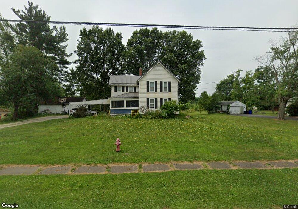
4110 Tallmadge Rd Rootstown, OH 44272
Estimated Value: $188,972 - $254,000
4
Beds
1
Bath
1,652
Sq Ft
$135/Sq Ft
Est. Value
About This Home
This home is located at 4110 Tallmadge Rd, Rootstown, OH 44272 and is currently estimated at $223,493, approximately $135 per square foot. 4110 Tallmadge Rd is a home located in Portage County with nearby schools including Rootstown Middle School - Schnee Building and Rootstown High School.
Ownership History
Date
Name
Owned For
Owner Type
Purchase Details
Closed on
Jul 18, 2005
Sold by
Kaltenbach Winifred L
Bought by
Day Andrew S and Shneider Deanna M
Current Estimated Value
Home Financials for this Owner
Home Financials are based on the most recent Mortgage that was taken out on this home.
Original Mortgage
$108,069
Outstanding Balance
$56,413
Interest Rate
5.66%
Mortgage Type
FHA
Estimated Equity
$167,080
Purchase Details
Closed on
Jan 1, 1990
Bought by
Kaltenbach Winifred L
Create a Home Valuation Report for This Property
The Home Valuation Report is an in-depth analysis detailing your home's value as well as a comparison with similar homes in the area
Home Values in the Area
Average Home Value in this Area
Purchase History
| Date | Buyer | Sale Price | Title Company |
|---|---|---|---|
| Day Andrew S | $109,800 | Portage Lawyers Title | |
| Kaltenbach Winifred L | -- | -- |
Source: Public Records
Mortgage History
| Date | Status | Borrower | Loan Amount |
|---|---|---|---|
| Open | Day Andrew S | $108,069 |
Source: Public Records
Tax History Compared to Growth
Tax History
| Year | Tax Paid | Tax Assessment Tax Assessment Total Assessment is a certain percentage of the fair market value that is determined by local assessors to be the total taxable value of land and additions on the property. | Land | Improvement |
|---|---|---|---|---|
| 2024 | $2,570 | $47,920 | $12,740 | $35,180 |
| 2023 | $2,294 | $39,450 | $11,200 | $28,250 |
| 2022 | $2,220 | $39,450 | $11,200 | $28,250 |
| 2021 | $1,996 | $39,450 | $11,200 | $28,250 |
| 2020 | $1,612 | $34,620 | $10,680 | $23,940 |
| 2019 | $2,116 | $34,620 | $10,680 | $23,940 |
| 2018 | $1,975 | $35,290 | $11,380 | $23,910 |
| 2017 | $1,871 | $35,290 | $11,380 | $23,910 |
| 2016 | $1,887 | $35,290 | $11,380 | $23,910 |
| 2015 | $1,716 | $35,290 | $11,380 | $23,910 |
| 2014 | $1,748 | $35,290 | $11,380 | $23,910 |
| 2013 | $1,736 | $35,290 | $11,380 | $23,910 |
Source: Public Records
Map
Nearby Homes
- 0 Rootstown Rd Unit 5173350
- 0 Lynn Rd Unit 5110102
- V/L 2 Lynn Rd
- V/L Lynn Rd
- 4326 Clover Dr
- 3987 J A Vaughn Ave
- 4691 Scenic Dr
- 0 New Milford Rd Unit 11489599
- 0 New Milford Rd Unit 5108183
- 4770 Valley Hills Dr
- sub lot Lane Ave
- 3401 Biltz Rd
- 3637 Old Forge Rd
- 3021 Hartville Rd
- 3136 Bird Dr
- 3807 Industry Rd
- 3914 Homestead Rd
- 5498 Edwards Rd
- 668 Westbrook Ct
- 5700 S Prospect St
- 4124 Tallmadge Rd
- 4098 Tallmadge Rd
- 4111 Tallmadge Rd
- 4105 Tallmadge Rd
- 4123 Tallmadge Rd
- 4099 Tallmadge Rd
- 4090 Tallmadge Rd
- 4136 Tallmadge Rd
- 4078 Tallmadge Rd
- 4091 Tallmadge Rd
- 4139 Tallmadge Rd
- 4129 Tallmadge Rd Unit B
- 4129 Tallmadge Rd
- 4141 Tallmadge Rd
- 4003 State Route 44
- 4155 Tallmadge Rd
- 4058 Wise Dr
- 4070 Wise Dr
- 4070 Wise Dr Unit 72
- 4061 Tallmadge Rd