Estimated Value: $538,991
3
Beds
2
Baths
1,736
Sq Ft
$310/Sq Ft
Est. Value
About This Home
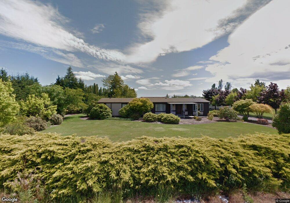
This home is located at 41108 NW Washington Ave, Banks, OR 97106 and is currently estimated at $538,991, approximately $310 per square foot. 41108 NW Washington Ave is a home located in Washington County with nearby schools including Banks Elementary School, Banks Middle School, and Banks High School.
Ownership History
Date
Name
Owned For
Owner Type
Purchase Details
Closed on
Sep 9, 2022
Sold by
Annatte Eaton Tami
Bought by
Eaton Todd Eugene
Current Estimated Value
Purchase Details
Closed on
Feb 16, 2016
Sold by
Carte Ronald and Tankersley Laurie
Bought by
Thompson Tami Annette
Home Financials for this Owner
Home Financials are based on the most recent Mortgage that was taken out on this home.
Original Mortgage
$269,950
Interest Rate
3.71%
Mortgage Type
New Conventional
Purchase Details
Closed on
Feb 23, 2010
Sold by
Trussell Evelyn and Trussell Evelyn F
Bought by
Carte Ronald and Tankersley Laurie
Create a Home Valuation Report for This Property
The Home Valuation Report is an in-depth analysis detailing your home's value as well as a comparison with similar homes in the area
Home Values in the Area
Average Home Value in this Area
Purchase History
| Date | Buyer | Sale Price | Title Company |
|---|---|---|---|
| Eaton Todd Eugene | -- | -- | |
| Thompson Tami Annette | $299,950 | First American | |
| Carte Ronald | -- | None Available |
Source: Public Records
Mortgage History
| Date | Status | Borrower | Loan Amount |
|---|---|---|---|
| Previous Owner | Thompson Tami Annette | $269,950 |
Source: Public Records
Tax History Compared to Growth
Tax History
| Year | Tax Paid | Tax Assessment Tax Assessment Total Assessment is a certain percentage of the fair market value that is determined by local assessors to be the total taxable value of land and additions on the property. | Land | Improvement |
|---|---|---|---|---|
| 2025 | $3,241 | $230,990 | -- | -- |
| 2024 | $2,884 | $224,270 | -- | -- |
| 2023 | $2,884 | $217,740 | $0 | $0 |
| 2022 | $2,810 | $217,740 | $0 | $0 |
| 2021 | $2,736 | $205,250 | $0 | $0 |
| 2020 | $2,655 | $199,280 | $0 | $0 |
| 2019 | $2,539 | $193,480 | $0 | $0 |
| 2018 | $2,473 | $187,850 | $0 | $0 |
| 2017 | $2,357 | $182,380 | $0 | $0 |
| 2016 | $2,331 | $177,070 | $0 | $0 |
Source: Public Records
Map
Nearby Homes
- 41637 NW Buckshire St
- 41710 NW Oak Way
- 41753 NW Buckshire St
- 12734 NW Hammond Place
- 42015 NW Buckshire St
- 42002 NW Elmhurst Ct
- 42098 NW Broadshire Ln
- 42371 NW Banks Rd
- 0 NW Lodge Rd
- 48025 NW Strohmayer Rd
- 45868 NW Hillside Rd
- 46345 NW Strohmayer Rd
- 0 NW Green Mountain Rd Unit 1 23320324
- 0 NW Green Mountain Rd Unit 24253646
- 18282 NW Hilltop Place
- 11911 NW Seavey Rd
- 40748 NW Verboort Rd
- 11289 NW 325th Ave
- 17034 NW Corey Rd
- 36303 NW 3 Cedars Ln
- 40960 NW Washington Ave
- 41262 NW Washington Ave
- 40995 NW Washington Ave
- 41060 NW Pacific Ave
- 41010 NW Pacific Ave
- 12379 NW Ashton Dr Unit HS262
- 12377 NW Ashton Dr Unit HS263
- 40800 NW Washington Ave
- 12386 NW Ashton Dr Unit HS261
- 12373 NW Ashton Dr
- 12388 NW Ashton Dr
- 41101 NW Wilkesboro Rd
- 12367 NW Ashton Dr Unit HS265
- 12390 NW Ashton Dr Unit HS259
- 12478 NW Ashton Dr
- 12363 NW Ashton Dr Unit HS266
- 12480 NW Ashton Dr
- 12355 NW Ashton Dr Unit HS267
- 41065 NW Wilkesboro Rd
- 12484 NW Ashton Dr