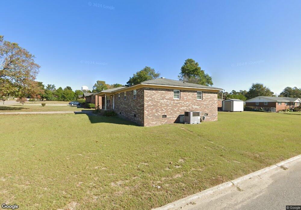
4112 Michael Place Hephzibah, GA 30815
Jamestown NeighborhoodEstimated Value: $172,697 - $205,000
3
Beds
2
Baths
1,584
Sq Ft
$122/Sq Ft
Est. Value
About This Home
This home is located at 4112 Michael Place, Hephzibah, GA 30815 and is currently estimated at $193,174, approximately $121 per square foot. 4112 Michael Place is a home located in Richmond County with nearby schools including Diamond Lakes Elementary School, Pine Hill Middle School, and Johnson Magnet.
Ownership History
Date
Name
Owned For
Owner Type
Purchase Details
Closed on
Mar 4, 2005
Sold by
Holmes Anthony A
Bought by
Holmes Pamela C
Current Estimated Value
Home Financials for this Owner
Home Financials are based on the most recent Mortgage that was taken out on this home.
Original Mortgage
$92,839
Interest Rate
5.79%
Mortgage Type
FHA
Purchase Details
Closed on
Apr 4, 2002
Sold by
Thomas Elnora J
Bought by
Holmes Anthony A
Home Financials for this Owner
Home Financials are based on the most recent Mortgage that was taken out on this home.
Original Mortgage
$70,550
Interest Rate
6.8%
Purchase Details
Closed on
Sep 14, 1989
Sold by
Ncnb National Bank Of North Carolina N
Bought by
Thomas George J
Create a Home Valuation Report for This Property
The Home Valuation Report is an in-depth analysis detailing your home's value as well as a comparison with similar homes in the area
Home Values in the Area
Average Home Value in this Area
Purchase History
| Date | Buyer | Sale Price | Title Company |
|---|---|---|---|
| Holmes Pamela C | -- | -- | |
| Holmes Anthony A | $83,000 | -- | |
| Thomas George J | -- | -- |
Source: Public Records
Mortgage History
| Date | Status | Borrower | Loan Amount |
|---|---|---|---|
| Previous Owner | Holmes Pamela C | $92,839 | |
| Previous Owner | Holmes Anthony A | $70,550 | |
| Closed | Holmes Anthony A | $12,450 |
Source: Public Records
Tax History Compared to Growth
Tax History
| Year | Tax Paid | Tax Assessment Tax Assessment Total Assessment is a certain percentage of the fair market value that is determined by local assessors to be the total taxable value of land and additions on the property. | Land | Improvement |
|---|---|---|---|---|
| 2025 | $1,030 | $73,832 | $4,480 | $69,352 |
| 2024 | $1,030 | $60,416 | $4,480 | $55,936 |
| 2023 | $870 | $59,832 | $4,480 | $55,352 |
| 2022 | $881 | $51,921 | $4,480 | $47,441 |
| 2021 | $765 | $36,827 | $4,467 | $32,360 |
| 2020 | $769 | $36,827 | $4,467 | $32,360 |
| 2019 | $795 | $36,827 | $4,467 | $32,360 |
| 2018 | $798 | $36,827 | $4,467 | $32,360 |
| 2017 | $805 | $36,827 | $4,467 | $32,360 |
| 2016 | $805 | $36,826 | $4,467 | $32,360 |
| 2015 | $805 | $36,826 | $4,467 | $32,360 |
| 2014 | $805 | $36,826 | $4,467 | $32,360 |
Source: Public Records
Map
Nearby Homes
- 4124 Country Ln
- 3366 Stockport Dr
- 2675 Ashton Dr
- 3371 Stockport Dr
- 3359 Stockport Dr
- 3351 Stockport Dr
- 3363 Stockport Dr
- 3367 Stockport Dr
- 3422 Firestone Dr
- 3434 Firestone Dr Unit 151
- 3424 Firestone Dr
- 3424 Firestone Dr Unit 155
- 3434 Firestone Dr
- 3422 Firestone Dr Unit 156
- Maywood 3 Plan at Laurel Park Townhomes
- 3440 Firestone Dr
- 3440 Firestone Dr Unit 148
- Stratford Plan at Laurel Park Townhomes
- 3428 Firestone Dr Unit 153
- Sudbury Plan at Laurel Park Townhomes
- 4110 Michael Place
- 4114 Michael Place
- 2513 Anthony Dejuan Pkwy
- 4109 Michael Place
- 4116 Michael Place
- 2514 Anthony Dejuan Pkwy
- 2511 Anthony Dejuan Pkwy
- 4107 Michael Place
- 4117 N Allendale Ct
- 4111 Michael Place
- 4106 Michael Place
- 4105 Michael Place
- 2512 Anthony Dejuan Pkwy
- 4118 Michael Place
- 4115 N Allendale Ct
- 4103 Michael Place
- 4178 Kevin Rd
- 4115 Michael Place
- 4176 Kevin Rd