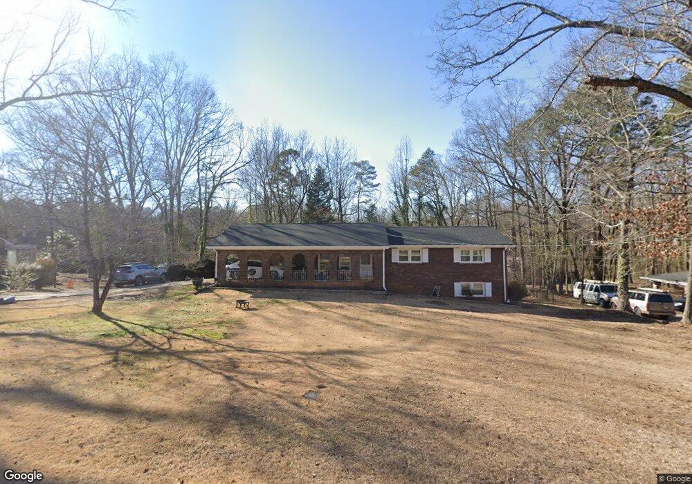
4112 Wells Cir Unit 2 Douglasville, GA 30135
Bill Arp NeighborhoodEstimated Value: $238,810 - $262,000
3
Beds
2
Baths
1,420
Sq Ft
$175/Sq Ft
Est. Value
About This Home
This home is located at 4112 Wells Cir Unit 2, Douglasville, GA 30135 and is currently estimated at $248,953, approximately $175 per square foot. 4112 Wells Cir Unit 2 is a home located in Douglas County with nearby schools including Bill Arp Elementary School, Yeager Middle School, and Alexander High School.
Ownership History
Date
Name
Owned For
Owner Type
Purchase Details
Closed on
Oct 16, 2018
Sold by
Willis Anita A
Bought by
Willis Rodney
Current Estimated Value
Purchase Details
Closed on
Dec 12, 2003
Sold by
Kelley Glenn F
Bought by
Willis Rodney
Home Financials for this Owner
Home Financials are based on the most recent Mortgage that was taken out on this home.
Original Mortgage
$100,000
Interest Rate
5.87%
Mortgage Type
New Conventional
Create a Home Valuation Report for This Property
The Home Valuation Report is an in-depth analysis detailing your home's value as well as a comparison with similar homes in the area
Home Values in the Area
Average Home Value in this Area
Purchase History
| Date | Buyer | Sale Price | Title Company |
|---|---|---|---|
| Willis Rodney | -- | -- | |
| Willis Rodney | $125,000 | -- |
Source: Public Records
Mortgage History
| Date | Status | Borrower | Loan Amount |
|---|---|---|---|
| Previous Owner | Willis Rodney | $100,000 |
Source: Public Records
Tax History Compared to Growth
Tax History
| Year | Tax Paid | Tax Assessment Tax Assessment Total Assessment is a certain percentage of the fair market value that is determined by local assessors to be the total taxable value of land and additions on the property. | Land | Improvement |
|---|---|---|---|---|
| 2024 | $2,410 | $76,600 | $17,480 | $59,120 |
| 2023 | $2,410 | $76,600 | $17,480 | $59,120 |
| 2022 | $1,723 | $62,240 | $10,360 | $51,880 |
| 2021 | $1,541 | $47,240 | $9,640 | $37,600 |
| 2020 | $1,567 | $47,240 | $9,640 | $37,600 |
| 2019 | $1,434 | $46,320 | $9,640 | $36,680 |
| 2018 | $1,645 | $52,880 | $11,400 | $41,480 |
| 2017 | $1,412 | $44,520 | $10,560 | $33,960 |
| 2016 | $1,155 | $35,800 | $8,800 | $27,000 |
| 2015 | $1,061 | $31,320 | $7,880 | $23,440 |
| 2014 | $1,061 | $31,560 | $8,440 | $23,120 |
| 2013 | -- | $31,520 | $8,440 | $23,080 |
Source: Public Records
Map
Nearby Homes
- 4153 Wells Cir
- 6464 Westerly Way
- 4045 Westview St
- 6407 Shore Dr
- 3964 Wedgewood Dr
- 3980 Highway 5
- 6225 Pebble Dr
- 4766 Mockingbird Ln
- 6226 Lullwater Dr
- 6394 Shore Dr
- 3948 Bright Star Rd
- 3976 Bright Star Rd
- 6201 Hillpine Dr
- 3850 Bright Star Rd
- 20 Roper Dr
- 4016 Nations Dr
- 3950 Sherwood Dr
- 6119 Lullwater Dr
- 4100 Wells Cir
- 4100 Wells Cir Unit 2
- 4124 Wells Cir
- 4113 Westview St
- 4125 Westview St
- 4111 Wells Cir Unit 2
- 4101 Westview St
- 4125 Wells Cir Unit 2
- 4099 Wells Cir
- 4140 Wells Cir Unit 2
- 4086 Wells Cir
- 4139 Westview St
- 4139 Wells Cir Unit 2
- 4085 Wells Cir Unit 2
- 4114 Westview St
- 4126 Westview St
- 4126 Westview St Unit 1
- 4102 Westview St
- 4154 Wells Cir
- 4153 Westview St