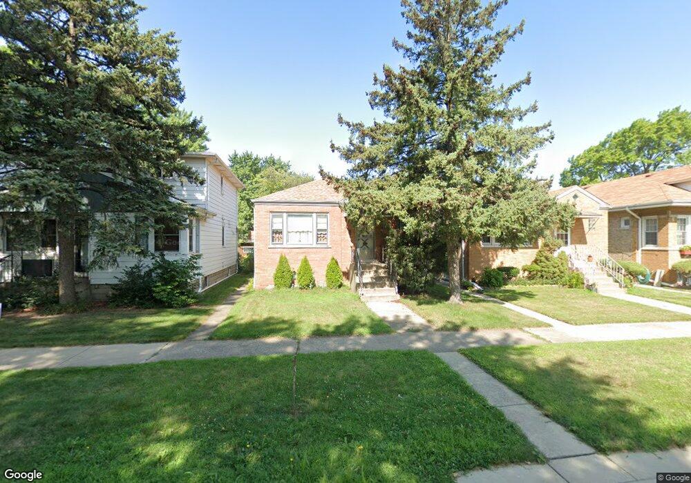
4112 Wenonah Ave Berwyn, IL 60402
Estimated Value: $244,000 - $291,000
2
Beds
1
Bath
944
Sq Ft
$289/Sq Ft
Est. Value
About This Home
This home is located at 4112 Wenonah Ave, Berwyn, IL 60402 and is currently estimated at $273,043, approximately $289 per square foot. 4112 Wenonah Ave is a home located in Cook County with nearby schools including Home Elementary School, George Washington Middle School, and J. Sterling Morton High School West.
Ownership History
Date
Name
Owned For
Owner Type
Purchase Details
Closed on
May 19, 2014
Sold by
Nolimal Donald
Bought by
Sosa Lupe B
Current Estimated Value
Home Financials for this Owner
Home Financials are based on the most recent Mortgage that was taken out on this home.
Original Mortgage
$110,953
Outstanding Balance
$83,561
Interest Rate
4.25%
Mortgage Type
FHA
Estimated Equity
$189,482
Purchase Details
Closed on
Jun 2, 1998
Sold by
Nolimal Catherine
Bought by
Catherine Nolimal Revocable Trust
Create a Home Valuation Report for This Property
The Home Valuation Report is an in-depth analysis detailing your home's value as well as a comparison with similar homes in the area
Home Values in the Area
Average Home Value in this Area
Purchase History
| Date | Buyer | Sale Price | Title Company |
|---|---|---|---|
| Sosa Lupe B | $113,000 | Premier Title | |
| Catherine Nolimal Revocable Trust | -- | -- |
Source: Public Records
Mortgage History
| Date | Status | Borrower | Loan Amount |
|---|---|---|---|
| Open | Sosa Lupe B | $110,953 |
Source: Public Records
Tax History
| Year | Tax Paid | Tax Assessment Tax Assessment Total Assessment is a certain percentage of the fair market value that is determined by local assessors to be the total taxable value of land and additions on the property. | Land | Improvement |
|---|---|---|---|---|
| 2025 | $4,345 | $19,000 | $3,891 | $15,109 |
| 2024 | $4,345 | $19,000 | $3,891 | $15,109 |
| 2023 | $4,406 | $19,000 | $3,891 | $15,109 |
| 2022 | $4,406 | $17,258 | $3,350 | $13,908 |
| 2021 | $1,310 | $17,257 | $3,350 | $13,907 |
| 2020 | $1,199 | $17,257 | $3,350 | $13,907 |
| 2019 | $1,503 | $14,740 | $3,026 | $11,714 |
| 2018 | $1,470 | $14,740 | $3,026 | $11,714 |
| 2017 | $1,404 | $14,740 | $3,026 | $11,714 |
| 2016 | $2,541 | $12,143 | $2,485 | $9,658 |
| 2015 | $3,249 | $12,143 | $2,485 | $9,658 |
| 2014 | $5,014 | $12,143 | $2,485 | $9,658 |
| 2013 | $6,109 | $16,003 | $2,485 | $13,518 |
Source: Public Records
Map
Nearby Homes
- 4122 Wenonah Ave
- 4109 Wenonah Ave
- 4103 Wisconsin Ave
- 4105 Maple Ave
- 7120 41st St
- 4115 S Harlem Ave Unit GE
- 4215 S Harlem Ave Unit 3
- 4215 S Harlem Ave Unit 8
- 4312 Wenonah Ave
- 4235 S Harlem Ave
- 4327 Wenonah Ave
- 4024 Grove Ave
- 4239 Grove Ave
- 7032 Pershing Rd
- 3829 Wisconsin Ave
- 4309 S Harlem Ave Unit 6
- 7316 40th St Unit 2E
- 7316 40th St Unit P-9
- 7316 40th St Unit P-10
- 7316 40th St Unit P-13
- 4108 Wenonah Ave
- 4114 Wenonah Ave
- 4104 Wenonah Ave
- 4116 Wenonah Ave
- 4118 Wenonah Ave
- 4100 Wenonah Ave
- 4120 Wenonah Ave
- 4111 Wisconsin Ave
- 4115 Wisconsin Ave
- 4107 Wisconsin Ave
- 4117 Wisconsin Ave
- 4105 Wisconsin Ave
- 4119 Wisconsin Ave
- 4101 Wisconsin Ave
- 4123 Wisconsin Ave
- 4107 Wenonah Ave
- 4124 Wenonah Ave
- 4111 Wenonah Ave
- 4105 Wenonah Ave
- 4115 Wenonah Ave
Your Personal Tour Guide
Ask me questions while you tour the home.