Estimated Value: $155,117 - $196,000
3
Beds
1
Bath
1,225
Sq Ft
$149/Sq Ft
Est. Value
About This Home
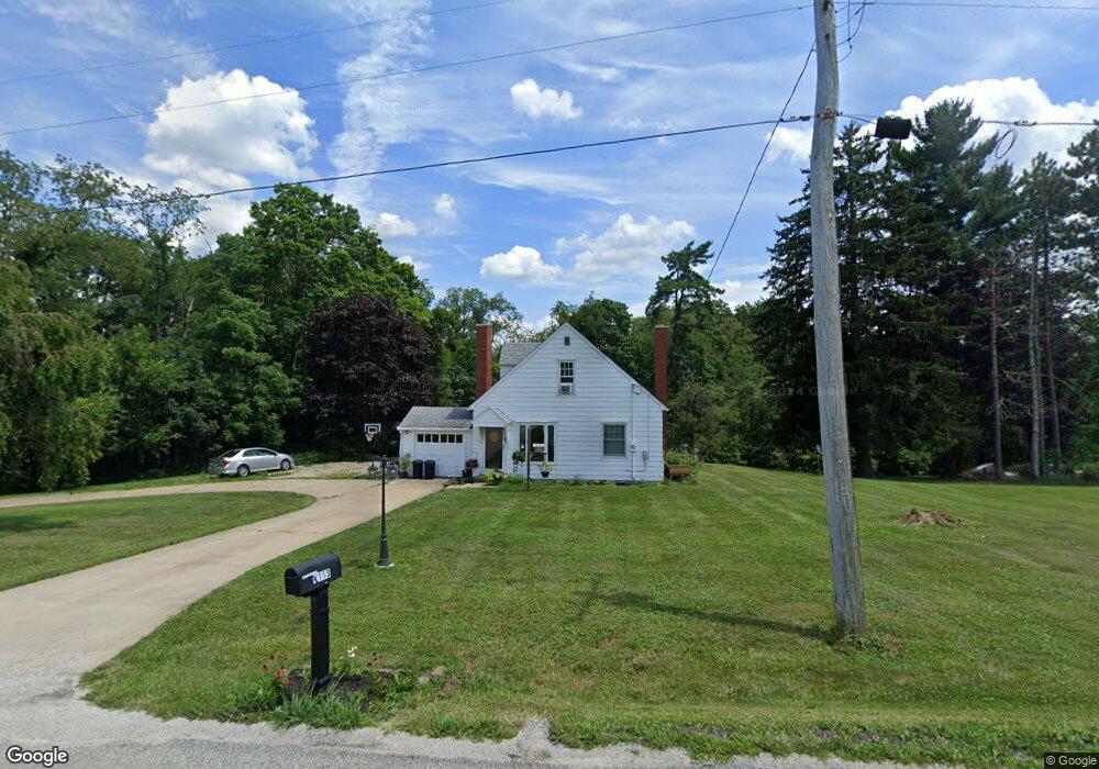
This home is located at 4113 Mount Zion Rd, Lucas, OH 44843 and is currently estimated at $182,279, approximately $148 per square foot. 4113 Mount Zion Rd is a home located in Richland County with nearby schools including Lucas Elementary School, Lucas Heritage Middle School, and Lucas High School.
Ownership History
Date
Name
Owned For
Owner Type
Purchase Details
Closed on
Aug 17, 2015
Sold by
Ashcraft Larraine A
Bought by
Swainhart Nicholas C
Current Estimated Value
Home Financials for this Owner
Home Financials are based on the most recent Mortgage that was taken out on this home.
Original Mortgage
$72,168
Outstanding Balance
$56,449
Interest Rate
3.87%
Mortgage Type
FHA
Estimated Equity
$125,830
Create a Home Valuation Report for This Property
The Home Valuation Report is an in-depth analysis detailing your home's value as well as a comparison with similar homes in the area
Home Values in the Area
Average Home Value in this Area
Purchase History
| Date | Buyer | Sale Price | Title Company |
|---|---|---|---|
| Swainhart Nicholas C | $73,500 | Chicago Title |
Source: Public Records
Mortgage History
| Date | Status | Borrower | Loan Amount |
|---|---|---|---|
| Open | Swainhart Nicholas C | $72,168 |
Source: Public Records
Tax History Compared to Growth
Tax History
| Year | Tax Paid | Tax Assessment Tax Assessment Total Assessment is a certain percentage of the fair market value that is determined by local assessors to be the total taxable value of land and additions on the property. | Land | Improvement |
|---|---|---|---|---|
| 2024 | $699 | $32,560 | $8,690 | $23,870 |
| 2023 | $1,365 | $32,560 | $8,690 | $23,870 |
| 2022 | $1,186 | $25,260 | $7,760 | $17,500 |
| 2021 | $1,188 | $25,260 | $7,760 | $17,500 |
| 2020 | $1,208 | $25,260 | $7,760 | $17,500 |
| 2019 | $1,092 | $21,470 | $6,580 | $14,890 |
| 2018 | $1,124 | $21,470 | $6,580 | $14,890 |
| 2017 | $1,131 | $21,470 | $6,580 | $14,890 |
| 2016 | $1,179 | $22,620 | $5,920 | $16,700 |
| 2015 | $1,179 | $22,620 | $5,920 | $16,700 |
| 2014 | $726 | $22,620 | $5,920 | $16,700 |
| 2012 | $358 | $22,620 | $5,920 | $16,700 |
Source: Public Records
Map
Nearby Homes
- 0 Mount Zion Rd Unit 9069748
- 0 Applegate Rd
- 2428 Applegate Rd
- 0 Moffett Rd
- 174 W Main St
- 0 Peterson Rd
- 2750 Lutz Ave
- 1048 Township Road 2156
- 2905 Tucker Rd
- 3261 Moffett Rd
- 1679 Pulver Rd
- 3386 Trumpower Rd
- 68.40 Acres Trumpower Rd
- 0 Trumpower Rd
- 19 Maine St
- 968 Township Road 2506
- 1183 County Road 30a
- 0 McBride Road Parcel # 1 Unit 9066028
- 775 Touby Ln
- 0 Township Road 925
- 4137 Mount Zion Rd
- 4161 Mount Zion Rd
- 4183 Mount Zion Rd
- 4201 Mount Zion Rd
- 3701 Kling Rd
- 3701 Kling Rd
- 3996 Mount Zion Rd
- 4214 Mount Zion Rd
- 1642 State Route 603
- 3751 Kling Rd
- 4261 Mount Zion Rd
- 3571 Kling Rd
- 1600 State Route 603
- 1600 State Route 603
- 1580 State Route 603
- 4265 Mount Zion Rd
- 1610 Harlan Rd
- 1692 State Route 603
- 1692 Ohio 603
- 1694 State Route 603