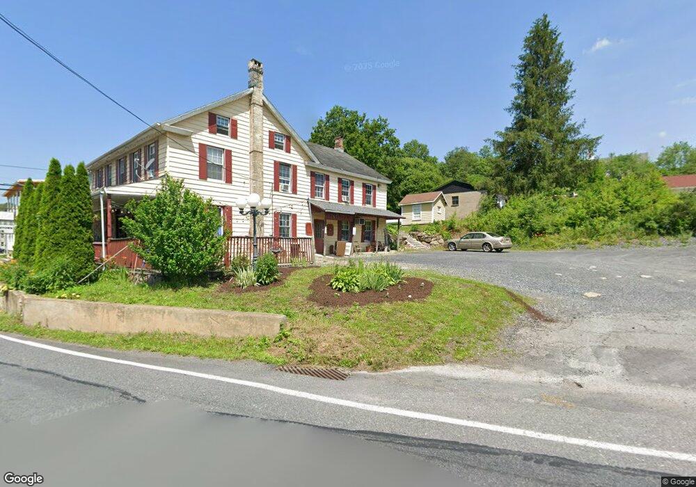
4113 Rr 4 Kunkletown, PA 18058
Estimated Value: $229,000 - $306,000
3
Beds
2
Baths
864
Sq Ft
$304/Sq Ft
Est. Value
About This Home
This home is located at 4113 Rr 4, Kunkletown, PA 18058 and is currently estimated at $262,765, approximately $304 per square foot. 4113 Rr 4 is a home located in Monroe County with nearby schools including Pleasant Valley Intermediate School, Pleasant Valley Elementary School, and Pleasant Valley Middle School.
Ownership History
Date
Name
Owned For
Owner Type
Purchase Details
Closed on
Jan 9, 2024
Sold by
Crane Stephen D and Crane Francesca J
Bought by
Jacke Bethany Crane and Crookes Jacke Steven
Current Estimated Value
Purchase Details
Closed on
Dec 10, 2009
Sold by
Noltemy Richard J and Noltemy Jennifer
Bought by
Crane Stephen D and Crane Francesca J
Home Financials for this Owner
Home Financials are based on the most recent Mortgage that was taken out on this home.
Original Mortgage
$132,000
Interest Rate
5.02%
Mortgage Type
New Conventional
Create a Home Valuation Report for This Property
The Home Valuation Report is an in-depth analysis detailing your home's value as well as a comparison with similar homes in the area
Home Values in the Area
Average Home Value in this Area
Purchase History
| Date | Buyer | Sale Price | Title Company |
|---|---|---|---|
| Jacke Bethany Crane | $125,000 | Monroe Abstract | |
| Jacke Bethany Crane | $125,000 | Monroe Abstract | |
| Crane Stephen D | $165,000 | None Available |
Source: Public Records
Mortgage History
| Date | Status | Borrower | Loan Amount |
|---|---|---|---|
| Previous Owner | Crane Stephen D | $132,000 |
Source: Public Records
Tax History Compared to Growth
Tax History
| Year | Tax Paid | Tax Assessment Tax Assessment Total Assessment is a certain percentage of the fair market value that is determined by local assessors to be the total taxable value of land and additions on the property. | Land | Improvement |
|---|---|---|---|---|
| 2025 | $701 | $108,450 | $20,800 | $87,650 |
| 2024 | $499 | $108,450 | $20,800 | $87,650 |
| 2023 | $2,934 | $103,010 | $15,360 | $87,650 |
| 2022 | $2,849 | $103,010 | $15,360 | $87,650 |
| 2021 | $2,784 | $103,010 | $15,360 | $87,650 |
| 2020 | $2,849 | $103,010 | $15,360 | $87,650 |
| 2019 | $2,314 | $13,200 | $880 | $12,320 |
| 2018 | $2,288 | $13,200 | $880 | $12,320 |
| 2017 | $2,288 | $13,200 | $880 | $12,320 |
| 2016 | $337 | $13,200 | $880 | $12,320 |
| 2015 | -- | $13,200 | $880 | $12,320 |
| 2014 | -- | $13,200 | $880 | $12,320 |
Source: Public Records
Map
Nearby Homes
- Lot 38 Woodview Hills
- 295 Railbed Trail
- 1182 Quail Rd
- 142 Pine Grove Rd
- 5990 Little Gap Rd
- 5138 Walnut St
- 2650 57 Rd
- 120 Upper Greenhill Rd
- CO Line Forest Dr
- Lot 32 Greenview Ct
- 150 Red Oak Dr
- 969 Hideaway Hill Rd
- 584 Pheasant Rd
- 209 Floyd Dr
- 311 Stacia Way
- 60 Ginkgo Rd
- 0 Sr 209 Unit PM-130225
- 131 Martindale Ct
- 4400 Little Gap Rd
- 160 Grassy Rd