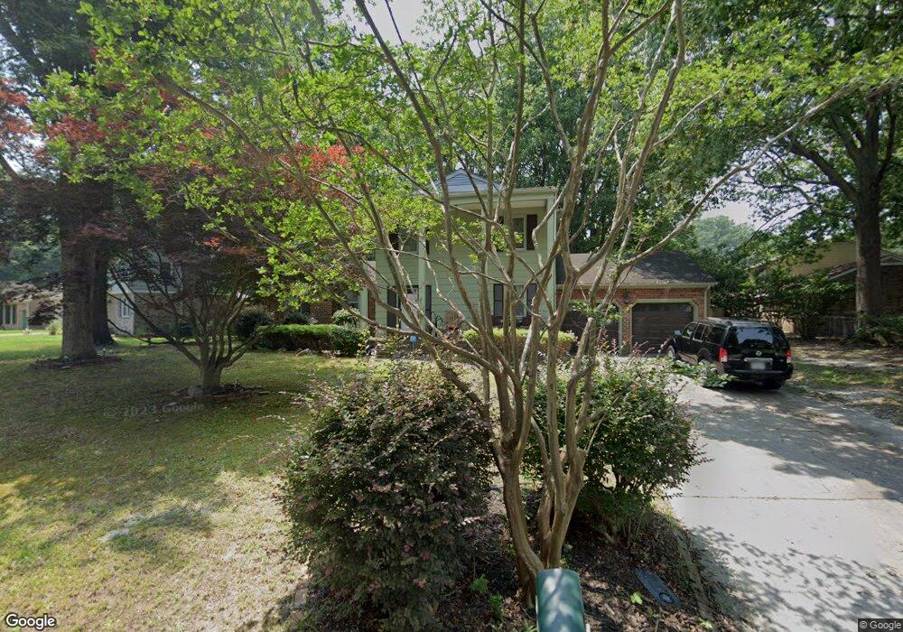
4114 Tarnywood Dr Portsmouth, VA 23703
Churchland NeighborhoodEstimated Value: $383,000 - $457,000
4
Beds
3
Baths
2,515
Sq Ft
$165/Sq Ft
Est. Value
About This Home
This home is located at 4114 Tarnywood Dr, Portsmouth, VA 23703 and is currently estimated at $413,973, approximately $164 per square foot. 4114 Tarnywood Dr is a home located in Portsmouth City with nearby schools including Churchland Primary/Intermediate School, Churchland Middle School, and Churchland High School.
Ownership History
Date
Name
Owned For
Owner Type
Purchase Details
Closed on
Jan 31, 2024
Sold by
Nelson Latoya Rogers and Nelson James Latoya
Bought by
Kimball Alex and Kimball Hillary
Current Estimated Value
Home Financials for this Owner
Home Financials are based on the most recent Mortgage that was taken out on this home.
Original Mortgage
$322,296
Outstanding Balance
$316,295
Interest Rate
6.62%
Mortgage Type
VA
Estimated Equity
$97,678
Purchase Details
Closed on
Nov 28, 2017
Sold by
Hinson Walter L
Bought by
Nelson Latoya Rogers
Home Financials for this Owner
Home Financials are based on the most recent Mortgage that was taken out on this home.
Original Mortgage
$196,278
Interest Rate
3.88%
Mortgage Type
FHA
Create a Home Valuation Report for This Property
The Home Valuation Report is an in-depth analysis detailing your home's value as well as a comparison with similar homes in the area
Home Values in the Area
Average Home Value in this Area
Purchase History
| Date | Buyer | Sale Price | Title Company |
|---|---|---|---|
| Kimball Alex | $312,000 | Old Republic National Title | |
| Nelson Latoya Rogers | $199,900 | Va Home Title & Settlements |
Source: Public Records
Mortgage History
| Date | Status | Borrower | Loan Amount |
|---|---|---|---|
| Open | Kimball Alex | $322,296 | |
| Previous Owner | Nelson Latoya Rogers | $196,278 |
Source: Public Records
Tax History Compared to Growth
Tax History
| Year | Tax Paid | Tax Assessment Tax Assessment Total Assessment is a certain percentage of the fair market value that is determined by local assessors to be the total taxable value of land and additions on the property. | Land | Improvement |
|---|---|---|---|---|
| 2025 | $4,511 | $362,580 | $85,500 | $277,080 |
| 2024 | $4,511 | $352,840 | $85,500 | $267,340 |
| 2023 | $4,118 | $329,440 | $85,500 | $243,940 |
| 2022 | $3,768 | $289,850 | $71,250 | $218,600 |
| 2021 | $3,462 | $266,310 | $57,460 | $208,850 |
| 2020 | $3,376 | $259,680 | $54,720 | $204,960 |
| 2019 | $3,249 | $249,930 | $54,720 | $195,210 |
| 2018 | $3,249 | $249,930 | $54,720 | $195,210 |
| 2017 | $3,249 | $249,930 | $54,720 | $195,210 |
| 2016 | $3,249 | $249,930 | $54,720 | $195,210 |
| 2015 | $3,249 | $249,930 | $54,720 | $195,210 |
| 2014 | $3,174 | $249,930 | $54,720 | $195,210 |
Source: Public Records
Map
Nearby Homes
- 5807 Dunkin St
- 3433 Willow Breeze Dr
- 4200 Quince Rd
- 4008 Oakhurst Rd
- 4100 Mayfair Way
- 4224 Burnham Dr
- 5806 Fawkes St
- 4232 Summerset Dr
- 3604 Lilac Dr
- 3616 Bowden St
- 5300 Larkspur Rd
- 3860 Sugar Creek Cir
- 5833 Hawthorne Ln
- 3866 Augustine Cir
- 5728 Hawthorne Ln
- 6015 Arthur Ave
- 5911 Dunkirk St
- 10AC Cedar Ln
- 3660B Towne Point Rd Unit A
- 8 Compass Ct
- 4112 Tarnywood Dr
- 4103 Queenswood Dr
- 4101 Queenswood Dr
- 4110 Tarnywood Dr
- 4113 Tarnywood Dr
- 4115 Tarnywood Dr
- 4119 Tarnywood Dr
- 4111 Tarnywood Dr
- 4117 Tarnywood Dr
- 4111 Timberland Dr
- 4121 Tarnywood Dr
- 4108 Tarnywood Dr
- 4109 Tarnywood Dr
- 4110 Forresthills Dr
- 4112 Forresthills Dr
- 4109 Timberland Dr
- 4114 Forresthills Dr
- 4108 Forresthills Dr
- 4106 Tarnywood Dr
- 4207 Burrland Rd