Estimated Value: $773,000 - $856,649
4
Beds
2
Baths
1,974
Sq Ft
$406/Sq Ft
Est. Value
About This Home
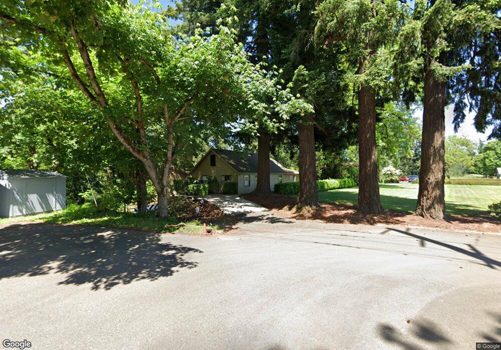
This home is located at 4116 N Locust St, Canby, OR 97013 and is currently estimated at $801,662, approximately $406 per square foot. 4116 N Locust St is a home located in Clackamas County with nearby schools including Howard Eccles Elementary School, Baker Prairie Middle School, and Canby High School.
Ownership History
Date
Name
Owned For
Owner Type
Purchase Details
Closed on
Jan 29, 2025
Sold by
Goodrich James Tait
Bought by
Rentenaar Jan Goodrich
Current Estimated Value
Purchase Details
Closed on
Sep 2, 2021
Sold by
Koepplin Carol and Koepplin Gail Josselyn
Bought by
Koepplin Carol
Purchase Details
Closed on
Feb 9, 2010
Sold by
Koepplin Carol G
Bought by
Koepplin Carol G and Koepplin Trust
Purchase Details
Closed on
Feb 10, 2006
Sold by
Rentenaar Jan
Bought by
Goodrich James and Goodrich Kristine
Purchase Details
Closed on
Feb 20, 2002
Sold by
Goodrich Kristine
Bought by
Goodrich James and Kiepplin Carol
Create a Home Valuation Report for This Property
The Home Valuation Report is an in-depth analysis detailing your home's value as well as a comparison with similar homes in the area
Home Values in the Area
Average Home Value in this Area
Purchase History
| Date | Buyer | Sale Price | Title Company |
|---|---|---|---|
| Rentenaar Jan Goodrich | -- | None Listed On Document | |
| Koepplin Carol | -- | None Available | |
| Koepplin Carol G | -- | None Available | |
| Goodrich James | -- | Chicago Title Insurance Co | |
| Goodrich James | -- | -- |
Source: Public Records
Tax History Compared to Growth
Tax History
| Year | Tax Paid | Tax Assessment Tax Assessment Total Assessment is a certain percentage of the fair market value that is determined by local assessors to be the total taxable value of land and additions on the property. | Land | Improvement |
|---|---|---|---|---|
| 2025 | $7,415 | $518,179 | -- | -- |
| 2024 | $7,209 | $503,087 | -- | -- |
| 2023 | $7,209 | $488,434 | $0 | $0 |
| 2022 | $6,592 | $474,208 | $0 | $0 |
| 2021 | $6,335 | $460,397 | $0 | $0 |
| 2020 | $6,239 | $446,988 | $0 | $0 |
| 2019 | $5,913 | $433,969 | $0 | $0 |
| 2018 | $5,792 | $421,329 | $0 | $0 |
| 2017 | $5,650 | $409,057 | $0 | $0 |
| 2016 | $5,456 | $397,143 | $0 | $0 |
| 2015 | $5,261 | $385,576 | $0 | $0 |
| 2014 | $5,110 | $374,346 | $0 | $0 |
Source: Public Records
Map
Nearby Homes
- 29951 SW Old Well Rd
- 476 SW Hebb Park Rd
- 29435 SW Mountain Rd Unit 2
- 29435 SW Mountain Rd Unit 1
- 29435 SW Mountain Rd Unit 3
- 1 SW Mountain Rd
- 527 SW Hoffman Rd
- 30000 SW 35th Dr
- 28282 SW Mountain Rd
- 2152 N Laurelwood St
- 32088 SW Peach Cove Rd
- 31616 SW Isle Way Ln
- 31678 SW Isle Way Ln
- 1200 NE Territorial Rd Unit 93
- 1165 NW 22nd Ave
- 1151 NW 22nd Ave
- 1199 NW 22nd Ave
- 1751 N Laurelwood Loop
- 1721 N Hyssop St
- 1762 N Oak St
- 4120 N Locust St
- 4111 N Locust St
- 3859 N Locust St
- 30100 SW Mountain Rd
- 250 NW Riverpark Place
- 300 NW Riverpark Place
- 133 NE 37th Ave
- 3610 N Locust St
- 100 NE 37th Ave
- 350 NW Riverpark Place
- 127 NE 37th Ave
- 241 NE 37th Ave
- 107 NE 37th Ave
- 115 NE 37th Ave
- 3670 N Holly St
- 29700 SW Mountain Rd
- 30113 SW Old Well Rd
- 3500 N Holly St
- 430 NW Riverpark Place
- 30131 SW Mountain Rd