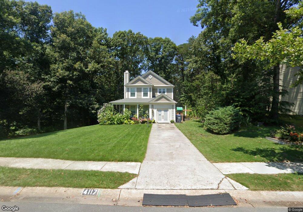
4117 Lancaster Cir Waldorf, MD 20603
Estimated Value: $332,799 - $406,000
Studio
3
Baths
1,654
Sq Ft
$233/Sq Ft
Est. Value
About This Home
This home is located at 4117 Lancaster Cir, Waldorf, MD 20603 and is currently estimated at $385,950, approximately $233 per square foot. 4117 Lancaster Cir is a home located in Charles County with nearby schools including C. Paul Barnhart Elementary School, Mattawoman Middle School, and Westlake High School.
Ownership History
Date
Name
Owned For
Owner Type
Purchase Details
Closed on
May 22, 1990
Sold by
Secor Jeffrey A and Garner Rita C
Bought by
Moran Gregory R and Moran Felicia A
Current Estimated Value
Home Financials for this Owner
Home Financials are based on the most recent Mortgage that was taken out on this home.
Original Mortgage
$136,600
Interest Rate
10.37%
Purchase Details
Closed on
Dec 7, 1987
Sold by
Pulte Home Corporation
Bought by
Secor Jeffrey A and Garner Rita C
Home Financials for this Owner
Home Financials are based on the most recent Mortgage that was taken out on this home.
Original Mortgage
$82,400
Interest Rate
10.6%
Purchase Details
Closed on
Oct 8, 1986
Sold by
St Charles Associates
Bought by
Pulte Home Corporation
Create a Home Valuation Report for This Property
The Home Valuation Report is an in-depth analysis detailing your home's value as well as a comparison with similar homes in the area
Home Values in the Area
Average Home Value in this Area
Purchase History
| Date | Buyer | Sale Price | Title Company |
|---|---|---|---|
| Moran Gregory R | $135,000 | -- | |
| Secor Jeffrey A | $103,000 | -- | |
| Pulte Home Corporation | $26,000 | -- |
Source: Public Records
Mortgage History
| Date | Status | Borrower | Loan Amount |
|---|---|---|---|
| Closed | Moran Gregory R | $136,600 | |
| Previous Owner | Secor Jeffrey A | $82,400 |
Source: Public Records
Tax History
| Year | Tax Paid | Tax Assessment Tax Assessment Total Assessment is a certain percentage of the fair market value that is determined by local assessors to be the total taxable value of land and additions on the property. | Land | Improvement |
|---|---|---|---|---|
| 2025 | $9,410 | $318,867 | -- | -- |
| 2024 | $4,061 | $303,000 | $125,300 | $177,700 |
| 2023 | $3,984 | $278,767 | $0 | $0 |
| 2022 | $3,521 | $254,533 | $0 | $0 |
| 2021 | $3,149 | $230,300 | $96,300 | $134,000 |
| 2020 | $3,149 | $222,233 | $0 | $0 |
| 2019 | $3,027 | $214,167 | $0 | $0 |
| 2018 | $2,881 | $206,100 | $90,300 | $115,800 |
| 2017 | $2,777 | $198,767 | $0 | $0 |
| 2016 | -- | $191,433 | $0 | $0 |
| 2015 | $2,728 | $184,100 | $0 | $0 |
| 2014 | $2,728 | $184,100 | $0 | $0 |
Source: Public Records
Map
Nearby Homes
- 4120 Lancaster Cir
- 4001 Bittern Ct
- 4130 Lancaster Cir
- 4044 Bluebird Dr
- 4205 Drake Ct
- 4202 Drake Ct
- 4098 Bluebird Dr
- 4235 Mockingbird Cir
- 4407 Eagle Ct
- 2750 Congress Ct
- 5318 Halibut Place
- 5085 Bluehead Ct
- 5504 Irish Lord Place
- 5052 Bigeye Ct
- 11124 Filberts Ct
- 3959 Prickly St
- 5111 Jumprock Ct
- 10818 Constitution Dr
- 10571 Sourwood Ave
- 3001 N Declaration Ct
- 4118 Lancaster CI
- 4116 Broadbill Dr
- 4115 Broadbill Dr
- 4121 Lancaster Cir
- 4178 Bluebird Dr
- 4179 Bluebird Dr
- 4180 Bluebird Dr
- 4114 Broadbill Dr
- 4177 Bluebird Dr
- 4031 Bluebird Dr
- 4181 Bluebird Dr
- 4176 Bluebird Dr
- 4182 Bluebird Dr
- 4030 Bluebird Dr
- 4175 Bluebird Dr
- 4183 Bluebird Dr
- 4123 Dunlin Ct
- 4174 Bluebird Dr
- 4122 Dunlin Ct
- 4029 Bluebird Dr
Your Personal Tour Guide
Ask me questions while you tour the home.