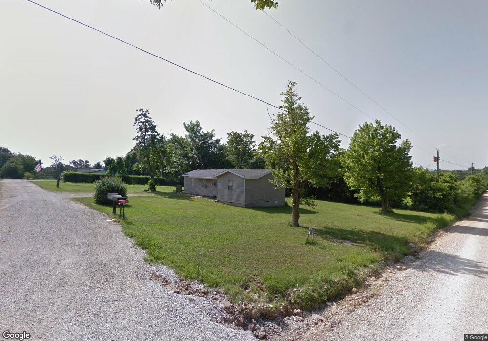
4119 Whorton Ln Springdale, AR 72764
Estimated Value: $142,000 - $259,000
2
Beds
1
Bath
1,000
Sq Ft
$194/Sq Ft
Est. Value
About This Home
This home is located at 4119 Whorton Ln, Springdale, AR 72764 and is currently estimated at $193,602, approximately $193 per square foot. 4119 Whorton Ln is a home located in Washington County with nearby schools including Sonora Elementary School, Lakeside Junior High School, and Sonora Middle School.
Ownership History
Date
Name
Owned For
Owner Type
Purchase Details
Closed on
Mar 8, 2013
Sold by
Anaya Daniel and Avalos Armando
Bought by
Hilton John I and Hilton Dorothy L
Current Estimated Value
Home Financials for this Owner
Home Financials are based on the most recent Mortgage that was taken out on this home.
Original Mortgage
$32,000
Outstanding Balance
$6,992
Interest Rate
5.25%
Mortgage Type
Adjustable Rate Mortgage/ARM
Estimated Equity
$186,610
Purchase Details
Closed on
Jan 1, 1985
Bought by
Whorton Kenneth W and Mary Nell
Create a Home Valuation Report for This Property
The Home Valuation Report is an in-depth analysis detailing your home's value as well as a comparison with similar homes in the area
Home Values in the Area
Average Home Value in this Area
Purchase History
| Date | Buyer | Sale Price | Title Company |
|---|---|---|---|
| Hilton John I | $40,000 | Elite Title Company Inc | |
| Whorton Kenneth W | -- | -- |
Source: Public Records
Mortgage History
| Date | Status | Borrower | Loan Amount |
|---|---|---|---|
| Open | Hilton John I | $32,000 |
Source: Public Records
Tax History Compared to Growth
Tax History
| Year | Tax Paid | Tax Assessment Tax Assessment Total Assessment is a certain percentage of the fair market value that is determined by local assessors to be the total taxable value of land and additions on the property. | Land | Improvement |
|---|---|---|---|---|
| 2025 | $717 | $19,290 | $8,250 | $11,040 |
| 2024 | $662 | $19,290 | $8,250 | $11,040 |
| 2023 | $620 | $19,290 | $8,250 | $11,040 |
| 2022 | $594 | $11,890 | $5,630 | $6,260 |
| 2021 | $552 | $11,890 | $5,630 | $6,260 |
| 2020 | $509 | $11,890 | $5,630 | $6,260 |
| 2019 | $466 | $9,070 | $3,750 | $5,320 |
| 2018 | $466 | $9,070 | $3,750 | $5,320 |
| 2017 | $422 | $9,070 | $3,750 | $5,320 |
| 2016 | $462 | $9,070 | $3,750 | $5,320 |
| 2015 | $462 | $9,070 | $3,750 | $5,320 |
| 2014 | $459 | $9,010 | $3,750 | $5,260 |
Source: Public Records
Map
Nearby Homes
- 4292 E Hewitt Springs Rd
- 3719 Sanday Ave
- 0 Parsons Rd
- TBD Parsons Rd
- 1744 Green Acres Cir
- 1380 Butterfield Coach Rd
- 2871 Commons Ave
- 4886-4856 Parsons Rd
- 768 Suffolk Cove
- 1779 Apple Butter St
- 393 Cascade Cir
- 20700 E Highway 412
- 2720 Granny Smith Ave
- 1533 Shannon St Unit A & B
- 2443 Kasey Ave
- 2403 E Emma Ave
- 2377 E Emma Ave
- 1407 A,B,C,D Oriole St
- 1407,1409,2103,2008 Oriole Christy Kim St
- 1409 A,B,C,D Oriole St
- 900 S Hewitt Springs Rd
- 4175 Whorton Ln
- 4077 Parsons Rd
- 4125 Parsons Rd
- 4216 Whorton Ln
- 4009 Burkett Ln
- 1078 S Hewitt Springs Rd
- 4270 Whorton Ln
- 4080 Parsons Rd
- 3999 Parsons Rd
- 3984 Burkett Ln
- 4159 Parsons Rd
- 3981 Parsons Rd
- 3981 Parsons Rd
- 3937 Parsons Rd
- 4175 Parsons Rd
- 750 Dhein Ln
- 3909 Parsons Rd
- 625 Carlock Rd
- 3928 Parsons Rd