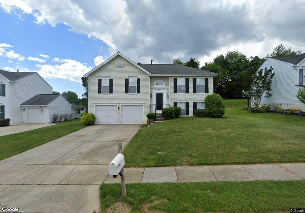
412 Brant Ct Havre de Grace, MD 21078
Estimated Value: $331,303 - $400,000
--
Bed
2
Baths
1,203
Sq Ft
$301/Sq Ft
Est. Value
About This Home
This home is located at 412 Brant Ct, Havre de Grace, MD 21078 and is currently estimated at $361,826, approximately $300 per square foot. 412 Brant Ct is a home located in Harford County with nearby schools including Meadowvale Elementary School, Havre de Grace Middle School, and Havre de Grace High School.
Ownership History
Date
Name
Owned For
Owner Type
Purchase Details
Closed on
Apr 12, 2022
Sold by
Kimball Richard Bradford
Bought by
Kimball Richard Bradford and Kimball Anita
Current Estimated Value
Purchase Details
Closed on
Dec 30, 1992
Sold by
Harford Properties Inc
Bought by
Ryan Operations G P
Purchase Details
Closed on
Jul 28, 1992
Sold by
Grace Harbour Limited Partnership
Bought by
Harford Properties Inc
Create a Home Valuation Report for This Property
The Home Valuation Report is an in-depth analysis detailing your home's value as well as a comparison with similar homes in the area
Home Values in the Area
Average Home Value in this Area
Purchase History
| Date | Buyer | Sale Price | Title Company |
|---|---|---|---|
| Kimball Richard Bradford | -- | None Listed On Document | |
| Ryan Operations G P | $18,000 | -- | |
| Harford Properties Inc | $426,800 | -- |
Source: Public Records
Tax History Compared to Growth
Tax History
| Year | Tax Paid | Tax Assessment Tax Assessment Total Assessment is a certain percentage of the fair market value that is determined by local assessors to be the total taxable value of land and additions on the property. | Land | Improvement |
|---|---|---|---|---|
| 2025 | $2,273 | $252,633 | $0 | $0 |
| 2024 | $2,273 | $238,400 | $90,500 | $147,900 |
| 2023 | $2,205 | $231,333 | $0 | $0 |
| 2022 | $2,138 | $224,267 | $0 | $0 |
| 2021 | $2,152 | $217,200 | $90,500 | $126,700 |
| 2020 | $2,152 | $214,000 | $0 | $0 |
| 2019 | $2,120 | $210,800 | $0 | $0 |
| 2018 | $2,069 | $207,600 | $94,200 | $113,400 |
| 2017 | $2,069 | $207,600 | $0 | $0 |
| 2016 | -- | $207,600 | $0 | $0 |
| 2015 | $2,151 | $209,600 | $0 | $0 |
| 2014 | $2,151 | $209,600 | $0 | $0 |
Source: Public Records
Map
Nearby Homes
- 400 Brant Ct
- 332 Pintail Dr
- 302 Goforth Dr
- 1514 Lyon St
- 102 Tidewater Dr
- 1514 Superior St
- 146 Remington Cir
- 101 Susquehanna Ct
- 221 War Admiral Way
- 311 Sunrise Ct
- 1411 Chapel Rd
- 202 Man o War Place
- 903 Eugene Dr
- 321 Friar Rock Cir
- 302 Friar Rock Cir
- 300 Friar Rock Cir
- Somerset II - Bulle Rock Plan at Bulle Rock - Single Family
- Franklin Plan at Bulle Rock - Single Family
- Hampton II Plan at Bulle Rock - Single Family
- Patton Plan at Bulle Rock - Single Family