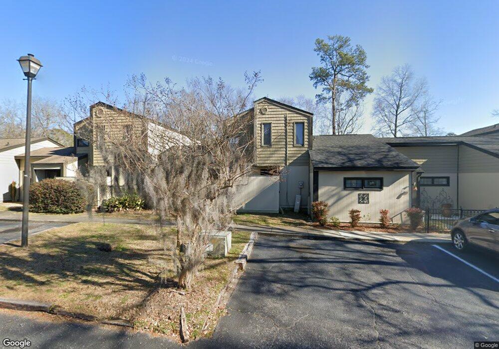
412 Burris Rd Unit L17 Florence, SC 29501
Estimated Value: $121,000 - $155,000
2
Beds
2
Baths
1,205
Sq Ft
$118/Sq Ft
Est. Value
About This Home
This home is located at 412 Burris Rd Unit L17, Florence, SC 29501 and is currently estimated at $142,585, approximately $118 per square foot. 412 Burris Rd Unit L17 is a home located in Florence County with nearby schools including Royall Elementary School, Henry L. Sneed Middle School, and John W. Moore Middle School.
Ownership History
Date
Name
Owned For
Owner Type
Purchase Details
Closed on
Apr 9, 2007
Sold by
Dean Larry M
Bought by
Barnes Richard S and Taylor Kristi N
Current Estimated Value
Home Financials for this Owner
Home Financials are based on the most recent Mortgage that was taken out on this home.
Original Mortgage
$54,000
Outstanding Balance
$32,704
Interest Rate
6.18%
Mortgage Type
Purchase Money Mortgage
Estimated Equity
$109,881
Purchase Details
Closed on
Jun 24, 2005
Sold by
Dean Shannan A and Webb Shannan A
Bought by
Dean Larry M
Home Financials for this Owner
Home Financials are based on the most recent Mortgage that was taken out on this home.
Original Mortgage
$65,475
Interest Rate
5.7%
Mortgage Type
New Conventional
Create a Home Valuation Report for This Property
The Home Valuation Report is an in-depth analysis detailing your home's value as well as a comparison with similar homes in the area
Home Values in the Area
Average Home Value in this Area
Purchase History
| Date | Buyer | Sale Price | Title Company |
|---|---|---|---|
| Barnes Richard S | $72,000 | None Available | |
| Dean Larry M | $67,500 | -- |
Source: Public Records
Mortgage History
| Date | Status | Borrower | Loan Amount |
|---|---|---|---|
| Open | Barnes Richard S | $54,000 | |
| Previous Owner | Dean Larry M | $65,475 |
Source: Public Records
Tax History Compared to Growth
Tax History
| Year | Tax Paid | Tax Assessment Tax Assessment Total Assessment is a certain percentage of the fair market value that is determined by local assessors to be the total taxable value of land and additions on the property. | Land | Improvement |
|---|---|---|---|---|
| 2024 | $1,729 | $3,952 | $480 | $3,472 |
| 2023 | $1,534 | $2,867 | $480 | $2,387 |
| 2022 | $1,567 | $2,867 | $480 | $2,387 |
| 2021 | $1,583 | $4,300 | $0 | $0 |
| 2020 | $1,528 | $4,300 | $0 | $0 |
| 2019 | $1,504 | $4,300 | $0 | $0 |
| 2018 | $1,440 | $4,300 | $0 | $0 |
| 2017 | $1,412 | $4,300 | $0 | $0 |
| 2016 | $1,374 | $4,300 | $0 | $0 |
| 2015 | $1,374 | $4,300 | $0 | $0 |
| 2014 | $1,311 | $0 | $0 | $0 |
Source: Public Records
Map
Nearby Homes
- 418 S Thomas Rd
- 700 S Cashua Dr
- 1013 Summer Duck Loop
- 2505 2nd Loop Rd
- 600 Ridgewood Dr
- 2525 3rd Loop Rd
- 541 Fairway Dr
- 917 S Cashua Dr
- 2206 W Piccadilly Dr
- 1506 Sandy Ln
- 310 Country Club Blvd
- 2051 2nd Loop Rd
- 2317 Lampley Way
- 1602 Cherokee Rd
- 2309 Chadwick Dr
- 2319 Lampley Way
- 2111 W Cambridge Dr
- 2220 Woodridge Ln
- 2220 Oakwood Ln
- 601 Greenway Dr
- 412 Burris Rd
- 412 Burris Rd Unit 1919
- 412 Burris Rd Unit 12
- 412 Burris Rd Unit 77
- 412 Burris Rd Unit 1111
- 412 Burris Rd Unit 99
- 412 Burris Rd Unit 14
- 412 Burris Rd Unit 13
- 412 Burris Rd Unit 1616
- 412 Burris Rd Unit 88
- 412 Burris Rd Unit 44
- 412 Burris Rd Unit 1010
- 412 Burris Rd Unit 5
- 412 Burris Rd Unit 55
- 412 Burris Rd Unit 9
- 412 Burris Rd Unit 12
- 412 Burris Rd Unit 1515
- 3907 Po Box
- 412 Burris Road #6
- 434 Woodland Dr