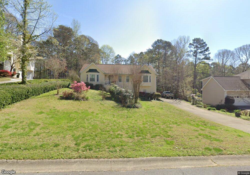
412 Dockside Cove Unit 2 Woodstock, GA 30189
Sutallee NeighborhoodEstimated Value: $371,000 - $461,860
3
Beds
2
Baths
2,674
Sq Ft
$156/Sq Ft
Est. Value
About This Home
This home is located at 412 Dockside Cove Unit 2, Woodstock, GA 30189 and is currently estimated at $416,430, approximately $155 per square foot. 412 Dockside Cove Unit 2 is a home located in Cherokee County with nearby schools including Boston Elementary School, E. T. Booth Middle School, and Etowah High School.
Ownership History
Date
Name
Owned For
Owner Type
Purchase Details
Closed on
Feb 25, 2000
Sold by
Cafarella William R
Bought by
Bushong Christopher D
Current Estimated Value
Home Financials for this Owner
Home Financials are based on the most recent Mortgage that was taken out on this home.
Original Mortgage
$162,700
Outstanding Balance
$53,443
Interest Rate
8.29%
Mortgage Type
VA
Estimated Equity
$362,987
Purchase Details
Closed on
Aug 19, 1997
Sold by
Blanchard Kenneth B
Bought by
Cafarella William R
Home Financials for this Owner
Home Financials are based on the most recent Mortgage that was taken out on this home.
Original Mortgage
$148,320
Interest Rate
7.5%
Mortgage Type
VA
Create a Home Valuation Report for This Property
The Home Valuation Report is an in-depth analysis detailing your home's value as well as a comparison with similar homes in the area
Home Values in the Area
Average Home Value in this Area
Purchase History
| Date | Buyer | Sale Price | Title Company |
|---|---|---|---|
| Bushong Christopher D | $158,000 | -- | |
| Cafarella William R | $144,000 | -- |
Source: Public Records
Mortgage History
| Date | Status | Borrower | Loan Amount |
|---|---|---|---|
| Open | Bushong Christopher D | $162,700 | |
| Previous Owner | Cafarella William R | $148,320 |
Source: Public Records
Tax History Compared to Growth
Tax History
| Year | Tax Paid | Tax Assessment Tax Assessment Total Assessment is a certain percentage of the fair market value that is determined by local assessors to be the total taxable value of land and additions on the property. | Land | Improvement |
|---|---|---|---|---|
| 2025 | $3,950 | $172,860 | $32,000 | $140,860 |
| 2024 | $3,784 | $165,220 | $28,000 | $137,220 |
| 2023 | $3,458 | $170,380 | $28,000 | $142,380 |
| 2022 | $3,590 | $153,980 | $28,000 | $125,980 |
| 2021 | $2,969 | $114,140 | $23,520 | $90,620 |
| 2020 | $2,701 | $102,500 | $20,800 | $81,700 |
| 2019 | $2,377 | $88,520 | $18,600 | $69,920 |
| 2018 | $2,301 | $84,760 | $16,800 | $67,960 |
| 2017 | $2,189 | $198,100 | $16,000 | $63,240 |
| 2016 | $2,158 | $192,500 | $16,000 | $61,000 |
| 2015 | $2,067 | $181,500 | $16,000 | $56,600 |
| 2014 | $1,823 | $160,500 | $16,000 | $48,200 |
Source: Public Records
Map
Nearby Homes
- 406 Ballymore Pass Unit III
- 416 Ballymore Pass
- 0 Black Oak Trail Unit 7303191
- 0 Black Oak Trail Unit 10267626
- 923 Pine Cir
- 234 Ascott Ln
- 1001 Ashfern Walk
- 812 Willow Oak Dr
- 104 Rose Cottage Ln Unit 65
- 1413 Reed Ln
- 128 Golden Hills Dr
- 1020 Braelin Ct
- 135 Golden Hills Dr
- 1001 Deer Hollow Dr
- 1516 Shadow Ridge Cir
- 2006 Hawthorne Way
- 712 Copper Trace Way
- 727 Copper Trace Way
- 507 Huntgate Rd
- 7119 Big Woods Dr
- 414 Dockside Cove Unit 2/65
- 410 Dockside Cove
- 503 Dockside Ct Unit 2
- 416 Dockside Cove
- 306 Mainsail Ln Unit 2
- 308 Mainsail Ln
- 605 Dockside Ct
- 417 Dockside Cove
- 157 Dockside Downs Dr Unit 2
- 159 Dockside Downs Dr
- 419 Dockside Cove Unit 2
- 408 Dockside Cove
- 408 Dockside Cove
- 415 Dockside Cove
- 155 Dockside Downs Dr
- 161 Dockside Downs Dr Unit 2
- 504 Dockside Ct
- 304 Mainsail Ln
- 421 Dockside Cove
- 302 Mainsail Ln